Landos
Landos (French pronunciation: [lɑ̃dɔs]; Occitan: Landòs) is a commune in the Haute-Loire department in south-central France.
Landos | |
|---|---|
Commune | |
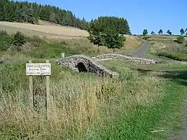 Castier Bridge | |
Location of Landos | |
 Landos  Landos | |
| Coordinates: 44°50′37″N 3°49′57″E | |
| Country | France |
| Region | Auvergne-Rhône-Alpes |
| Department | Haute-Loire |
| Arrondissement | Le Puy-en-Velay |
| Canton | Velay volcanique |
| Government | |
| • Mayor (2020–2026) | Jean-Louis Reynaud[1] |
| Area 1 | 36.51 km2 (14.10 sq mi) |
| Population | 872 |
| • Density | 24/km2 (62/sq mi) |
| Time zone | UTC+01:00 (CET) |
| • Summer (DST) | UTC+02:00 (CEST) |
| INSEE/Postal code | 43111 /43340 |
| Elevation | 978–1,237 m (3,209–4,058 ft) (avg. 1,120 m or 3,670 ft) |
| 1 French Land Register data, which excludes lakes, ponds, glaciers > 1 km2 (0.386 sq mi or 247 acres) and river estuaries. | |
The Robert Louis Stevenson Trail (GR 70), a popular long-distance path, runs through the town, which is also on a disused railway from Le Puy-en-Velay to Langogne.[3]
Population
|
|
References
- "Répertoire national des élus: les maires". data.gouv.fr, Plateforme ouverte des données publiques françaises (in French). 2 December 2020.
- "Populations légales 2020". The National Institute of Statistics and Economic Studies. 29 December 2022.
- Castle, Alan (2007). The Robert Louis Stevenson Trail (2nd ed.). Cicerone. p. 82. ISBN 978-1-85284-511-7.
Wikimedia Commons has media related to Landos.
This article is issued from Wikipedia. The text is licensed under Creative Commons - Attribution - Sharealike. Additional terms may apply for the media files.