Karaj County
Karaj County (Persian: شهرستان کرج) is in Alborz province, Iran. The capital of the county is the city of Karaj.
Karaj County
Persian: شهرستان کرج | |
|---|---|
County | |
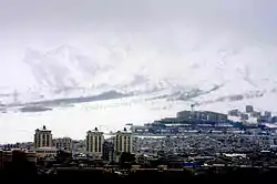 Karaj in winter | |
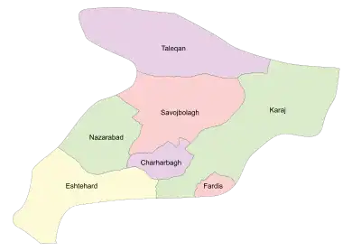 Location of Karaj County in Alborz province (right, green) | |
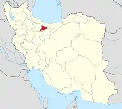 Location of Alborz province in Iran | |
| Coordinates: 35°58′N 51°05′E[1] | |
| Country | Iran |
| Province | Alborz |
| Capital | Karaj |
| Districts | Central, Asara |
| Population (2016)[2] | |
| • Total | 1,973,470 |
| Time zone | UTC+3:30 (IRST) |
| Karaj County can be found at GEOnet Names Server, at this link, by opening the Advanced Search box, entering "9206117" in the "Unique Feature Id" form, and clicking on "Search Database". | |
At the 2006 census, when it was a county in Tehran province, its population was 1,709,481 in 472,365 households.[3] At the 2016 census, the county's population was 1,973,470 in 623,801 households, by which time it had become a part of recently established Alborz province.[2]
Administrative divisions
The population history and structural changes of Karaj County's administrative divisions over two censuses are shown in the following table. The latest census shows two districts, six rural districts, and six cities.[2]
| Administrative Divisions | 2006[3] | 2016[2] | |
|---|---|---|---|
| Central District | 1,667,024 | 1,956,267 | |
| Garmdarreh Rural District | 544 | 221 | |
| Kamalabad Rural District | 3,836 | 4,892 | |
| Mohammadabad Rural District | 22,099 | 11,939 | |
| Garmdarreh (city) | 12,738 | 22,726 | |
| Kamal Shahr (city) | 80,435 | 141,669 | |
| Karaj (city) | 1,377,450 | 1,592,492 | |
| Mahdasht (city) | 43,100 | 62,910 | |
| Meshkin Dasht (city)1 | 43,696 | ||
| Mohammadshahr (city) | 83,126 | 119,418 | |
| Asara District | 18,856 | 17,150 | |
| Adaran Rural District | 8,995 | 7,679 | |
| Asara Rural District | 3,780 | 3,063 | |
| Nesa Rural District | 6,081 | 5,069 | |
| Asara (city) | 1,339 | ||
| Eshtehard District2 | 23,601 | ||
| Palangabad Rural District | 6,613 | ||
| Eshtehard (city) | 16,988 | ||
| Total | 1,709,481 | 1,973,470 | |
| 1Became a part of Fardis County 2Became a part of Eshtehard County | |||


References
- OpenStreetMap contributors (25 March 2023). "Karaj County" (Map). OpenStreetMap. Retrieved 25 March 2023.
- "Census of the Islamic Republic of Iran, 1395 (2016)". AMAR (in Persian). The Statistical Center of Iran. p. 30. Archived from the original (Excel) on 28 January 2020. Retrieved 19 December 2022.
- "Census of the Islamic Republic of Iran, 1385 (2006)". AMAR (in Persian). The Statistical Center of Iran. p. 23. Archived from the original (Excel) on 20 September 2011. Retrieved 25 September 2022.
| Capital city | 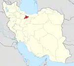 | ||||||||||||
|---|---|---|---|---|---|---|---|---|---|---|---|---|---|
| Counties and cities |
| ||||||||||||
| Sights |
| ||||||||||||
| Populated places | |||||||||||||
| Capital | |||||||||||||||||||||||||
|---|---|---|---|---|---|---|---|---|---|---|---|---|---|---|---|---|---|---|---|---|---|---|---|---|---|
| Districts |
| ||||||||||||||||||||||||
This article is issued from Wikipedia. The text is licensed under Creative Commons - Attribution - Sharealike. Additional terms may apply for the media files.