Fontaine-Étoupefour
Fontaine-Étoupefour (French pronunciation: [fɔ̃tɛn etupfuʁ] ⓘ) is a commune in the Calvados department in the Normandy region in northwestern France.
Fontaine-Étoupefour | |
|---|---|
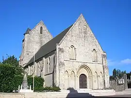 St. Pierre Church | |
Location of Fontaine-Étoupefour | |
 Fontaine-Étoupefour  Fontaine-Étoupefour | |
| Coordinates: 49°08′49″N 0°27′10″W | |
| Country | France |
| Region | Normandy |
| Department | Calvados |
| Arrondissement | Caen |
| Canton | Évrecy |
| Intercommunality | Vallées de l'Orne et de l'Odon |
| Government | |
| • Mayor (2020–2026) | Bernard Énault[1] |
| Area 1 | 5.08 km2 (1.96 sq mi) |
| Population | 2,682 |
| • Density | 530/km2 (1,400/sq mi) |
| Time zone | UTC+01:00 (CET) |
| • Summer (DST) | UTC+02:00 (CEST) |
| INSEE/Postal code | 14274 /14790 |
| Elevation | 19–111 m (62–364 ft) (avg. 32 m or 105 ft) |
| 1 French Land Register data, which excludes lakes, ponds, glaciers > 1 km2 (0.386 sq mi or 247 acres) and river estuaries. | |
Population
|
| ||||||||||||||||||||||||||||||||||||||||||||||||||||||||||||||||||||||||||||||||||||||||||||||||||||||||||||||||||
| Source: EHESS[3] and INSEE (1968-2017)[4] | |||||||||||||||||||||||||||||||||||||||||||||||||||||||||||||||||||||||||||||||||||||||||||||||||||||||||||||||||||
See also
References
- "Répertoire national des élus: les maires". data.gouv.fr, Plateforme ouverte des données publiques françaises (in French). 2 December 2020.
- "Populations légales 2020". The National Institute of Statistics and Economic Studies. 29 December 2022.
- Des villages de Cassini aux communes d'aujourd'hui: Commune data sheet Fontaine-Étoupefour, EHESS (in French).
- Population en historique depuis 1968, INSEE
External links
Wikimedia Commons has media related to Fontaine-Étoupefour.
This article is issued from Wikipedia. The text is licensed under Creative Commons - Attribution - Sharealike. Additional terms may apply for the media files.