Faryab County
Faryab County (Persian: شهرستان فاریاب) is in Kerman province, Iran. Its capital is the city of Faryab.
Faryab County
Persian: شهرستان فاریاب | |
|---|---|
County | |
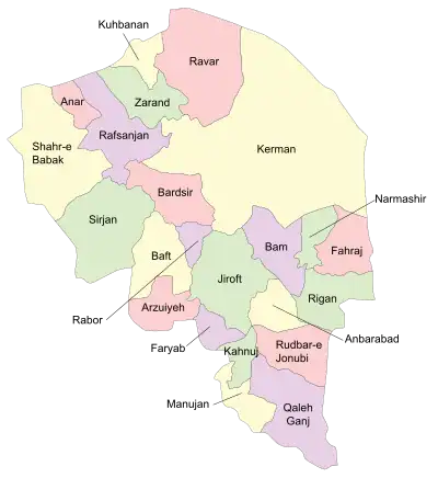
 Location of Faryab County in Kerman province (lower center, purple) | |
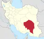
 Location of Kerman province in Iran | |
| Coordinates: 28°12′N 57°20′E[1] | |
| Country | Iran |
| Province | Kerman |
| Capital | Faryab |
| Districts | Central, Hur |
| Population (2016)[2] | |
| • Total | 34,000 |
| Time zone | UTC+3:30 (IRST) |
At the 2006 census, the region's population (as Faryab District of Kahnuj County) was 31,605 in 6,751 households.[3] The following census in 2011 counted 34,417 people in 8,553 households,[4] by which time the district had been separated from the county to form Faryab County.[5] At the 2016 census, the county's population was 34,000 in 9,817 households.[2]
Administrative divisions
The population history and structural changes of Faryab County's administrative divisions over three consecutive censuses are shown in the following table. The latest census shows two districts, four rural districts, and one city.[2]
| Administrative Divisions | 2006[3] | 2011[4] | 2016[2] |
|---|---|---|---|
| Central District | 16,685 | 18,949 | 16,952 |
| Golashkerd Rural District | 5,353 | 5,513 | 5,205 |
| Mehruiyeh Rural District | 6,824 | 7,411 | 6,884 |
| Faryab (city) | 4,508 | 6,025 | 4,863 |
| Hur District | 14,920 | 15,468 | 17,048 |
| Hur Rural District | 14,920 | 11,964 | 13,062 |
| Zahmakan Rural District | 3,504 | 3,986 | |
| Hur-e Pa Sefid (city)2 | |||
| Total | 31,605 | 34,417 | 34,000 |
| 1As a part of Kahnuj County at the 2006 census 2Became a city after the 2016 census[6] | |||
Wikimedia Commons has media related to Faryab County.
References
- OpenStreetMap contributors (27 June 2023). "Faryab County" (Map). OpenStreetMap. Retrieved 27 June 2023.
- "Census of the Islamic Republic of Iran, 1395 (2016)". AMAR (in Persian). The Statistical Center of Iran. p. 08. Archived from the original (Excel) on 20 October 2020. Retrieved 19 December 2022.
- "Census of the Islamic Republic of Iran, 1385 (2006)". AMAR (in Persian). The Statistical Center of Iran. p. 08. Archived from the original (Excel) on 20 September 2011. Retrieved 25 September 2022.
- "Census of the Islamic Republic of Iran, 1390 (2011)" (Excel). Iran Data Portal (in Persian). The Statistical Center of Iran. p. 08. Retrieved 19 December 2022.
- Rahimi, Mohammad Reza (8 February 2011). "Faryab County was added to the map of country divisions". Islamic Republic News Agency (in Persian). Ministry of Interior, Board of Ministers. Retrieved 27 June 2023.
- "The members of the board of directors of the new Hur-e Pa Sefid city council were elected". Khabar Farsi (in Persian). Makran. 13 June 2020. Archived from the original on 11 June 2023. Retrieved 27 June 2023.
This article is issued from Wikipedia. The text is licensed under Creative Commons - Attribution - Sharealike. Additional terms may apply for the media files.
