Clam, Charente-Maritime
Clam is a commune with 418 residents (as of January 1, 2017) in the French department of Charente-Maritime in the Poitou-Charentes region. Clam is located in the arrondissement (eng. administrative region) as well as in the canton of Jonzac. The residents are called Clamais.
Clam | |
|---|---|
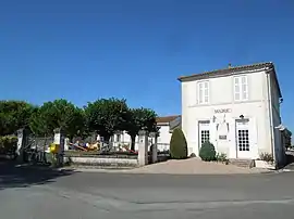 The town hall in Clam | |
Location of Clam | |
 Clam  Clam | |
| Coordinates: 45°29′41″N 0°26′51″W | |
| Country | France |
| Region | Nouvelle-Aquitaine |
| Department | Charente-Maritime |
| Arrondissement | Jonzac |
| Canton | Jonzac |
| Intercommunality | Haute-Saintonge |
| Government | |
| • Mayor (2020–2026) | Jean-Michel Videau[1] |
| Area 1 | 6.83 km2 (2.64 sq mi) |
| Population | 411 |
| • Density | 60/km2 (160/sq mi) |
| Time zone | UTC+01:00 (CET) |
| • Summer (DST) | UTC+02:00 (CEST) |
| INSEE/Postal code | 17108 /17240 |
| Elevation | 23–71 m (75–233 ft) |
| 1 French Land Register data, which excludes lakes, ponds, glaciers > 1 km2 (0.386 sq mi or 247 acres) and river estuaries. | |
Geography
Clam lies about 80 kilometers northeast of Bourdeaux. Clam is bordered by Marignac to the north and northwest, Neulles to the north and northeast, Saint-Germain-de-Luisignan to the south and east, as well as Saint-Georges-Antignac to the west.
Population
| Year | Pop. | ±% |
|---|---|---|
| 1962 | 232 | — |
| 1968 | 203 | −12.5% |
| 1975 | 216 | +6.4% |
| 1982 | 209 | −3.2% |
| 1990 | 237 | +13.4% |
| 1999 | 283 | +19.4% |
| 2008 | 354 | +25.1% |
Places of interest
- The Church of Saint-Martin from the 12th century.
References
- "Répertoire national des élus: les maires". data.gouv.fr, Plateforme ouverte des données publiques françaises (in French). 9 August 2021.
- "Populations légales 2020". The National Institute of Statistics and Economic Studies. 29 December 2022.
External links
 Media related to Clam (Charente-Maritime) at Wikimedia Commons
This article is issued from Wikipedia. The text is licensed under Creative Commons - Attribution - Sharealike. Additional terms may apply for the media files.