Égliseneuve-d'Entraigues
Égliseneuve-d'Entraigues (French pronunciation: [egliznœv dɑ̃tʁɛg]; Occitan: Gleianèva d'Entraigas) is a commune in the Puy-de-Dôme department in Auvergne in central France.
Égliseneuve-d'Entraigues | |
|---|---|
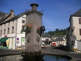 The town center | |
.svg.png.webp) Coat of arms | |
Location of Égliseneuve-d'Entraigues | |
 Égliseneuve-d'Entraigues  Égliseneuve-d'Entraigues | |
| Coordinates: 45°24′32″N 2°49′41″E | |
| Country | France |
| Region | Auvergne-Rhône-Alpes |
| Department | Puy-de-Dôme |
| Arrondissement | Issoire |
| Canton | Le Sancy |
| Intercommunality | Massif du Sancy |
| Government | |
| • Mayor (2020–2026) | Didier Cardenoux[1] |
| Area 1 | 56.43 km2 (21.79 sq mi) |
| Population | 338 |
| • Density | 6.0/km2 (16/sq mi) |
| Time zone | UTC+01:00 (CET) |
| • Summer (DST) | UTC+02:00 (CEST) |
| INSEE/Postal code | 63144 /63850 |
| Elevation | 877–1,358 m (2,877–4,455 ft) (avg. 950 m or 3,120 ft) |
| 1 French Land Register data, which excludes lakes, ponds, glaciers > 1 km2 (0.386 sq mi or 247 acres) and river estuaries. | |
Geography
The village lies in the southern part of the commune, on the right bank of the Rhue, which flows southward through the commune.
See also
Wikimedia Commons has media related to Égliseneuve-d'Entraigues.
References
- "Répertoire national des élus: les maires" (in French). data.gouv.fr, Plateforme ouverte des données publiques françaises. 13 September 2022.
- "Populations légales 2020". The National Institute of Statistics and Economic Studies. 29 December 2022.
This article is issued from Wikipedia. The text is licensed under Creative Commons - Attribution - Sharealike. Additional terms may apply for the media files.