West Rutland (CDP), Vermont
West Rutland is the central village and a census-designated place (CDP) in the town of West Rutland, Rutland County, Vermont, United States. As of the 2020 census, it had a population of 1,898,[2] out of 2,214 in the entire town of West Rutland.
West Rutland, Vermont | |
|---|---|
 West Rutland  West Rutland | |
| Coordinates: 43°35′35″N 73°2′44″W | |
| Country | United States |
| State | Vermont |
| County | Rutland |
| Town | West Rutland |
| Area | |
| • Total | 3.69 sq mi (9.57 km2) |
| • Land | 3.68 sq mi (9.52 km2) |
| • Water | 0.02 sq mi (0.05 km2) |
| Elevation | 498 ft (152 m) |
| Population | 1,898 |
| Time zone | UTC-5 (Eastern (EST)) |
| • Summer (DST) | UTC-4 (EDT) |
| ZIP Code | 05777 |
| Area code | 802 |
| FIPS code | 50-82375 |
| GNIS feature ID | 2378138[3] |
The CDP is in central Rutland County, in the southern part of the town. It sits in a valley on the east side of the Taconic Mountains, drained to the east by the Clarendon River, a tributary of Otter Creek, and to the west by the Castleton River, a tributary of the Poultney River. Both sets of rivers eventually flow to Lake Champlain.
U.S. Route 4, a four-lane expressway, passes south of the village center, with access from Exit 6. Route 4 leads east 4 miles (6 km) to U.S. Route 7 on the south side of Rutland and west 13 miles (21 km) to Fair Haven. Vermont Route 4A, former US 4, is Main Street through West Rutland; it leads east 4 miles (6 km) to downtown Rutland and west 7 miles (11 km) to Castleton. Vermont Route 133 (Clarendon Avenue) leads south from the center of West Rutland 11 miles (18 km) to Middletown Springs.
References
- "2020 U.S. Gazetteer Files – Vermont". United States Census Bureau. Retrieved October 20, 2021.
- "West Rutland CDP, Vermont: 2020 DEC Redistricting Data (PL 94-171)". U.S. Census Bureau. Retrieved October 20, 2021.
- "West Rutland Census Designated Place". Geographic Names Information System. United States Geological Survey, United States Department of the Interior.
Municipalities and communities of Rutland County, Vermont, United States | ||
|---|---|---|
| City | 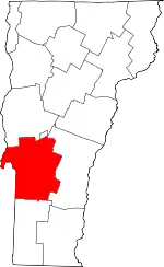 Map of Vermont highlighting Rutland County | |
| Towns | ||
| Village | ||
| CDPs | ||
| Other communities | ||