Wavrille
Wavrille is a commune in the Meuse department in Grand Est in north-eastern France.
Wavrille | |
|---|---|
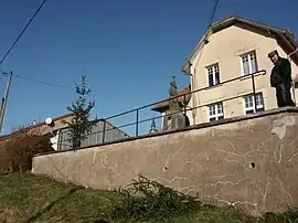 The town hall in Wavrille | |
Location of Wavrille | |
 Wavrille 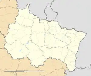 Wavrille | |
| Coordinates: 49°19′42″N 5°23′24″E | |
| Country | France |
| Region | Grand Est |
| Department | Meuse |
| Arrondissement | Verdun |
| Canton | Montmédy |
| Intercommunality | Damvillers Spincourt |
| Government | |
| • Mayor (2020–2026) | Ernest Furina[1] |
| Area 1 | 5.31 km2 (2.05 sq mi) |
| Population | 50 |
| • Density | 9.4/km2 (24/sq mi) |
| Time zone | UTC+01:00 (CET) |
| • Summer (DST) | UTC+02:00 (CEST) |
| INSEE/Postal code | 55580 /55150 |
| Elevation | 210–361 m (689–1,184 ft) (avg. 228 m or 748 ft) |
| 1 French Land Register data, which excludes lakes, ponds, glaciers > 1 km2 (0.386 sq mi or 247 acres) and river estuaries. | |
Population
| Year | Pop. | ±% p.a. |
|---|---|---|
| 1968 | 60 | — |
| 1975 | 52 | −2.02% |
| 1982 | 44 | −2.36% |
| 1990 | 41 | −0.88% |
| 1999 | 49 | +2.00% |
| 2007 | 45 | −1.06% |
| 2012 | 46 | +0.44% |
| 2017 | 50 | +1.68% |
| Source: INSEE[3] | ||
See also
References
- "Répertoire national des élus: les maires" (in French). data.gouv.fr, Plateforme ouverte des données publiques françaises. 13 September 2022.
- "Populations légales 2020". The National Institute of Statistics and Economic Studies. 29 December 2022.
- Population en historique depuis 1968, INSEE
Wikimedia Commons has media related to Wavrille.
This article is issued from Wikipedia. The text is licensed under Creative Commons - Attribution - Sharealike. Additional terms may apply for the media files.