Abaucourt-Hautecourt
Abaucourt-Hautecourt (French pronunciation: [abokuʁ otkuʁ]) is a commune in the Meuse department in the Grand Est region of north-eastern France.
Abaucourt-Hautecourt | |
|---|---|
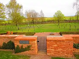
 German Military cemetery | |
Location of Abaucourt-Hautecourt | |
 Abaucourt-Hautecourt  Abaucourt-Hautecourt | |
| Coordinates: 49°11′49″N 5°32′26″E | |
| Country | France |
| Region | Grand Est |
| Department | Meuse |
| Arrondissement | Verdun |
| Canton | Belleville-sur-Meuse |
| Intercommunality | Pays d'Étain |
| Government | |
| • Mayor (2020–2026) | Jean-Marie Mittaux[1] |
| Area 1 | 9.68 km2 (3.74 sq mi) |
| Population | 101 |
| • Density | 10/km2 (27/sq mi) |
| Demonym(s) | Abaucourtois, Abaucourtoises |
| Time zone | UTC+01:00 (CET) |
| • Summer (DST) | UTC+02:00 (CEST) |
| INSEE/Postal code | 55002 /55400 |
| Elevation | 210–251 m (689–823 ft) (avg. 233 m or 764 ft) |
| 1 French Land Register data, which excludes lakes, ponds, glaciers > 1 km2 (0.386 sq mi or 247 acres) and river estuaries. | |
The inhabitants of the commune are known as Abaucourtois or Abaucourtoises.[3]
Geography
Abbaucourt-Hautecourt is located on the Highway D603 which transects the commune from south-east to north-east about 8 km north-east of Verdun. Highway D114 also transects the commune from north to south. Both Highways intersect in the village of Abaucourt. The commune consists entirely of farmland.[4]
Neighbouring communes and villages
Villages and Hamlets
- Broville: north of the D603.
- Eix-Abaucourt a small row of houses on the south side of the D603 midway between Eix and the village of Abaucourt.
- Hautecourt south of the D603.
History
In the 1970s, Abaucourt-lès-Souppleville joined Hautecourt-lès-Broville to form a new joint commune called "Abaucourt-Hautecourt".
Administration
List of Successive Mayors of Abaucourt-Hautecort
| From | To | Name |
|---|---|---|
| 1989 | 2001 | Jean Schlemer |
| 2001 | 2014 | Marcel Picard |
| 2014 | Current | Jean-Marie Mittaux |
Population
|
| |||||||||||||||||||||||||||||||||||||||||||||||||||||||||||||||||||||||||||||||||||||||||||||||||||||||||||||||||||||||||||||||||||||||||||||||||||
| Source: EHESS (1793-1999)[5] and INSEE[6][7] | ||||||||||||||||||||||||||||||||||||||||||||||||||||||||||||||||||||||||||||||||||||||||||||||||||||||||||||||||||||||||||||||||||||||||||||||||||||
Sites and Monuments
- German Military Cemetery No. 7885 (1914-1918)
- War Memorial
 [8]
[8]
Religious Buildings
The commune does not have a church.
Notable people linked to the Commune
- Lieutenant René Dorme, a famous aviator of the First World War.
See also
References
- "Répertoire national des élus: les maires" (in French). data.gouv.fr, Plateforme ouverte des données publiques françaises. 13 September 2022.
- "Populations légales 2020". The National Institute of Statistics and Economic Studies. 29 December 2022.
- Inhabitants of Meuse (in French)
- Google Maps
- Des villages de Cassini aux communes d'aujourd'hui: Commune data sheet Abaucourt-Hautecourt, EHESS (in French).
- Population en historique depuis 1968, INSEE
- Historique des populations légales
- Ministry of Culture, Mérimée IA00036854 War Memorial (in French)
External links
![]() Media related to Abaucourt-Hautecourt at Wikimedia Commons
Media related to Abaucourt-Hautecourt at Wikimedia Commons
- Abaucourt-Hautecourt on Géoportail, National Geographic Institute (IGN) website (in French)
- Abaucourt & Hauteceurt on the 1750 Cassini Map