Wadley, Georgia
Wadley is a city in Jefferson County, Georgia, United States. The population was 2,061 at the 2010 census.
Wadley, Georgia | |
|---|---|
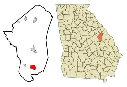 Location in Jefferson County and the state of Georgia | |
| Coordinates: 32°52′14″N 82°24′14″W | |
| Country | United States |
| State | Georgia |
| County | Jefferson |
| Area | |
| • Total | 4.60 sq mi (11.91 km2) |
| • Land | 4.56 sq mi (11.80 km2) |
| • Water | 0.04 sq mi (0.11 km2) |
| Elevation | 253 ft (77 m) |
| Population (2020) | |
| • Total | 1,643 |
| • Density | 360.62/sq mi (139.23/km2) |
| Time zone | UTC-5 (Eastern (EST)) |
| • Summer (DST) | UTC-4 (EDT) |
| ZIP code | 30477 |
| Area code | 478 |
| FIPS code | 13-79864[2] |
| GNIS feature ID | 0356616[3] |
History
The community was named for William Morill Wadley, a railroad official.[4]
The Georgia General Assembly incorporated Wadley as a town in 1876.[5] It was incorporated as a city in 1970.[6]
Geography
Wadley is located at 32°52′14″N 82°24′14″W (32.870491, -82.403756).[7]
According to the United States Census Bureau, the city has a total area of 4.6 square miles (12 km2), of which 4.6 square miles (12 km2) is land and 0.1 square miles (0.26 km2) (1.09%) is water.
Demographics
| Census | Pop. | Note | %± |
|---|---|---|---|
| 1880 | 281 | — | |
| 1890 | 522 | 85.8% | |
| 1900 | 630 | 20.7% | |
| 1910 | 872 | 38.4% | |
| 1920 | 1,126 | 29.1% | |
| 1930 | 1,055 | −6.3% | |
| 1940 | 1,133 | 7.4% | |
| 1950 | 1,624 | 43.3% | |
| 1960 | 1,898 | 16.9% | |
| 1970 | 1,989 | 4.8% | |
| 1980 | 2,438 | 22.6% | |
| 1990 | 2,473 | 1.4% | |
| 2000 | 2,088 | −15.6% | |
| 2010 | 2,061 | −1.3% | |
| 2020 | 1,643 | −20.3% | |
| U.S. Decennial Census[8] | |||
2020 census
| Race | Num. | Perc. |
|---|---|---|
| White (non-Hispanic) | 262 | 15.95% |
| Black or African American (non-Hispanic) | 1,281 | 77.97% |
| Native American | 1 | 0.06% |
| Asian | 8 | 0.49% |
| Other/Mixed | 29 | 1.77% |
| Hispanic or Latino | 62 | 3.77% |
As of the 2020 United States census, there were 1,643 people, 654 households, and 381 families residing in the city.
2000 census
As of the census[2] of 2000, there were 2,088 people, 765 households, and 516 families living in the city. The population density was 458.3 inhabitants per square mile (177.0/km2). There were 872 housing units at an average density of 191.4 per square mile (73.9/km2). The racial makeup of the city was 77.11% African American, 20.26% White, 0.14% Native American, 0.05% Asian, 1.92% from other races, and 0.53% from two or more races. 2.49% of the population were Hispanic or Latino of any race.
There were 765 households, out of which 35.7% had children under the age of 18 living with them, 31.0% were married couples living together, 31.4% had a female householder with no husband present, and 32.5% were non-families. 30.6% of all households were made up of individuals, and 13.5% had someone living alone who was 65 years of age or older. The average household size was 2.61 and the average family size was 3.23.
In the city, the population was spread out, with 30.9% under the age of 18, 9.4% from 18 to 24, 25.0% from 25 to 44, 19.3% from 45 to 64, and 15.5% who were 65 years of age or older. The median age was 34 years. For every 100 females, there were 79.4 males. For every 100 females age 18 and over, there were 72.6 males.
The median income for a household in the city was $15,300, and the median income for a family was $20,590. Males had a median income of $21,544 versus $16,895 for females. The per capita income for the city was $9,369. 40.2% of the population and 33.7% of families were below the poverty line. Out of the total population, 53.1% of those under the age of 18 and 39.3% of those 65 and older were living below the poverty line.
See also
References
- "2020 U.S. Gazetteer Files". United States Census Bureau. Retrieved December 18, 2021.
- "U.S. Census website". United States Census Bureau. Retrieved January 31, 2008.
- "US Board on Geographic Names". United States Geological Survey. October 25, 2007. Retrieved January 31, 2008.
- Krakow, Kenneth K. (1975). Georgia Place-Names: Their History and Origins (PDF). Macon, GA: Winship Press. p. 244. ISBN 0-915430-00-2.
- Acts Passed by the General Assembly of Georgia. J. Johnston. 1876. p. 153.
- "Wadley". GeorgiaGov. Retrieved June 27, 2019.
- "US Gazetteer files: 2010, 2000, and 1990". United States Census Bureau. February 12, 2011. Retrieved April 23, 2011.
- "Census of Population and Housing". Census.gov. Retrieved June 4, 2015.
- "Explore Census Data". data.census.gov. Retrieved December 15, 2021.
External links
- The News and Farmer and Wadley Herald/ Jefferson Reporter, the county's weekly newspaper and the oldest weekly newspaper in Georgia.
Municipalities and communities of Jefferson County, Georgia, United States | ||
|---|---|---|
| Cities | 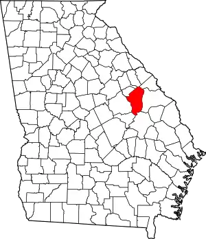 Map of Georgia highlighting Jefferson County | |
| Town | ||
| CDP | ||
| Unincorporated communities | ||
| Footnotes | ‡This populated place also has portions in an adjacent county or counties | |