Villefranche-d'Allier
Villefranche-d'Allier (French pronunciation: [vilfʁɑ̃ʃ dalje]; Auvergnat: Vilafrancha (d'Alèir)) is a commune in the Allier department in Auvergne-Rhône-Alpes in central France.
Villefranche-d’Allier | |
|---|---|
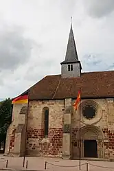 The church in Villefranche-d'Allier | |
 Coat of arms | |
Location of Villefranche-d’Allier | |
 Villefranche-d’Allier  Villefranche-d’Allier | |
| Coordinates: 46°23′51″N 2°51′29″E | |
| Country | France |
| Region | Auvergne-Rhône-Alpes |
| Department | Allier |
| Arrondissement | Montluçon |
| Canton | Commentry |
| Intercommunality | Commentry Montmarault Néris Communauté |
| Government | |
| • Mayor (2020–2026) | Gérard Ferrière[1] |
| Area 1 | 39.63 km2 (15.30 sq mi) |
| Population | 1,282 |
| • Density | 32/km2 (84/sq mi) |
| Time zone | UTC+01:00 (CET) |
| • Summer (DST) | UTC+02:00 (CEST) |
| INSEE/Postal code | 03315 /03430 |
| Elevation | 227–351 m (745–1,152 ft) (avg. 280 m or 920 ft) |
| 1 French Land Register data, which excludes lakes, ponds, glaciers > 1 km2 (0.386 sq mi or 247 acres) and river estuaries. | |
Population
| Year | Pop. | ±% |
|---|---|---|
| 1962 | 1,279 | — |
| 1968 | 1,347 | +5.3% |
| 1975 | 1,273 | −5.5% |
| 1982 | 1,272 | −0.1% |
| 1990 | 1,360 | +6.9% |
| 1999 | 1,306 | −4.0% |
| 2008 | 1,325 | +1.5% |
| 2013 | 1,342 | +1.3% |
| Source: INSEE (1968–2013) | ||
See also
References
- "Répertoire national des élus: les maires" (in French). data.gouv.fr, Plateforme ouverte des données publiques françaises. 13 September 2022.
- "Populations légales 2020". The National Institute of Statistics and Economic Studies. 29 December 2022.
Wikimedia Commons has media related to Villefranche-d'Allier.
This article is issued from Wikipedia. The text is licensed under Creative Commons - Attribution - Sharealike. Additional terms may apply for the media files.