Sazeret
Sazeret (French pronunciation: [sazʁɛ]) is a commune in the Allier department in Auvergne-Rhône-Alpes in central France.
Sazeret | |
|---|---|
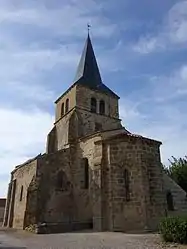 The church in Sazeret | |
Location of Sazeret | |
 Sazeret  Sazeret | |
| Coordinates: 46°20′25″N 2°57′24″E | |
| Country | France |
| Region | Auvergne-Rhône-Alpes |
| Department | Allier |
| Arrondissement | Montluçon |
| Canton | Commentry |
| Government | |
| • Mayor (2020–2026) | Viviane Alloin[1] |
| Area 1 | 17.94 km2 (6.93 sq mi) |
| Population | 142 |
| • Density | 7.9/km2 (21/sq mi) |
| Time zone | UTC+01:00 (CET) |
| • Summer (DST) | UTC+02:00 (CEST) |
| INSEE/Postal code | 03270 /03390 |
| Elevation | 348–497 m (1,142–1,631 ft) (avg. 430 m or 1,410 ft) |
| 1 French Land Register data, which excludes lakes, ponds, glaciers > 1 km2 (0.386 sq mi or 247 acres) and river estuaries. | |
Population
| Year | Pop. | ±% |
|---|---|---|
| 1968 | 261 | — |
| 1975 | 228 | −12.6% |
| 1982 | 188 | −17.5% |
| 1990 | 153 | −18.6% |
| 1999 | 149 | −2.6% |
| 2007 | 153 | +2.7% |
| 2012 | 164 | +7.2% |
| 2017 | 148 | −9.8% |
| Source: INSEE[3] | ||
See also
References
- "Répertoire national des élus: les maires". data.gouv.fr, Plateforme ouverte des données publiques françaises (in French). 2 December 2020.
- "Populations légales 2020". The National Institute of Statistics and Economic Studies. 29 December 2022.
- Population en historique depuis 1968, INSEE
Wikimedia Commons has media related to Sazeret.
This article is issued from Wikipedia. The text is licensed under Creative Commons - Attribution - Sharealike. Additional terms may apply for the media files.