Langy
Langy (French pronunciation: [lɑ̃ʒi]) is a commune in the Allier department in central France.[3]
Langy | |
|---|---|
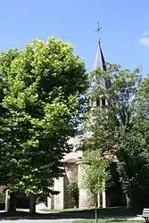 The church in Langy | |
Location of Langy | |
 Langy  Langy | |
| Coordinates: 46°16′06″N 3°28′22″E | |
| Country | France |
| Region | Auvergne-Rhône-Alpes |
| Department | Allier |
| Arrondissement | Vichy |
| Canton | Saint-Pourçain-sur-Sioule |
| Intercommunality | Entr'Allier Besbre et Loire |
| Government | |
| • Mayor (2020–2026) | Franck Fortin[1] |
| Area 1 | 7.36 km2 (2.84 sq mi) |
| Population | 270 |
| • Density | 37/km2 (95/sq mi) |
| Time zone | UTC+01:00 (CET) |
| • Summer (DST) | UTC+02:00 (CEST) |
| INSEE/Postal code | 03137 /03150 |
| Elevation | 260–342 m (853–1,122 ft) (avg. 336 m or 1,102 ft) |
| 1 French Land Register data, which excludes lakes, ponds, glaciers > 1 km2 (0.386 sq mi or 247 acres) and river estuaries. | |
Population
| Year | Pop. | ±% |
|---|---|---|
| 1962 | 218 | — |
| 1968 | 259 | +18.8% |
| 1975 | 227 | −12.4% |
| 1982 | 187 | −17.6% |
| 1990 | 194 | +3.7% |
| 1999 | 218 | +12.4% |
| 2008 | 237 | +8.7% |
| 2012 | 262 | +10.5% |
| Source: INSEE (1968–2012) | ||
See also
References
- "Répertoire national des élus: les maires" (in French). data.gouv.fr, Plateforme ouverte des données publiques françaises. 13 September 2022.
- "Populations légales 2020". The National Institute of Statistics and Economic Studies. 29 December 2022.
- INSEE commune file
Wikimedia Commons has media related to Langy.
This article is issued from Wikipedia. The text is licensed under Creative Commons - Attribution - Sharealike. Additional terms may apply for the media files.