Tumed Left Banner
Tumed Left Banner (Mongolian: ᠲᠦᠮᠡᠳ ᠵᠡᠭᠦᠨ ᠬᠣᠰᠢᠭᠤ; Chinese: 土默特左旗) is a banner (a county-level division) in Hohhot, Inner Mongolia Autonomous Region, North China. It is under the administration of the prefecture-level city of Hohhot, the capital of the autonomous region, it is some distance to the east-northeast.
Tumed Left Banner
土默特左旗 • ᠲᠦᠮᠡᠳ ᠵᠡᠭᠦᠨ ᠬᠣᠰᠢᠭᠤ | |
|---|---|
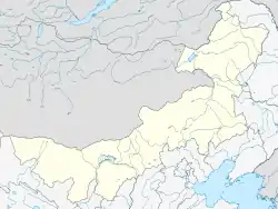 Tumed Left Banner Location in Inner Mongolia 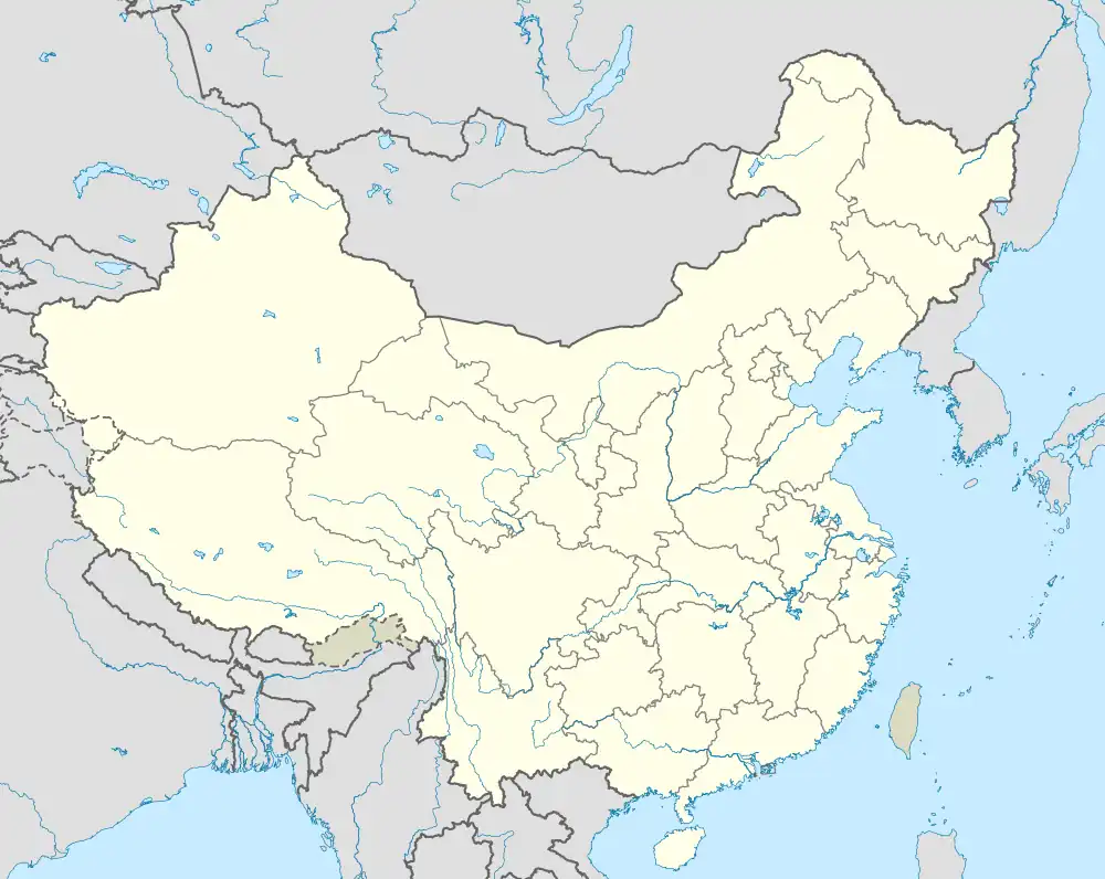 Tumed Left Banner Tumed Left Banner (China) | |
| Coordinates: 40°44′N 111°10′E | |
| Country | China |
| Autonomous region | Inner Mongolia |
| Prefecture-level city | Hohhot |
| Banner seat | Qasq |
| Area | |
| • Total | 2,776 km2 (1,072 sq mi) |
| Elevation | 1,046 m (3,432 ft) |
| Population (2020)[1] | |
| • Total | 263,131 |
| • Density | 95/km2 (250/sq mi) |
| Time zone | UTC+8 (China Standard) |
| Website | www |
| Tumed Left Banner | |||||||
|---|---|---|---|---|---|---|---|
| Chinese name | |||||||
| Chinese | 土默特左旗 | ||||||
| |||||||
| Mongolian name | |||||||
| Mongolian Cyrillic | Түмэд зүүн хошуу | ||||||
| Mongolian script | ᠲᠦᠮᠡᠳ ᠵᠡᠭᠦᠨ ᠬᠣᠰᠢᠭᠤ | ||||||
| |||||||
Administrative divisions
Tumed Left Banner is made up of 7 towns and 2 townships.
| Name | Simplified Chinese | Hanyu Pinyin | Mongolian (Hudum Script) | Mongolian (Cyrillic) | Administrative division code |
|---|---|---|---|---|---|
| Towns | |||||
| Qasq Town | 察素齐镇 | Chásùqí Zhèn | ᠴᠠᠭᠠᠰᠤᠴᠢ ᠪᠠᠯᠭᠠᠰᠤ | Цаасч балгас | 150121100 |
| Biqeq Town | 毕克齐镇 | Bìkèqí Zhèn | ᠪᠢᠴᠢᠭᠡᠴᠢ ᠪᠠᠯᠭᠠᠰᠤ | Бичээч балгас | 150121101 |
| Xangd Town | 善岱镇 | Shàndài Zhèn | ᠱᠠᠩᠳᠠ ᠪᠠᠯᠭᠠᠰᠤ | Шанд балгас | 150121102 |
| Taig Mod Town | 台阁牧镇 | Táigémù Zhèn | ᠲᠠᠢᠭᠠ ᠮᠣᠳᠣ ᠪᠠᠯᠭᠠᠰᠤ | Тайга мод балгас | 150121103 |
| Baimiaozi Town | 白庙子镇 | Báimiàozi Zhèn | ᠪᠠᠢ ᠮᠢᠶᠣᠤ ᠽᠢ ᠪᠠᠯᠭᠠᠰᠤ | Бай мяо зи балгас | 150121104 |
| Salqin Town | 沙尔沁镇 | Shā'ěrqìn Zhèn | ᠰᠠᠭᠠᠯᠢᠴᠢᠨ ᠪᠠᠯᠭᠠᠰᠤ | Саальчин балгас | 150121105 |
| Qelger Tal Town | 敕勒川镇 | Chìlèchuān Zhèn | ᠴᠡᠯᠡᠭᠡᠷ ᠲᠠᠯᠠ ᠪᠠᠯᠭᠠᠰᠤ | Цэлгэр тал балгас | 150121106 |
| Townships | |||||
| Beishizhou Township | 北什轴乡 | Běishízhóu Xiāng | ᠪᠧᠢ ᠱᠢ ᠵᠧᠦ ᠰᠢᠶᠠᠩ | Бей ши жүү шиян | 150121207 |
| Taban Sain Township | 塔布赛乡 | Tǎbùsài Xiāng | ᠲᠠᠪᠠᠨᠰᠠᠢᠨ ᠰᠢᠶᠠᠩ | Давансайн шиян | 150121208 |
Other:
- Jinshan Economic-Technological Development Area (金山经济技术开发区, ᠵᠢᠨ ᠱᠠᠨ ᠠᠵᠤ ᠠᠬᠤᠢ ᠶᠢᠨ ᠮᠡᠷᠭᠡᠵᠢᠯ ᠦᠨ ᠨᠡᠭᠡᠭᠡᠯᠲᠡ ᠶᠢᠨ ᠲᠣᠭᠣᠷᠢᠭ)
Climate
| Climate data for Tumed Left Banner (1991–2020 normals, extremes 1981–2010) | |||||||||||||
|---|---|---|---|---|---|---|---|---|---|---|---|---|---|
| Month | Jan | Feb | Mar | Apr | May | Jun | Jul | Aug | Sep | Oct | Nov | Dec | Year |
| Record high °C (°F) | 7.2 (45.0) |
16.8 (62.2) |
24.9 (76.8) |
34.1 (93.4) |
35.7 (96.3) |
38.7 (101.7) |
37.9 (100.2) |
34.6 (94.3) |
33.0 (91.4) |
27.5 (81.5) |
17.4 (63.3) |
10.3 (50.5) |
38.7 (101.7) |
| Average high °C (°F) | −4.4 (24.1) |
1.4 (34.5) |
9.1 (48.4) |
17.8 (64.0) |
24.1 (75.4) |
28.2 (82.8) |
29.3 (84.7) |
27.3 (81.1) |
22.5 (72.5) |
15.2 (59.4) |
5.3 (41.5) |
−2.6 (27.3) |
14.4 (58.0) |
| Daily mean °C (°F) | −11.0 (12.2) |
−5.5 (22.1) |
2.2 (36.0) |
10.6 (51.1) |
17.2 (63.0) |
21.8 (71.2) |
23.4 (74.1) |
21.3 (70.3) |
15.8 (60.4) |
8.2 (46.8) |
−0.9 (30.4) |
−8.7 (16.3) |
7.9 (46.2) |
| Average low °C (°F) | −16.4 (2.5) |
−11.3 (11.7) |
−3.9 (25.0) |
3.4 (38.1) |
9.9 (49.8) |
15.0 (59.0) |
17.5 (63.5) |
15.5 (59.9) |
9.7 (49.5) |
2.3 (36.1) |
−5.8 (21.6) |
−13.6 (7.5) |
1.9 (35.4) |
| Record low °C (°F) | −28.5 (−19.3) |
−25.2 (−13.4) |
−20.2 (−4.4) |
−7.9 (17.8) |
−1.7 (28.9) |
2.3 (36.1) |
9.4 (48.9) |
5.6 (42.1) |
−1.6 (29.1) |
−8.9 (16.0) |
−24.1 (−11.4) |
−30.4 (−22.7) |
−30.4 (−22.7) |
| Average precipitation mm (inches) | 1.9 (0.07) |
4.3 (0.17) |
10.4 (0.41) |
12.3 (0.48) |
30.4 (1.20) |
49.2 (1.94) |
106.2 (4.18) |
89.9 (3.54) |
59.8 (2.35) |
20.2 (0.80) |
8.7 (0.34) |
3.0 (0.12) |
396.3 (15.6) |
| Average precipitation days (≥ 0.1 mm) | 1.6 | 2.1 | 3.2 | 3.4 | 6.4 | 9.7 | 11.9 | 11.3 | 9.1 | 4.3 | 2.6 | 1.8 | 67.4 |
| Average snowy days | 3.1 | 3.3 | 2.7 | 0.7 | 0 | 0 | 0 | 0 | 0 | 0.2 | 2.6 | 3.2 | 15.8 |
| Average relative humidity (%) | 57 | 48 | 41 | 34 | 36 | 46 | 61 | 65 | 61 | 55 | 57 | 57 | 52 |
| Mean monthly sunshine hours | 198.6 | 208.8 | 252.4 | 270.6 | 285.3 | 260.8 | 242.6 | 244.7 | 222.2 | 226.6 | 194.9 | 184.3 | 2,791.8 |
| Percent possible sunshine | 66 | 69 | 68 | 67 | 64 | 58 | 54 | 58 | 60 | 67 | 66 | 64 | 63 |
| Source: China Meteorological Administration[2][3] | |||||||||||||
See also
References
- Inner Mongolia: Prefectures, Cities, Districts and Counties
- 中国气象数据网 – WeatherBk Data (in Simplified Chinese). China Meteorological Administration. Retrieved 10 October 2023.
- 中国气象数据网 (in Simplified Chinese). China Meteorological Administration. Retrieved 10 October 2023.
- www.xzqh.org (in Chinese)
This article is issued from Wikipedia. The text is licensed under Creative Commons - Attribution - Sharealike. Additional terms may apply for the media files.