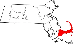
Truro, Massachusetts
Truro /ˈtrɜːroʊ/ is a town in Barnstable County, Massachusetts, United States, comprising two villages: Truro and North Truro. Located slightly more than 100 miles (160 km) by road from Boston, it is a summer vacation community just south of the northern tip of Cape Cod, in an area known as the "Outer Cape".[1] English colonists named it after Truro in Cornwall, United Kingdom.
Truro, Massachusetts | |
|---|---|
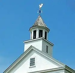 Truro Town Hall | |
 Seal | |
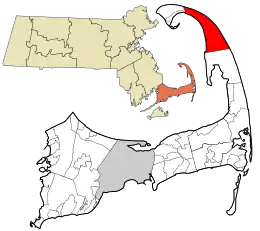 Location in Barnstable County and the Commonwealth of Massachusetts. | |
| Coordinates: 41°59′36″N 70°03′01″W | |
| Country | United States |
| State | Massachusetts |
| County | Barnstable |
| Settled | 1700 |
| Incorporated | 1709 |
| Government | |
| • Type | Open town meeting |
| Area | |
| • Total | 26.3 sq mi (68.2 km2) |
| • Land | 21.1 sq mi (54.5 km2) |
| • Water | 5.3 sq mi (13.6 km2) |
| Elevation | 25 ft (8 m) |
| Population (2020) | |
| • Total | 2,454 |
| • Density | 116.3/sq mi (45.0/km2) |
| Time zone | UTC-5 (Eastern) |
| • Summer (DST) | UTC-4 (Eastern) |
| ZIP code | 02666 |
| Area code | 508 |
| FIPS code | 25-70605 |
| GNIS feature ID | 0618260 |
| Website | truro-ma.gov |
The historic Wampanoag Native American people called the area Pamet or Payomet. Their language was part of the large Algonquian family. This name was adopted for the Pamet River and the harbor area around the town center known as the Pamet Roads.[2] The population of Truro was 2,454 at the 2020 census.[3]
Over half of the land area of the town is part of the Cape Cod National Seashore, established in 1961 by President John F. Kennedy, and administered by the U.S. National Park Service.
History
Cape Cod was the territory of successive cultures of indigenous peoples for thousands of years before Europeans arrived. At the time of English colonization, the Wampanoag tribe was the dominant one on Cape Cod, numbering about 7,000 by early accounts. They used the cape and its waters for hunting, fishing and gathering shellfish. They also cultivated maize to supplement their diets and to store for winter eating.
The English Pilgrims stopped in Truro and Provincetown in 1620 as their original choice for a landing before later deciding the area to be unsuitable. While there, they discovered fresh water and corn stored by the Wampanoag. Historians debate the accuracy of the account about the latter discovery, but in popular lore it led to the place being called Corn Hill.
Truro was settled by English immigrant colonists in the 1690s as the northernmost portion of the town of Eastham. The town was officially separated and incorporated in 1709. Fishing, whaling and shipbuilding made up the town's early industry. These industries had to shift to other locations as the harsh tides of the Lower Cape reduced the town's main port in the 1850s. In the late 19th and early 20th century, Cape Cod was a popular location for artists because of its light.
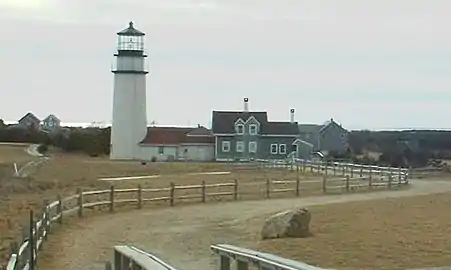
Today, Truro is one of the more exclusive towns on the Cape, noted for its affluent residences and the rolling hills and dunes along the coast. Truro is the site of the Highland Light (also known as the Cape Cod Light), the earliest lighthouse on Cape Cod. The first building was erected in 1797; the current lighthouse was built in 1857. The entire 430-ton light was moved about 1⁄10 of a mile inland in 1996. By then, because of erosion, its original site was just ten yards from the edge of the shore cliffs.[4]
The old town cemetery was the location of the murders in 1969 of Susan Perry, Patricia Walsh, Sydney Monzon and Mary Anna Wysocki by Tony Costa.[5]
Geography
According to the United States Census Bureau, the town has a total area of 26.3 square miles (68 km2), of which 21.0 square miles (54 km2) is land and 5.3 square miles (14 km2) (20.02%) is water. Truro is located just south and east of the "tip" of Cape Cod, and is bordered by Provincetown to the northwest, the Atlantic Ocean to the north and east, Wellfleet to the south, and Cape Cod Bay to the west. The town is thirty-eight miles by road to Barnstable, fifty miles from the Sagamore Bridge and 105 miles by road from Boston.
The topography generally slopes downward from the Atlantic to Cape Cod Bay, and from south to north. There are several small ponds throughout town, all of which combined are smaller than the Pilgrim Lake, just east of the Provincetown town line, and just south of the sand dunes which make up most of the northern tip of the Cape. Pamet Harbor, a small inlet, is in the southern half of the town on the Cape Cod Bay side, and leads to the Pamet River. Just south of the lighthouse is a Coast Guard radar station, equipped with a Doppler radar tower, close to the nearby Jenny Lind Tower.
Climate
The town of Truro has a mild summer Humid continental climate (Dfb). The plant hardiness zone is 7a with an average annual extreme minimum air temperature of 4.0 °F (−15.6 °C).[6] The average seasonal (Nov–Apr) snowfall total is around 30 in (76 cm). The average snowiest month is February which corresponds to the annual peak in nor'easter activity.
| Climate data for Truro, Barnstable County, Massachusetts (1981–2010 averages). | |||||||||||||
|---|---|---|---|---|---|---|---|---|---|---|---|---|---|
| Month | Jan | Feb | Mar | Apr | May | Jun | Jul | Aug | Sep | Oct | Nov | Dec | Year |
| Average high °F (°C) | 38.5 (3.6) |
39.6 (4.2) |
44.7 (7.1) |
53.7 (12.1) |
62.9 (17.2) |
73.4 (23.0) |
79.4 (26.3) |
78.0 (25.6) |
71.5 (21.9) |
61.9 (16.6) |
53.0 (11.7) |
44.4 (6.9) |
58.5 (14.7) |
| Daily mean °F (°C) | 31.8 (−0.1) |
32.9 (0.5) |
37.9 (3.3) |
46.5 (8.1) |
55.3 (12.9) |
65.2 (18.4) |
71.4 (21.9) |
70.6 (21.4) |
64.3 (17.9) |
54.7 (12.6) |
46.2 (7.9) |
37.4 (3.0) |
51.3 (10.7) |
| Average low °F (°C) | 25.1 (−3.8) |
26.2 (−3.2) |
31.0 (−0.6) |
39.2 (4.0) |
47.8 (8.8) |
56.9 (13.8) |
63.4 (17.4) |
63.2 (17.3) |
57.0 (13.9) |
47.5 (8.6) |
39.4 (4.1) |
30.3 (−0.9) |
44.0 (6.7) |
| Average precipitation inches (mm) | 3.73 (95) |
3.23 (82) |
4.35 (110) |
4.21 (107) |
3.32 (84) |
3.54 (90) |
2.86 (73) |
3.68 (93) |
3.59 (91) |
4.09 (104) |
4.36 (111) |
3.87 (98) |
44.83 (1,139) |
| Average relative humidity (%) | 68.2 | 66.9 | 66.7 | 67.7 | 70.3 | 71.6 | 73.8 | 74.2 | 74.4 | 70.0 | 67.9 | 66.6 | 69.9 |
| Source: PRISM Climate Group[7] | |||||||||||||
| Month | Jan | Feb | Mar | Apr | May | Jun | Jul | Aug | Sep | Oct | Nov | Dec | Year |
|---|---|---|---|---|---|---|---|---|---|---|---|---|---|
| Average Dew Point °F | 22.5 | 23.1 | 27.8 | 36.4 | 45.8 | 55.8 | 62.6 | 62.0 | 56.0 | 45.1 | 36.2 | 27.3 | 41.8 |
| Average Dew Point °C | −5.3 | −4.9 | −2.3 | 2.4 | 7.7 | 13.2 | 17.0 | 16.7 | 13.3 | 7.3 | 2.3 | −2.6 | 5.4 |
Source = PRISM Climate Group[8] | |||||||||||||
Demographics
| Year | Pop. | ±% |
|---|---|---|
| 1850 | 2,051 | — |
| 1860 | 1,583 | −22.8% |
| 1870 | 1,269 | −19.8% |
| 1880 | 1,017 | −19.9% |
| 1890 | 919 | −9.6% |
| 1900 | 767 | −16.5% |
| 1910 | 655 | −14.6% |
| 1920 | 554 | −15.4% |
| 1930 | 513 | −7.4% |
| 1940 | 585 | +14.0% |
| 1950 | 661 | +13.0% |
| 1960 | 1,002 | +51.6% |
| 1970 | 1,234 | +23.2% |
| 1980 | 1,486 | +20.4% |
| 1990 | 1,573 | +5.9% |
| 2000 | 2,087 | +32.7% |
| 2010 | 2,003 | −4.0% |
| 2020 | 2,454 | +22.5% |
| 2022* | 2,486 | +1.3% |
| * = population estimate. Source: United States census records and Population Estimates Program data.[9][10][11][12][13][14][15][16][17][18][19] | ||
As of the census[20] of 2000, there were 2,087 people, 907 households, and 515 families residing in the town. The population density was 99.1 inhabitants per square mile (38.3/km2). There were 2,551 housing units at an average density of 121.2 per square mile (46.8/km2). The racial makeup of the town was 95.11% White, 1.87% African American, 0.43% Native American, 0.38% Asian, 0.10% Pacific Islander, 0.77% from other races, and 1.34% from two or more races. Hispanic or Latino of any race were 1.15% of the population.
There were 907 households, out of which 21.2% had children under the age of 18 living with them, 46.3% were married couples living together, 7.9% had a female householder with no husband present, and 43.2% were non-families. 32.0% of all households were made up of individuals, and 12.5% had someone living alone who was 65 years of age or older. The average household size was 2.18 and the average family size was 2.76.
In the town, the population was spread out, with 17.4% under the age of 18, 4.1% from 18 to 24, 27.2% from 25 to 44, 34.4% from 45 to 64, and 17.0% who were 65 years of age or older. The median age was 46 years. For every 100 females, there were 86.5 males. For every 100 females age 18 and over, there were 84.7 males.
The median income for a household in the town was $42,981, and the median income for a family was $51,389. Males had a median income of $37,208 versus $30,435 for females. The per capita income for the town was $22,608. About 4.8% of families and 11.2% of the population were below the poverty line, including 8.5% of those under age 18 and 10.3% of those age 65 or over.

Government
Truro is represented in the Massachusetts House of Representatives as a part of the Fourth Barnstable district, which includes (with the exception of Brewster) all the towns east and north of Harwich on the Cape. The seat is held by Democrat Sarah Peake. The town is represented in the Massachusetts Senate as a part of the Cape and Islands District, which includes all of Cape Cod, Martha's Vineyard and Nantucket except the towns of Bourne, Falmouth, and Sandwich.[21] The Senate seat is held by Democrat Julian Cyr.
On the national level, Truro is a part of Massachusetts's 9th congressional district, and is currently represented by Bill Keating. The state's senior member of the United States Senate is Elizabeth Warren (elected in 2012); the state's junior Senate member, elected in 2014, is Edward Markey.
Like most small incorporated communities in New England, Truro uses an open town meeting form of government, led by a Town Moderator and a Board of Selectmen. The town has its own police and fire departments, headquartered on Route 6 just south of the Route 6A split. The town has two post offices: one for Truro proper (02666), located on Truro Center Road, and one for the village of North Truro (02652), located on Shore Road (MA Route 6A). The town's Public Library is located between the two routes in a secluded spot, leading to the nickname, "The Library In The Woods."
Opposition to development
Through town meeting, as well as the town's Planning Board and the Cape Cod Commission, some Truro residents have made considerable, and often successful, efforts to prevent development projects which they perceive to threaten the town's character. They opposed a proposed Stop & Shop grocery store and the WTUR/WCDJ/WGTX communication tower. The latter project was finally built in 2007, almost 20 years after the station was first licensed.
Education
Truro operates the Truro Central School for students from pre-kindergarten through eighth grade. The town does not have its own high school; a tuition agreement is in place with Nauset Regional High School to send its students there.[22] Cape Cod Times states that normally Nauset secondary schools are the destinations of students above grade 6.[23] Formerly Truro residents had the option of going to Provincetown High School.[24] Provincetown High School ended operations after 2013.[25]
There are no private schools anywhere on the lower Cape; high school students additionally have the option of attending the Cape Cod Regional Technical High School in Harwich, Monomoy Regional High School In Harwich, or students can attend Sturgis Charter school In Hyannis.
There are private scholarships for students from Truro and Provincetown: the John Anderson Francis Family Scholarship Fund and the Captain Joseph F. Oliver Scholarship Fund. c. 2019 each year the number of applicants ranged from 6–10, a figure the organizers consider to be low.[26]
The Truro Public Library is in the city.[27] The library has a puppet theater performance. The outside of the facility has a pavilion. Cynthia McCormick of Cape Cod Times described it as "a home away from home for parents".[28]
Transportation
U.S. Route 6 (US 6) is the main route through town, traveling through the town from south to north on its way to Provincetown. The "second" portion of the Cape's Massachusetts Route 6A (Route 6A) begins in the town, tracing the original path of US 6, and traveling into Provincetown barely 250 feet (76 m) south of the main route. There is no rail or air service in the town; the nearest regional airport is located in neighboring Provincetown. The nearest national and international air service can be found at Logan International Airport in Boston.
Notable people

- Marshall Ayres, pioneer of the American west
- Edward Knight Collins, 19th-century shipping magnate
- Lee Falk, writer
- L. Thomas Hopkins, education theorist
- Edward Hopper, artist
- Patty Larkin, singer-songwriter
- Lucy L'Engle, artist
- Danny MacFayden, Major League Baseball pitcher
- Nick Minnerath, professional basketball player
- Steve Nelson, political activist and veteran of the Spanish Civil War
- Anthony Perkins, American actor
- Josh Taves, American football defensive end
Truro in popular culture and art

Artist Edward Hopper owned a summer house in Truro, and painted numerous Truro scenes including Corn Hill (1930), Highland Light, North Truro (1930), and Cottages at North Truro (1936).[29]
The first film in the Men In Black series displayed Truro on a satellite map, but the map zoomed in on Sandwich, a town at the opposite end of Cape Cod. In Men in Black II (2002), Truro was the town to which Tommy Lee Jones' character "Agent K" retired, becoming a postal worker. The post office was portrayed as a solitary building in the middle of nowhere. In contrast, Truro's post office is in the heart of "downtown" Truro, which is also the location of a small convenience store and a few shops.
Shipwrecks
Off Head of the Meadow beach on the Atlantic side of Truro lies the wreck of the three-masted barque Frances.[30] The Hamburg-based ship wrecked off Truro on December 27, 1872, while on her way from the Far East to Boston. Usually submerged, the wreck will appear when weather and tides line up.[30]
References
- Sheedy, Jack and Coogan, Jim. Cape Cod Voyage: A Journey Through Cape Cod's History and Lore, East Dennis, Massachusetts: Harvest Home Books, 2001, p. 19 The "lower" Cape is the northernmost part of Cape Cod, while the "upper" Cape is to the south. These directional terms were determined in seafaring days by the prevailing westerly winds, which were of paramount importance during the time when sailed boats were a primary form of travel. A boat sailing south-to-north on Cape Cod Bay would have the wind at its back, and was thus traveling "down", while the opposite was true of a boat sailing north-to-south.
- "Roads", Dictionary.com. "Roads" in the nautical sense of "a partly sheltered area of water near a shore in which vessels may ride at anchor."
- "Census - Geography Profile: Truro town, Barnstable County, Massachusetts". Retrieved October 6, 2021.
- Cape Cod, Martha's Vineyard and Nantucket Street Atlas. Arrow Maps Inc. 2004. p. 86.
- Albright, EJ. "The Tony Costa Cape Cod murders" Archived 2011-07-21 at the Wayback Machine, Cape Cod Confidential. CapeCodToday.com 9 November 2007.
- "USDA Interactive Plant Hardiness Map". United States Department of Agriculture. Archived from the original on July 4, 2019. Retrieved June 28, 2019.
- "PRISM Climate Group, Oregon State U". www.prism.oregonstate.edu. Retrieved June 26, 2019.
- "PRISM Climate Group, Oregon State U". www.prism.oregonstate.edu. Retrieved June 27, 2019.
- "Total Population (P1), 2010 Census Summary File 1". American FactFinder, All County Subdivisions within Massachusetts. United States Census Bureau. 2010.
- "Massachusetts by Place and County Subdivision - GCT-T1. Population Estimates". United States Census Bureau. Retrieved July 12, 2011.
- "1990 Census of Population, General Population Characteristics: Massachusetts" (PDF). US Census Bureau. December 1990. Table 76: General Characteristics of Persons, Households, and Families: 1990. 1990 CP-1-23. Retrieved July 12, 2011.
- "1980 Census of the Population, Number of Inhabitants: Massachusetts" (PDF). US Census Bureau. December 1981. Table 4. Populations of County Subdivisions: 1960 to 1980. PC80-1-A23. Retrieved July 12, 2011.
- "1950 Census of Population" (PDF). Bureau of the Census. 1952. Section 6, Pages 21-10 and 21-11, Massachusetts Table 6. Population of Counties by Minor Civil Divisions: 1930 to 1950. Retrieved July 12, 2011.
- "1920 Census of Population" (PDF). Bureau of the Census. Number of Inhabitants, by Counties and Minor Civil Divisions. Pages 21-5 through 21-7. Massachusetts Table 2. Population of Counties by Minor Civil Divisions: 1920, 1910, and 1920. Retrieved July 12, 2011.
- "1890 Census of the Population" (PDF). Department of the Interior, Census Office. Pages 179 through 182. Massachusetts Table 5. Population of States and Territories by Minor Civil Divisions: 1880 and 1890. Retrieved July 12, 2011.
- "1870 Census of the Population" (PDF). Department of the Interior, Census Office. 1872. Pages 217 through 220. Table IX. Population of Minor Civil Divisions, &c. Massachusetts. Retrieved July 12, 2011.
- "1860 Census" (PDF). Department of the Interior, Census Office. 1864. Pages 220 through 226. State of Massachusetts Table No. 3. Populations of Cities, Towns, &c. Retrieved July 12, 2011.
- "1850 Census" (PDF). Department of the Interior, Census Office. 1854. Pages 338 through 393. Populations of Cities, Towns, &c. Retrieved July 12, 2011.
- "City and Town Population Totals: 2020-2022". United States Census Bureau. Retrieved October 21, 2023.
- "U.S. Census website". United States Census Bureau. Retrieved January 31, 2008.
- "Index of Legislative Representation by City and Town, from Mass.gov". Archived from the original on September 29, 2007. Retrieved March 1, 2007.
- "2020 CENSUS - SCHOOL DISTRICT REFERENCE MAP: Barnstable County, MA" (PDF). U.S. Census Bureau. Retrieved July 21, 2022. - Text list - The source directly states that Nauset and Provincetown districts are the two options, and currently Provincetown only goes up to the middle school level.
- "Ex-Nauset superintendent picked for Truro post". Cape Cod Times. March 13, 2014. Retrieved February 3, 2021.
- "SCHOOL DISTRICT REFERENCE MAP (2010 CENSUS): Barnstable County, MA" (PDF). U.S. Census Bureau. Retrieved July 22, 2022. - Text list - At the time Provincetown did have a high school.
- "Final class graduates from Provincetown High School - The Boston Globe". The Boston Globe.
- Steele, Peter A. (September 25, 2019). "Scholarships to spare Provincetown but few scholars". Provincetown Banner. Retrieved February 7, 2021.
- "Home". Truro Public Library. Retrieved February 10, 2021.
- McCormick, Cynthia (March 23, 2019). "Where are the children of Outer Cape Cod?". Cape Cod Times. Archived from the original on February 10, 2021. Retrieved February 9, 2021.
- Dicum, Gregory (August 10, 2008). "Cape Cod, in Edward Hopper's Light". The New York Times.
- Lum, Kaimi Rose (December 26, 2012). "Shipwreck Frances emerges from Truro sands". Wicked Local Provincetown. Retrieved December 27, 2012.
