List of lighthouses in Massachusetts
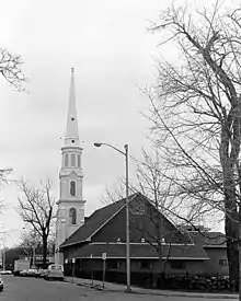
This is a list of all lighthouses in the U.S. state of Massachusetts as identified by the United States Coast Guard. Enumeration of the lighthouses in this state is complicated by the number of multiple tower stations and replacement of older towers, with the Brant Point Light station having had nine towers, two of which survive.[1] At present there are forty-seven active towers, of which eleven are privately maintained; thirteen are standing but inactive, seven have been replaced with skeleton towers, thirteen have been destroyed or removed, and one tower has been moved to another state. The oldest station, Boston Light, established in 1716, was the first lighthouse built in the colonies, and the current tower at that station, built in 1783, is the oldest survivor in the state and the second oldest in the nation, and was the last lighthouse automated in the United States.[2] The last station established was at the Buzzards Bay Entrance Light in 1961 (since replaced by an automated light on a steel tripod), but in 1986 the 1818 Great Point Light was rebuilt and relit, making it the last tower constructed in the state. The tallest towers in the state are the two Cape Ann Light towers, but the highest focal plane is at the Hospital Point Range Rear Light, which is located in the steeple of the First Baptist Church of Beverly.[2]
A number of inactivated Massachusetts lights have met with unusual fates. The Three Sisters of Nauset were sold off to separate private buyers before being purchased by the National Park Service and moved back near their original site. Range lights in Nantucket and Hyannis were incorporated into private dwellings, the former housing the Gilbreth family of Cheaper by the Dozen fame. The Point Gammon Light was converted into an observation tower for birdwatching.
If not otherwise noted, focal height and coordinates are taken from the United States Coast Guard Light List,[3] while location and dates of activation, automation, and deactivation are taken from the United States Coast Guard Historical information site for lighthouses.[4] Lighthouses in the "Former" section only include structures that no longer exist.
Existing lighthouses
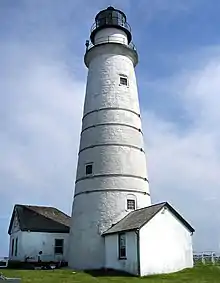
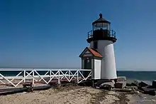
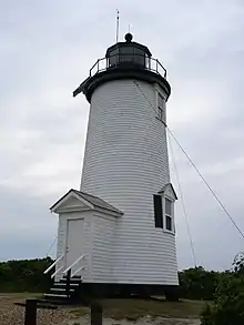
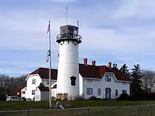
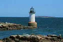
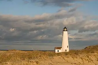
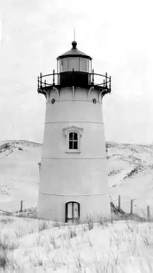
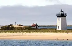
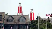
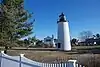
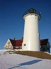
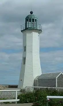
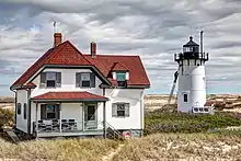
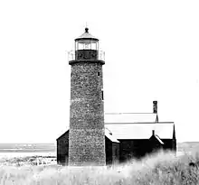
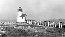
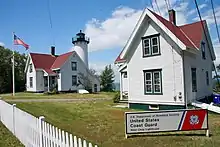
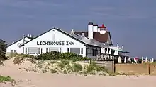
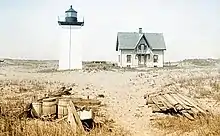
Traditional

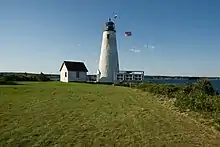


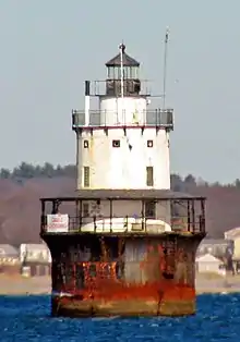


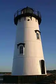


.jpg.webp)


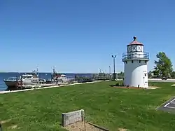

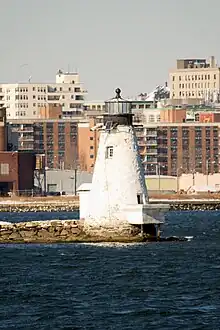


.jpg.webp)
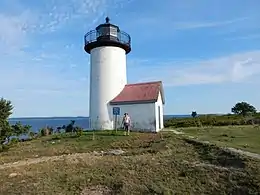

.jpg.webp)
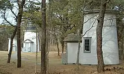

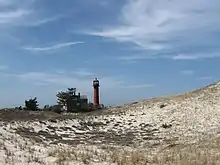
Modern
The United States Coast Guard lists these as active lighthouses.
| Name | Image | Location | Coordinates | Year first lit | Status | Current Lens | Focal Height |
|---|---|---|---|---|---|---|---|
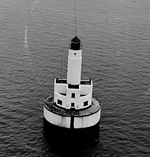
| Buzzards Bay Entrance Light | — | Buzzards Bay | 41.3970°N 71.0347°W | 1997 | Active | Unknown | 67 ft (20 m) |
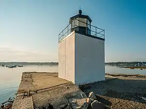
| Ipswich Light | — | Ipswich | 42.6853°N 70.7662°W | 1939 | Active | Unknown | 42 ft (13 m)[11] |
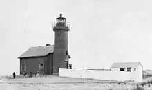
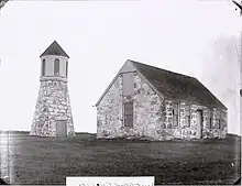
Former lighthouses
| Name | Image | Location | Coordinates | Year first lit | Automated | Year deactivated | Light | Focal Height |
|---|---|---|---|---|---|---|---|---|
| Annisquam Harbor Light |  |
Gloucester (Cape Ann) |
42.6619°N 70.6815°W | 1851 | Never | 1897 (Razed) |
Fifth-order Fresnel lens | 40 ft (12 m) |
| Bakers Island Light |  |
Salem | 42.5364°N 70.7859°W | 1815 | Never | 1926 (Razed) |
Fourth-order Fresnel lens | Unknown |
| Billingsgate Island Light |  |
Wellfleet (Billingsgate Island) |
41.871°N 70.068°W[27] | 1858 | Never | 1915 (Destroyed) |
Fourth-order Fresnel lens | 40 ft (12 m) |
| Bishop and Clerks Light |  |
Hyannis | 41.5743°N 70.2501°W | 1858 | 1923 | 1928 (Demolished in 1952) |
Fourth-order Fresnel lens | 59 ft (18 m)[4] |
| Boston Light | 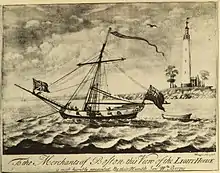 |
Boston (Little Brewster Island) |
42.3280°N 70.8901°W | 1716 | Never | 1776 (Destroyed) |
Tallow candles | 75 ft (23 m) |
| Broad Sound Channel Inner Range Lights |  |
Boston (Spectacle Island) |
42.3278°N 70.9842°W[28] (Front Light) 42.3275°N 70.9853°W[28] (Rear Light) |
1903[29] | Never | 1950[29] (Removed) |
Fourth-order Fresnel lens | 53 ft (16 m)[29] (Front) 70 ft (21 m)[29] (Rear) |
| Buzzards Bay Entrance Light | _MA.JPG.webp) |
Buzzards Bay | 41.3970°N 71.0347°W | 1961 | 1980 | 1997 (Dismantled) |
Unknown | 101 ft (31 m)[30] |
| Clarks Point Light |  |
New Bedford | 41.5932°N 70.9014°W | 1818 | Never | 1906 (Demolished) |
Unknown | 68 ft (21 m)[4] |
| Cuttyhunk Light |  |
Gosnold (Cuttyhunk Island) |
41.414°N 70.950°W | 1891 | Never | 1947 (Demolished) |
Fifth-order Fresnel lens | 63 ft (19 m) |
| Deer Island Light |  |
Boston (Deer Island) |
42.3399°N 70.9545°W | 1890 | 1960 | 1982 (Destroyed in 1984) |
Unknown | 53 ft (16 m)[31] |
| Dumpling Rocks Light |  |
Buzzards Bay | 41.538°N 70.921°W | 1829[lower-alpha 6] | Never | 1938 (Destroyed) |
Fifth-order Fresnel lens | Unknown |
| Egg Rock Light |  |
Egg Rock (Near Nahant) |
42.433°N 70.898°W[32] | 1856[lower-alpha 7] | 1918[33] | 1922 (Destroyed in 1927) |
Fifth-order Fresnel lens | 90 ft (27 m)[32] |
| Falmouth Inner Light |  |
Falmouth | 41.5421°N 70.6083°W | Unknown | Unknown | Unknown | Unknown | 25 ft (7.6 m) |
| Fairhaven Bridge Light |  |
Fairhaven | 41.6392°N 70.9175°W | 1888 | Never | 1891 (Razed) |
Unknown | Unknown |
| Great Point Light |  |
Nantucket | 41.3902°N 70.0483°W | 1817 | 1955 | 1984 (Destroyed) |
Third-order Fresnel lens | 71 ft (22 m) |
| Hyannis Front Range Light |  |
Hyannis | 41.634°N 70.289°W | 1885 | Never | 1929 (Removed) |
Fifth-order Fresnel lens | 20 ft (6.1 m)[34] |
| Hyannis Rear Range Light |  |
Hyannis | 41.636°N 70.2885°W[35] | 1849 | Never | 1929 (Removed) |
Fifth-order Fresnel lens | 43 ft (13 m)[34] |
| Ipswich Front Range Light |  |
Ipswich | 42.686°N 70.765°W[11] | 1867 | Never | 1932 | Unknown | 25 ft (7.6 m)[11] |
| Long Island Head Light |  |
Boston (Long Island) |
42.3302°N 70.9577°W | 1844[12] | Never | 1881[12] (Replaced) |
Fourth-order Fresnel lens | 120 ft (37 m) |
| Long Point Light | 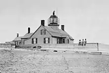 |
Provincetown (Long Point) |
42.0331°N 70.1687°W | 1827 | Never | 1873 (Replaced) |
Sixth-order Fresnel lens | 36 ft (11 m) |
| Lovells Island Range Lights |  |
Boston (Lovells Island) |
42.3328°N 70.9303°W[4] (Front Light) 42.3319°N 70.9311°W[4] (Rear Light) |
1903 | Never | 1939 (Removed) |
None | 31 ft (9.4 m)[36] (Front Light) 40 ft (12 m)[36] (Rear Light) |
| Marblehead Light | 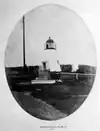 |
Marblehead | 42.5054°N 70.8337°W[13] | 1835 | Never | 1895 (Replaced) |
Sixth-order Fresnel lens | 130 ft (40 m)[13] |
| Nantucket Beacon | .JPG.webp) |
Nantucket | 41.273°N 70.073°W[8] | c.1807[lower-alpha 8] | Never | Unknown | Lanterns | 24 ft (7.3 m)[8] |
| Race Point Light | 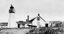 |
Provincetown | 42.0623°N 70.2430°W | 1816 | Never | 1876 (Replaced) |
Fourth-order Fresnel lens | 25 ft (7.6 m) |
| Spectacle Island Range Lights | 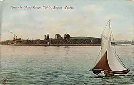 |
Boston (Spectacle Island) |
42.3281°N 70.9853°W[28] (Front Light) 42.3275°N 70.9844°W[28] (Rear Light) |
1897 | Never | 1913 | None | 29 ft (8.8 m)[28] (Front Light) 54 ft (16 m)[28] (Rear Light) |
| Ten Pound Island Light |  |
Gloucester | 42.6019°N 70.6656°W | 1821 | Never | 1881 (Replaced) |
57 ft (17 m) | |
| Twin Lights | Chatham | 41.6713°N 69.9502°W | 1841 | Never | 1877 (Razed) |
Fourth-order Fresnel lens | 40 ft (12 m) |
See also
Notes
- The "North Tower" was inactive from 1932 to 1989 when it was automated and relit.
- One or more towers predate the currently listed structure. At this time, there is not enough available information to make an entry under the "Former lighthouses" section for them.
- At least 5 different towers have been constructed since the first structure in 1828. The current lighthouse was originally the Ipswich Rear Range Light before it was moved in 1939.
- The current tower dates to 1877 when it was built for use in Chatham.
- Point Gammon Light was converted into a bird watching observation tower in the late 19th century.
- The last "traditional" stone lighthouse was built in 1889.
- The last "traditional" stone lighthouse was built in 1898.
- The United States Coast Guard claims Nantucket Beacon was established in 1794. This is disputed by a congressional claim which dates to 1820.
References
- "Brant Point, MA". Lighthouse Friends.
- Rowlett, Russ. "Lighthouses of the United States: Northern Massachusetts". The Lighthouse Directory. University of North Carolina at Chapel Hill.
- Light List, Volume I, Atlantic Coast, St. Croix River, Maine to Shrewsbury River, New Jersey (PDF). Light List. United States Coast Guard. 2012.
- "Historic Light Station Information and Photography: Massachusetts". United States Coast Guard Historian's Office. Archived from the original on 2017-05-01.
- Russ Rowlett (May 24, 2022). "Lighthouses of the United States: Southeastern Massachusetts". University of North Carolina. Archived from the original on October 30, 2022. Retrieved March 11, 2023.
- "Bird Island Light". Jeremy D'Entremont.
- "Brant Point (old), MA". Lighthouse Friends.
- Report of the Secretary of the Treasury on the State of the Finances. Washington, DC: William A. Harris. December 6, 1858. pp. 446–447. Retrieved 2012-09-28.
- "Derby Wharf Light: History". Jeremy D'Entremont.
- "Cape Cod (Highland), MA". Lighthouse Friends.
- Ipswich Bay to Gloucester, Massachusetts (Map). 1:20,000. Department of Commerce. 1930. Chart 243.
- "Long Island Head Light: History". Jeremy D'Entremont.
- "Section VIII: Light List Corrections" (PDF). Local Notice to Mariners, District 1. United States Coast Guard (week 3): 22. 2012.
- "Mayo's Beach, MA". Lighthouse Friends. Archived from the original on 2007-10-13.
- "Monomoy Point Light". Jeremy E'Entremont.
- "Nantucket Cliff Range, MA". Lighthouse Friends.
- "Newburyport Harbor Range Front, MA". Lighthouse Friends.
- Newburyport Harbor and Plum Island Sound (Map). 1:20,000. US Dept. of Commerce. 1958. Chart 213.
- "Newburyport Harbor Range Rear, MA". Lighthouse Friends.
- "Scituate Light". Jeremy D'Entremont.
- "Palmer's Island Light". Jeremy D'Entremont.
- "Point Gammon, MA". Lighthouse Friends. Archived from the original on 2012-10-04.
- "Point Gammon Light". Jeremy D'Entremont.
- "Sandy Neck, MA". Lighthouse Friends.
- "Stage harbor, MA". Lighthouse Friends.
- "Three Sisters, MA". Lighthouse Friends.
- "Billingsgate Island Light". Jeremy D'Entremont.
- List of Lights and Fog Signals on the Atlantic and Gulf Coasts of the United States. Washington, DC: US Government Printing Office. 1900. p. 38.
- "Broad Sound Channel Inner Range Lights: History". Jeremy D'Entremont.
- Marthas Vineyard to Block Island (Map). 1:80,000. NOAA. 1980. Chart 13218.
- Boston Harbor (Map). 1:25,000. NOAA. 1969. Chart 13270.
- "Egg Rock Light". Jeremy D'Entremont.
- "Egg Rock Light: History". Jeremy D'Entremont.
- "Hyannis Harbor Light: History". Jeremy d'Entremont.
- "Hyannis Harbor Light". Jeremy d'Entremont.
- Boston Harbor (Map). 1:20,000. US Dept. of Commerce. 1928. Chart 246.