Sudak Municipality
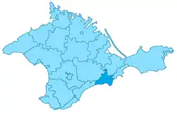
Sudak City Municipality (Ukrainian: Судацька міськрада, Russian: Судакский горсовет, Crimean Tatar: Sudaq şeer şurası), officially "the territory governed by the Sudak city council" is one of the 25 regions of the Crimean peninsula, currently subject to a territorial dispute between the Russian Federation and Ukraine. Population: 32,278 (2014 Census).[1]
Sudak City Municipality
Sudaq şeer şurası | |
|---|---|
 | |
 Location within Crimea | |
| Coordinates: 44°51′5″N 34°58′21″E | |
| Country | Disputed: |
| Republic | Crimea |
| Capital | Sudak |
| Subdivisions | List
|
| Area | |
| • Total | 539 km2 (208 sq mi) |
| Population (2014) | |
| • Total | 32,278 |
| • Density | 60/km2 (160/sq mi) |
| Time zone | UTC+3 (MSK) |
| Dialing code | +7-36566 (de facto) |
| Website | http://sudak.rk.gov.ru/ (de facto) |
Administrative divisions
Within the framework of administrative divisions of Russia, Sudak is, together with a number of urban and rural localities, incorporated separately as the town of republican significance of Sudak—an administrative unit with the status equal to that of the districts.[2] As a municipal division, the town of republican significance of Sudak is incorporated as Sudak Urban Okrug.[3]
Within the framework of administrative divisions of Ukraine, Sudak is incorporated as the town of republican significance of Sudak.[4] Ukraine does not have municipal divisions.
Besides the city of Sudak the region includes the town of Novyi Svet and 14 villages which are organised into 7 communities.
Former Crimean Tatar names which were officially changed in 1945-49 and are now used only by the Crimean Tatar community are mentioned in brackets.
- Vesele village community
- Vesele (Qutlaq)
- Hrushivka village community
- Hrushivka (Suvuq Sala)
- Perevalivka (El Buzlu)
- Kholodivka (Osmançıq)
- Dachne village community
- Dachne (Taraq Taş)
- Lisne (Suvuq Suv)
- Mizhrichchya village community
- Mizhrichchya (Ay Serez)
- Voron
- Morske village community
- Morske (Qapsihor)
- Hromivka (Şelen)
- Novyi Svit town community
- Sonyachna Dolyna village community
- Sonyachna Dolyna (Qoz)
- Bahativka (Toqluq)
- Myndalne (Arqa Deresi)
- Pryberezhne (Kefessiya)
References
- Russian Federal State Statistics Service (2014). "Таблица 1.3. Численность населения Крымского федерального округа, городских округов, муниципальных районов, городских и сельских поселений" [Table 1.3. Population of Crimean Federal District, Its Urban Okrugs, Municipal Districts, Urban and Rural Settlements]. Федеральное статистическое наблюдение «Перепись населения в Крымском федеральном округе». ("Population Census in Crimean Federal District" Federal Statistical Examination) (in Russian). Federal State Statistics Service. Retrieved January 4, 2016.
- Law of the Republic of Crimea #35-ZRK
- Law of the Republic of Crimea #15-ZRK
- Чисельність наявного населення України (in Ukrainian). State Service of Statistics. Retrieved 8 August 2014.
