Soroksár
Soroksár (German: Markt) is the 23rd district of Budapest, Hungary.
23rd District of Budapest
Budapest XXIII. kerülete Soroksár | |
|---|---|
| District XXIII | |
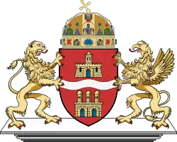
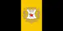 Flag  Coat of arms | |
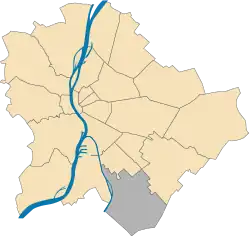 Location of District XXIII in Budapest (shown in grey) | |
| Coordinates: 47.3964°N 19.1311°E | |
| Country | Hungary |
| Region | Central Hungary |
| City | Budapest |
| Established | 11 December 1994 |
| Quarters[1] | List
|
| Government | |
| • Mayor | Ferenc Bese (Ind.) |
| Area | |
| • Total | 40.77 km2 (15.74 sq mi) |
| • Rank | 2nd |
| Population (2016)[2] | |
| • Total | 23,641 |
| • Rank | 23rd |
| • Density | 579/km2 (1,500/sq mi) |
| Demonym | huszonharmadik kerületi ("23rd districter") |
| Time zone | UTC+1 (CET) |
| • Summer (DST) | UTC+2 (CEST) |
| Postal code | 1237 ... 1239 |
| Website | soroksar |
Twin towns - twin cities
References
- "94/2012. (XII. 27.) Főv. Kgy. rendelet - a közterület- és városrésznevek megállapításáról, azok jelöléséről, valamint a házszám-megállapítás szabályairól" (in Hungarian).
- "A fővárosi kerületek, a megyei jogú városok, a városok területe, lakónépessége és a lakások száma" [The area of districts of the capital, of the towns with county's rights, resident population and number of dwellings]. Magyarország közigazgatási helynévkönyve 2016. január 1 [Gazetteer of Hungary 1 January 2016] (PDF). Hungarian Central Statistical Office. 2016. p. 21.
External links
Wikimedia Commons has media related to Budapest District XXIII.
|  | |
This article is issued from Wikipedia. The text is licensed under Creative Commons - Attribution - Sharealike. Additional terms may apply for the media files.