16th district of Budapest
16th District is the 16th district of Budapest, Hungary.
16th District of Budapest
Budapest XVI. kerülete | |
|---|---|
| District XVI | |
 Flag  Coat of arms | |
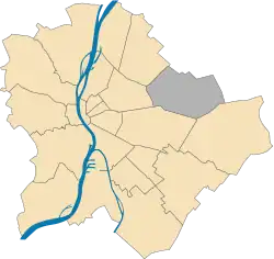 Location of District XVI in Budapest (shown in grey) | |
| Coordinates: 47°31′13″N 19°10′26″E | |
| Country | Hungary |
| Region | Central Hungary |
| City | Budapest |
| Established | 1 January 1950 |
| Quarters[1] | List
|
| Government | |
| • Mayor | Péter Kovács (Fidesz-KDNP) |
| Area | |
| • Total | 33.51 km2 (12.94 sq mi) |
| • Rank | 7th |
| Population (2016)[2] | |
| • Total | 73,486 |
| • Rank | 13th |
| • Density | 2,192/km2 (5,680/sq mi) |
| Demonym | tizenhatodik kerületi ("16th districter") |
| Time zone | UTC+1 (CET) |
| • Summer (DST) | UTC+2 (CEST) |
| Postal code | 1161 ... 1165 |
| Website | www |
It consists of these parts: Árpádföld, Cinkota, Mátyásföld, Sashalom, Rákosszentmihály.
Sport
The oldest football and athletics team is Rákosszentmihályi AFC that competes in the Budapest Bajnokság I.
THSE Sashalom (or THSE Szabadkikötő) currently competes in the 2018-19 Nemzeti Bajnokság III.
Sightseeing
Education
The College of International Management and Business Faculty of the Budapest Business School is located in the district.
Cinkota is also the home of the secondary school, Szerb Antal Gimnázium.
List of mayors
| Member | Party | Date | |
|---|---|---|---|
| Gábor Fekete | Fidesz | 1990–1994 | |
| Attila Kovács | MDF | 1994–1998 | |
| Lajos Mátyás Szabó | MSZP | 1998–2006 | |
| Péter Kovács | Fidesz | 2006– | |
Twin towns – Twin cities
 Waltershausen – Germany
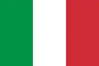 Canistro – Italy
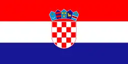 Novi Vinodolski – Croatia
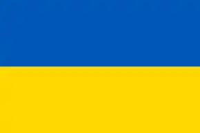 Zápszony – Ukraine
 Valea lui Mihai – Romania
 Opole – Poland
 Kütahya – Turkey
 Podunajské Biskupice – Slovakia
 Mali Iđoš – Serbia
 Wimbledon – United Kingdom
 Hanoi – Tay Ho – Vietnam
 Mont-Saint-Martin – France
- Mihăileni – Romania
- Oravița – Romania
- Cambridge – United Kingdom
- Dragomirești – Romania
References
- "94/2012. (XII. 27.) Főv. Kgy. rendelet - a közterület- és városrésznevek megállapításáról, azok jelöléséről, valamint a házszám-megállapítás szabályairól" (in Hungarian).
- "A fővárosi kerületek, a megyei jogú városok, a városok területe, lakónépessége és a lakások száma" [The area of districts of the capital, of the towns with county's rights, resident population and number of dwellings]. Magyarország közigazgatási helynévkönyve 2016. január 1 [Gazetteer of Hungary 1 January 2016] (PDF). Hungarian Central Statistical Office. 2016. p. 21.
External links
Wikimedia Commons has media related to Budapest District XVI.
Wikivoyage has a travel guide for East Pest.
|  | |
This article is issued from Wikipedia. The text is licensed under Creative Commons - Attribution - Sharealike. Additional terms may apply for the media files.