Shire of Walpeup
The Shire of Walpeup was a local government area in northwestern Victoria, Australia, along the South Australian border. The shire covered an area of 10,964 square kilometres (4,233.2 sq mi), and existed from 1911 until 1995.
| Shire of Walpeup Victoria | |||||||||||||||
|---|---|---|---|---|---|---|---|---|---|---|---|---|---|---|---|
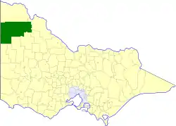 Location in Victoria | |||||||||||||||
| Population | 3,310 (1992)[1] | ||||||||||||||
| • Density | 0.3019/km2 (0.7819/sq mi) | ||||||||||||||
| Established | 1911 | ||||||||||||||
| Area | 10,964 km2 (4,233.2 sq mi) | ||||||||||||||
| Council seat | Ouyen | ||||||||||||||
| Region | Mallee | ||||||||||||||
| County | Karkarooc, Millewa, Weeah | ||||||||||||||
| |||||||||||||||
History
Walpeup was incorporated as a shire on 1 November 1911, created out of parts of the Shires of Mildura, Swan Hill, Lawloit, Lowan, Dimboola and Karkarooc.[2]
On 20 January 1995, the Shire of Walpeup was abolished, and along with the City of Mildura and the Shire of Mildura, was merged into the newly created Rural City of Mildura.[3]
Ridings
The Shire of Walpeup was divided into four ridings in 1986, each of which elected three councillors:
- Ouyen East Riding
- Ouyen West Riding
- Walpeup/Underbool Riding
- Murrayville Riding
Towns and localities
- Big Desert
- Cowangie
- Kattyoong
- Kiamal
- Koonda
- Kulwin
- Mittyack
- Murrayville
- Murray-Sunset (shared with the Shire of Mildura)
- Ngallo
- Ouyen*
- Panitya
- Tiega
- Underbool
- Walpeup
- Wyperfeld National Park (shared with the Shire of Dimboola)
* Council seat.
Population
| Year | Population |
|---|---|
| 1954 | 4,310 |
| 1958 | 4,480* |
| 1961 | 4,548 |
| 1966 | 4,429 |
| 1971 | 3,964 |
| 1976 | 3,846 |
| 1981 | 3,594 |
| 1986 | 3,496 |
| 1991 | 3,237 |
* Estimate in the 1958 Victorian Year Book.
References
- Australian Bureau of Statistics, Victoria Office (1994). Victorian Year Book. pp. 49–52. ISSN 0067-1223.
- Victorian Municipal Directory. Brunswick: Arnall & Jackson. 1992. pp. 873–874. Accessed at State Library of Victoria, La Trobe Reading Room.
- Australian Bureau of Statistics (1 August 1995). Victorian local government amalgamations 1994-1995: Changes to the Australian Standard Geographical Classification (PDF). Commonwealth of Australia. p. 9. ISBN 0-642-23117-6. Retrieved 5 January 2008.
External links
This article is issued from Wikipedia. The text is licensed under Creative Commons - Attribution - Sharealike. Additional terms may apply for the media files.