Shire of Bungaree
The Shire of Bungaree was a local government area northeast of the regional city of Ballarat, Victoria, Australia. The shire covered an area of 228 square kilometres (88.0 sq mi) and existed from 1863 until 1994.
| Shire of Bungaree Victoria | |||||||||||||||
|---|---|---|---|---|---|---|---|---|---|---|---|---|---|---|---|
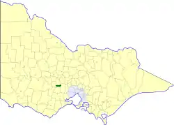 Location in Victoria | |||||||||||||||
| Population | 4,900 (1992)[1] | ||||||||||||||
| • Density | 21.49/km2 (55.7/sq mi) | ||||||||||||||
| Established | 1863 | ||||||||||||||
| Area | 228 km2 (88.0 sq mi) | ||||||||||||||
| Council seat | Leigh Creek | ||||||||||||||
| Region | Grampians | ||||||||||||||
| County | Grant, Talbot, Grenville, Ripon | ||||||||||||||
 | |||||||||||||||
History
Bungaree was first incorporated as a road district on 16 January 1863 and became a shire on 27 January 1871. The shire was originally divided into three ridings in August 1879, but after it lost a small section to the City of Ballaarat on 31 March 1930, it was redivided into two ridings. All divisions were abolished on 6 August 1988, and the council, from then until its dissolution, had nine councillors.[2]
On 6 May 1994, the Shire of Bungaree was abolished, and along with parts of the Shire of Buninyong, was merged into the newly created Shire of Moorabool.
Towns and localities
- Brown Hill
- Bullarook
- Bungaree
- Chapel Flat
- Claretown
- Clarkes Hill
- Glen Park
- Gong Gong
- Invermay
- Leigh Creek*
- Nerrina
- Pootilla
- Wallace
* Council seat.
Population
| Year | Population |
|---|---|
| 1954 | 1,966 |
| 1958 | 2,090* |
| 1961 | 2,049 |
| 1966 | 2,206 |
| 1971 | 2,514 |
| 1976 | 3,130 |
| 1981 | 3,690 |
| 1986 | 4,087 |
| 1991 | 4,573 |
* Estimate in 1958 Victorian Year Book.
References
- Australian Bureau of Statistics, Victoria Office (1994). Victorian Year Book. pp. 49–52. ISSN 0067-1223.
- Victorian Municipal Directory. Brunswick: Arnall & Jackson. 1992. pp. 620–621. Accessed at State Library of Victoria, La Trobe Reading Room.