Shek O Peak
Shek O Peak or Ta Lan Tsing Teng Shan (Chinese: 打爛埕頂山) is a hill in southern Hong Kong. It is the tallest hill along the Dragon's Back trail.
| Shek O Peak | |
|---|---|
| 打爛埕頂山 | |
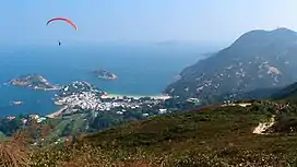 View of Shek O from Shek O Peak's summit | |
| Highest point | |
| Elevation | 284 m (932 ft) |
| Coordinates | 22°14′8.57″N 114°14′37.33″E |
| Geography | |
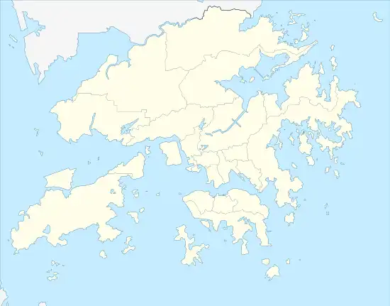 Shek O Peak Location of Shek O Peak in Hong Kong | |
| Location | |
| Shek O Peak | |||||||||||
|---|---|---|---|---|---|---|---|---|---|---|---|
| Traditional Chinese | 爛埕頂山 | ||||||||||
| Simplified Chinese | 烂埕顶山 | ||||||||||
| |||||||||||
| Shek O Peak | |||||||||||
| Chinese | 石澳山 | ||||||||||
| |||||||||||
Geography
.jpg.webp)
Summit of Shek O Peak
Shek O Peak is 284m in height.[1] To the south lies another hill called D'Aguilar Peak.
Access
Section 8 of the Hong Kong Trail runs through the top ridge of Shek O Peak.[2] It is possible to access the summit of Shek O Peak after hiking for about 30 minutes from the To Tei Wan bus stop on Shek O Road.
References
- "Dragon's Back | Hong Kong Tourism Board". www.discoverhongkong.com. Retrieved 16 December 2019.
- "Shek O". www.afcd.gov.hk. Retrieved 16 December 2019.
External links
This article is issued from Wikipedia. The text is licensed under Creative Commons - Attribution - Sharealike. Additional terms may apply for the media files.