Scionzier
Scionzier (French pronunciation: [sjɔ̃zje]) is a commune in the Haute-Savoie department in the Auvergne-Rhône-Alpes region in south-eastern France.
Scionzier | |
|---|---|
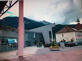 The town hall in Scionzier | |
 Coat of arms | |
Location of Scionzier | |
 Scionzier  Scionzier | |
| Coordinates: 46°03′29″N 6°33′01″E | |
| Country | France |
| Region | Auvergne-Rhône-Alpes |
| Department | Haute-Savoie |
| Arrondissement | Bonneville |
| Canton | Cluses |
| Government | |
| • Mayor (2020–2026) | Stéphane Pépin[1] |
| Area 1 | 10.62 km2 (4.10 sq mi) |
| Population | 9,057 |
| • Density | 850/km2 (2,200/sq mi) |
| Time zone | UTC+01:00 (CET) |
| • Summer (DST) | UTC+02:00 (CEST) |
| INSEE/Postal code | 74264 /74950 |
| Elevation | 468–1,969 m (1,535–6,460 ft) |
| Website | Scionzier.fr |
| 1 French Land Register data, which excludes lakes, ponds, glaciers > 1 km2 (0.386 sq mi or 247 acres) and river estuaries. | |
Population
| Year | Pop. | ±% p.a. |
|---|---|---|
| 1968 | 5,046 | — |
| 1975 | 5,702 | +1.76% |
| 1982 | 5,463 | −0.61% |
| 1990 | 5,945 | +1.06% |
| 1999 | 6,163 | +0.40% |
| 2007 | 6,753 | +1.15% |
| 2012 | 7,586 | +2.35% |
| 2017 | 8,683 | +2.74% |
| Source: INSEE[3] | ||
References
- "Répertoire national des élus: les maires" (in French). data.gouv.fr, Plateforme ouverte des données publiques françaises. 13 September 2022.
- "Populations légales 2020". The National Institute of Statistics and Economic Studies. 29 December 2022.
- Population en historique depuis 1968, INSEE
Wikimedia Commons has media related to Scionzier.
This article is issued from Wikipedia. The text is licensed under Creative Commons - Attribution - Sharealike. Additional terms may apply for the media files.