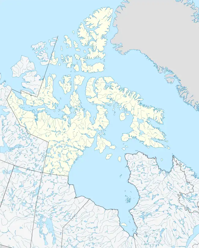
Sanirajak
Sanirajak (Inuktitut meaning the shoreline[7]), Syllabics: ᓴᓂᕋᔭᒃ), formerly known as Hall Beach until 27 February 2020,[8] is an Inuit settlement within the Qikiqtaaluk Region of Nunavut, Canada, approximately 69 km (43 mi) south of Igloolik.
Sanirajak
ᓴᓂᕋᔭᒃ | |
|---|---|
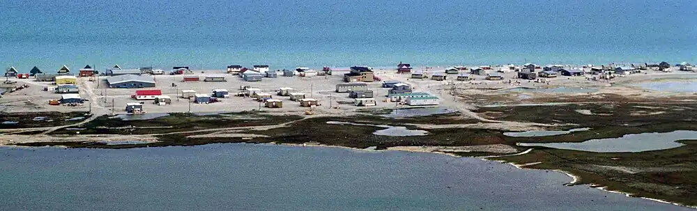
.jpg.webp) North Warning site 1997 | |
 Sanirajak  Sanirajak | |
| Coordinates: 68°47′25″N 081°14′15″W[1] | |
| Country | Canada |
| Territory | Nunavut |
| Region | Qikiqtaaluk |
| Electoral district | Amittuq |
| Settled | 1953 |
| Government | |
| • Mayor | Jaypetee Audlakiakk |
| • MLA Amittuq | Joelie Kaernerk |
| Area (2021)[5] | |
| • Total | 16.36 km2 (6.32 sq mi) |
| Elevation | 8 m (26 ft) |
| Population (2021)[5] | |
| • Total | 891 |
| • Density | 54.5/km2 (141/sq mi) |
| Time zone | UTC−05:00 (EST) |
| • Summer (DST) | UTC−04:00 (EDT) |
| Canadian Postal code | |
| Area code | 867 |
History
It was established in 1957 during the construction of a Distant Early Warning (DEW) site. Currently the settlement is home to a North Warning System (68°45′44″N 081°13′44″W) radar facility and the Hall Beach Airport.
In 1971, seven sounding rockets of the Tomahawk Sandia type were launched from Sanirajak, some reaching altitudes of 270 km (170 mi).[9]
Demographics
| Year | Pop. | ±% |
|---|---|---|
| 1976 | 287 | — |
| 1981 | 349 | +21.6% |
| 1986 | 451 | +29.2% |
| 1991 | 526 | +16.6% |
| 1996 | 543 | +3.2% |
| 2001 | 609 | +12.2% |
| 2006 | 654 | +7.4% |
| 2011 | 736 | +12.5% |
| 2016 | 848 | +15.2% |
| 2021 | 891 | +5.1% |
| Source: Statistics Canada [5][10][11][12][13][14][15][16][17][18] | ||
In the 2021 Canadian census conducted by Statistics Canada, Sanirajak (Hall Beach) had a population of 891 living in 197 of its 205 total private dwellings, a change of 5.1% from its 2016 population of 848. With a land area of 16.36 km2 (6.32 sq mi), it had a population density of 54.5/km2 (141.1/sq mi) in 2021.[5]
Geography
Climate
Sanirajak has a tundra climate (“ET”), a polar climate sub-type under the Köppen climate classification, without the presence of trees, and iced over for most of the year.[19] Summers are very short and cool, with chilly nights. Winters are long and extremely cold, lasting most of the year with little chance of a thaw.
| Climate data for Sanirajak (Hall Beach Airport) WMO ID: 71081; coordinates 68°46′33″N 81°14′33″W; elevation: 9.1 m (30 ft); 1981–2010 normals, | |||||||||||||
|---|---|---|---|---|---|---|---|---|---|---|---|---|---|
| Month | Jan | Feb | Mar | Apr | May | Jun | Jul | Aug | Sep | Oct | Nov | Dec | Year |
| Record high humidex | 0.0 | 0.4 | −0.6 | 2.2 | 4.0 | 21.1 | 27.9 | 28.0 | 14.0 | 4.3 | 0.3 | −0.9 | 28.0 |
| Record high °C (°F) | 1.3 (34.3) |
0.4 (32.7) |
−0.5 (31.1) |
3.3 (37.9) |
4.4 (39.9) |
21.1 (70.0) |
23.3 (73.9) |
24.8 (76.6) |
13.5 (56.3) |
4.2 (39.6) |
−0.1 (31.8) |
0.4 (32.7) |
24.8 (76.6) |
| Average high °C (°F) | −27.9 (−18.2) |
−28.4 (−19.1) |
−24.2 (−11.6) |
−15.0 (5.0) |
−4.9 (23.2) |
3.2 (37.8) |
10.1 (50.2) |
7.7 (45.9) |
2.1 (35.8) |
−5.2 (22.6) |
−14.9 (5.2) |
−22.5 (−8.5) |
−10.0 (14.0) |
| Daily mean °C (°F) | −31.9 (−25.4) |
−32.5 (−26.5) |
−28.7 (−19.7) |
−19.9 (−3.8) |
−8.8 (16.2) |
1.0 (33.8) |
6.7 (44.1) |
5.0 (41.0) |
0.3 (32.5) |
−8.0 (17.6) |
−19.0 (−2.2) |
−26.6 (−15.9) |
−13.6 (7.5) |
| Average low °C (°F) | −35.8 (−32.4) |
−36.6 (−33.9) |
−33.3 (−27.9) |
−24.8 (−12.6) |
−12.7 (9.1) |
−1.3 (29.7) |
3.3 (37.9) |
2.2 (36.0) |
−1.5 (29.3) |
−10.9 (12.4) |
−23.1 (−9.6) |
−30.7 (−23.3) |
−17.1 (1.2) |
| Record low °C (°F) | −50.0 (−58.0) |
−54.1 (−65.4) |
−52.5 (−62.5) |
−44.1 (−47.4) |
−31.1 (−24.0) |
−20.6 (−5.1) |
−3.3 (26.1) |
−5.1 (22.8) |
−16.7 (1.9) |
−33.6 (−28.5) |
−42.2 (−44.0) |
−53.9 (−65.0) |
−54.1 (−65.4) |
| Record low wind chill | −72.8 | −71.7 | −66.6 | −58.0 | −44.7 | −32.7 | −7.8 | −11.7 | −25.1 | −49.6 | −61.4 | −64.6 | −72.8 |
| Average precipitation mm (inches) | 6.1 (0.24) |
4.8 (0.19) |
7.1 (0.28) |
12.0 (0.47) |
15.7 (0.62) |
18.2 (0.72) |
25.7 (1.01) |
44.0 (1.73) |
28.9 (1.14) |
24.4 (0.96) |
19.2 (0.76) |
9.3 (0.37) |
215.4 (8.48) |
| Average rainfall mm (inches) | 0.0 (0.0) |
0.0 (0.0) |
0.0 (0.0) |
0.2 (0.01) |
2.2 (0.09) |
11.2 (0.44) |
25.6 (1.01) |
41.3 (1.63) |
17.2 (0.68) |
1.5 (0.06) |
0.1 (0.00) |
0.0 (0.0) |
99.3 (3.91) |
| Average snowfall cm (inches) | 7.3 (2.9) |
6.0 (2.4) |
9.2 (3.6) |
14.4 (5.7) |
15.4 (6.1) |
7.2 (2.8) |
0.1 (0.0) |
3.1 (1.2) |
12.0 (4.7) |
27.6 (10.9) |
24.0 (9.4) |
10.6 (4.2) |
136.8 (53.9) |
| Average precipitation days (≥ 0.2 mm) | 6.7 | 5.4 | 7.4 | 9.0 | 9.7 | 8.9 | 10.6 | 13.5 | 11.0 | 14.5 | 11.6 | 8.4 | 116.4 |
| Average rainy days (≥ 0.2 mm) | 0.0 | 0.0 | 0.0 | 0.2 | 0.8 | 5.8 | 10.6 | 12.8 | 6.1 | 0.9 | 0.3 | 0.1 | 37.5 |
| Average snowy days (≥ 0.2 cm) | 7.2 | 5.7 | 7.6 | 9.4 | 9.8 | 4.6 | 0.1 | 1.3 | 6.7 | 14.5 | 12.6 | 9.0 | 88.5 |
| Average afternoon relative humidity (%) (at 1500 LST) | 66.6 | 67.0 | 69.5 | 75.7 | 83.4 | 86.9 | 77.7 | 81.1 | 83.7 | 86.1 | 78.2 | 71.3 | 77.3 |
| Source: Environment and Climate Change Canada Canadian Climate Normals 1981–2010[20][21] | |||||||||||||
References
- "Sanirajak". Geographical Names Data Base. Natural Resources Canada.
- "Sanirajak". Geographical Names Data Base. Natural Resources Canada.
- "Municipal Election Results 2019-2020" (PDF). Elections Nunavut. Retrieved 21 January 2023.
- "2021 General Election" (PDF). Elections Nunavut. Retrieved 21 January 2023.
- "Population and dwelling counts: Canada, provinces and territories, and census subdivisions (municipalities), Nunavut". Statistics Canada. 9 February 2022. Retrieved 19 February 2022.
- Elevation at airport. Canada Flight Supplement. Effective 0901Z 16 July 2020 to 0901Z 10 September 2020.
- "Sanirajak (Hall Beach)". Retrieved 21 January 2023.
- Tranter, Emma (28 February 2020). "Nunavut minister signs off on name changes for two communities". Nunatsiaq News. Nortext Publishing Corporation. Nunatsiaq News. Archived from the original on 17 August 2020. Retrieved 6 October 2020.
- "Hall Beach". Archived from the original on 2 December 2008.
- "1976 Census of Canada: Population - Geographic Distributions" (PDF). Statistics Canada. June 1977. Retrieved 1 February 2022.
- "1981 Census of Canada: Census subdivisions in decreasing population order" (PDF). Statistics Canada. May 1992. Retrieved 1 February 2022.
- "1986 Census: Population - Census Divisions and Census Subdivisions" (PDF). Statistics Canada. September 1987. Retrieved 1 February 2022.
- "91 Census: Census Divisions and Census Subdivisions - Population and Dwelling Counts" (PDF). Statistics Canada. April 1992. Retrieved 1 February 2022.
- "96 Census: A National Overview - Population and Dwelling Counts" (PDF). Statistics Canada. April 1997. Retrieved 1 February 2022.
- "Population and Dwelling Counts, for Canada, Provinces and Territories, and Census Subdivisions (Municipalities), 2001 and 1996 Censuses - 100% Data (Nunavut)". Statistics Canada. 15 August 2012. Retrieved 1 February 2022.
- "Population and dwelling counts, for Canada, provinces and territories, and census subdivisions (municipalities), 2006 and 2001 censuses - 100% data (Nunavut)". Statistics Canada. 20 August 2021. Retrieved 1 February 2022.
- "Population and dwelling counts, for Canada, provinces and territories, and census subdivisions (municipalities), 2011 and 2006 censuses (Nunavut)". Statistics Canada. 25 July 2021. Retrieved 1 February 2022.
- "Population and dwelling counts, for Canada, provinces and territories, and census subdivisions (municipalities), 2016 and 2011 censuses – 100% data (Nunavut)". Statistics Canada. 8 February 2017. Retrieved 1 February 2022.
- "Hall Beach, Nunavut Köppen Climate Classification (Weatherbase)". Weatherbase. Retrieved 24 March 2020.
- "Hall Beach A". Canadian Climate Normals 1981–2010. Environment and Climate Change Canada. 1 December 2022. Climate ID: 2402350. Retrieved 21 January 2023.
- "Almanac Averages and Extremes for July 26". climate.weather.gc.ca. Environment and Climate Change Canada. 31 October 2011. Retrieved 6 October 2020.
Further reading
- McAlpine PJ, and NE Simpson. 1976. "Fertility and Other Demographic Aspects of the Canadian Eskimo Communities of Igloolik and Hall Beach". Human Biology; an International Record of Research. 48, no. 1: 114–38.
- Wenzel, George W. 1997. "Using Harvest Research in Nunavut: An Example from Hall Beach". Arctic Anthropology. 34, no. 1: 18.