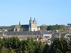
Saint-Hubert, Belgium
Saint-Hubert (French pronunciation: [sɛ̃.t‿y.bɛʁ] ⓘ; Walloon: Sint-Houbert) is a city and municipality of Wallonia located in the province of Luxembourg, Belgium.
Saint-Hubert
| |
|---|---|
 | |
 Flag  Coat of arms | |
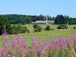
Location of Saint-Hubert | |
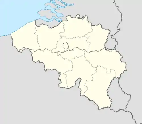 Saint-Hubert Location in Belgium
Location of Saint-Hubert in Luxembourg province  | |
| Coordinates: 50°1′30″N 05°22′20″E | |
| Country | |
| Community | French Community |
| Region | Wallonia |
| Province | Luxembourg |
| Arrondissement | Neufchâteau |
| Government | |
| • Mayor | Jean-Luc Henneaux (Cap 2018) |
| • Governing party/ies | Cap 2018 |
| Area | |
| • Total | 111.99 km2 (43.24 sq mi) |
| Population (2018-01-01)[1] | |
| • Total | 5,571 |
| • Density | 50/km2 (130/sq mi) |
| Postal codes | 6870 |
| NIS code | 84059 |
| Area codes | 061 |
| Website | www.saint-hubert.be |
On 1 January 2007 the municipality, which covers 111.16 km² (42.92 sq mi), had 5,737 inhabitants, giving a population density of 51.6 inhabitants per square kilometre.
The municipality consists of the following districts: Arville, Awenne, Hatrival, Mirwart, Saint-Hubert, and Vesqueville. Other population centers include: Lorcy and Poix-Saint-Hubert.
The town is named in commemoration of Saint Hubert, whose body was moved in 825 to the Benedictine Abbey of Andage, thereafter called Abbey of Saint-Hubert.
Monuments
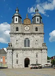 Basilica of Saint-Hubert
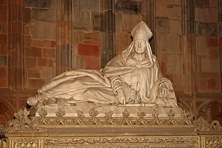 Cenotaph of Hubertus by Guillaume Geefs (1847)
Climate
| Climate data for Saint Hubert | |||||||||||||
|---|---|---|---|---|---|---|---|---|---|---|---|---|---|
| Month | Jan | Feb | Mar | Apr | May | Jun | Jul | Aug | Sep | Oct | Nov | Dec | Year |
| Average high °C (°F) | 2.3 (36.1) |
3.2 (37.8) |
6.7 (44.1) |
9.9 (49.8) |
14.7 (58.5) |
17.1 (62.8) |
19.6 (67.3) |
19.6 (67.3) |
15.9 (60.6) |
11.4 (52.5) |
5.8 (42.4) |
3.3 (37.9) |
10.8 (51.4) |
| Average low °C (°F) | −2.3 (27.9) |
−2.4 (27.7) |
−0.1 (31.8) |
1.9 (35.4) |
6.2 (43.2) |
8.9 (48.0) |
11.1 (52.0) |
11.1 (52.0) |
8.4 (47.1) |
5.0 (41.0) |
1.0 (33.8) |
−0.9 (30.4) |
4.0 (39.2) |
| Average precipitation mm (inches) | 96.9 (3.81) |
76.0 (2.99) |
95.3 (3.75) |
76.8 (3.02) |
85.7 (3.37) |
100.4 (3.95) |
91.9 (3.62) |
72.9 (2.87) |
88.1 (3.47) |
102.7 (4.04) |
105.7 (4.16) |
108.8 (4.28) |
1,101.2 (43.33) |
| Average precipitation days | 15 | 12 | 15 | 13 | 13 | 13 | 12 | 10 | 12 | 13 | 15 | 16 | 159 |
| Source: World Meteorological Organisation (UN) [2] | |||||||||||||
See also
The Benedictine monastery of Our Lady of Hurtebise (near Saint-Hubert)
References
- "Wettelijke Bevolking per gemeente op 1 januari 2018". Statbel. Retrieved 9 March 2019.
- "World Weather Information Service – Saint Hubert". United Nations. Retrieved 19 January 2011.
External links
Wikimedia Commons has media related to Saint-Hubert (Belgium).
- Official website (in French)
Places adjacent to Saint-Hubert, Belgium | ||||||||||||||||
|---|---|---|---|---|---|---|---|---|---|---|---|---|---|---|---|---|
| ||||||||||||||||
Municipalities of the province of Luxembourg, Wallonia | ||
|---|---|---|
| Arlon | 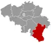 | |
| Bastogne | ||
| Marche-en-Famenne | ||
| Neufchâteau | ||
| Virton | ||
Bold indicates cities | ||
This article is issued from Wikipedia. The text is licensed under Creative Commons - Attribution - Sharealike. Additional terms may apply for the media files.