Rustaq District, Afghanistan
Rustaq District is a district of Takhar Province, northern Afghanistan. The district centre is the town of Rostaq.[4] As recently as 2020, the district was considered to be under government control,[5][6] as opposed to control by the Taliban. However, the district has had issues with illegal armed men.[7][8]
Rustaq District | |
|---|---|
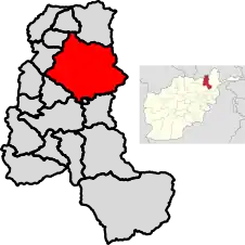
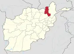
 Location of the district in Takhar Province | |
| Coordinates: 37°08′30″N 69°48′16″E | |
| Country | |
| Province | Takhār Province |
| Area | |
| • Total | 1,915 km2 (739 sq mi) |
| Population (2015)[2] | |
| • Total | 199,160 |
| • Density | 104/km2 (270/sq mi) |
| Ethnicity | |
| • Uzbek | 45% |
| • Tajik | 40% |
| • Baloch | 15% |
| Time zone | UTC+4:30 (Afghanistan Standard Time) |
| Post code | 3754 [3] |
Geography
Rustaq has an area of 1915 square kilometers, comparatively equivalent to Maui.[9] The district has the Rustaq River, or the Ab-i Rustaq, running through the district, emptying into the Panj River.[10] Some streams run to the Kokcha River.[4][11]
Location
This district borders 12 other districts. Going clockwise from the north, they are Chah Ab District, Shahri Buzurg District, Argo District, Tishkan District, Kishim District, Kalafgan District, Taluqan District, Hazar Sumuch District, Khwaja Ghar District, Dashti Qala District, Khwaja Bahauddin District, and finally Yangi Qala District. Shahri Buzurg, Argo, Tishkan, and Kishim districts are all located in Badakhshan Province, with all other districts Rustaq borders in Takhar province. Taluqan District holds the provincial capital, Taloqan.[12][2]
Many districts to its north and west have increased Taliban activity, however, Rustaq has escaped that fate.[6]
Demographics
Rustaq has 102 males for every 100 females or 2% more males than females. The median age is 16.1 years old, and the average household size is 6.5 persons, meaning there is about 30 thousand households in the district.[2]
Most of the population lives next to the Rustaq River.[13]
Economy
The majority of district residents are engaged in agricultural activity, with wheat, corn, sugarcane, and chickpeas being the main crops. Both men and women work in this area. However, there is low agricultural output, because of a lack of tools, skill, and cold storehouses. In addition, armed groups cut and utilize resources illegally.
Weaving, tailoring, jungles, and mines are also important economic activities in Rustaq. However, lack of training, lack of management in the exploitation of resources, and lack of international selling for handicrafts are all major problems in these sectors.[1]
Rustaq has about a 55% unemployment rate, with males being 8 times more likely to be working as females. Approximately 8% of the district's population are migrants.[2]
Education and Healthcare
Rustaq has 47 schools with access to primary, secondary, literacy courses, and high schools for boys and girls. However, there are shortages of buildings, materials, and money. About a third of residents ages 15–24 can read. 89% of the district has had no schooling, with more males being schooled than females.[2]
The district also has 6 clinics with doctors, nurses, and midwives. However, there is a lack of trained doctors and medical drugs.[1]
Footnotes
- "SUMMARY OF THE DISTRICT DEVELOPMENT PLAN ROSTAQ DISTRICT TAKHAR PROVINCE" (PDF). mrrd-nabdp.org. Ministry of Rural Rehabilitation and Development. July 2006. Archived from the original (PDF) on 7 April 2014. Retrieved 15 July 2020.
- "Takhar Socio-Demographic and Economic Survey 2015" (PDF). UNFPA. Retrieved 15 July 2020.
- "Rustaq, Afghanistan Postal Codes". worldpostalcode.com. Retrieved 15 July 2020.
- "Map of Rustaq" (PDF). aims.org.af. Archived from the original (PDF) on 15 December 2011. Retrieved 15 July 2020.
- "Quarterly Report to the United States Congress" (PDF). SIGAR. 30 January 2019. p. 71. Retrieved 15 July 2020.
- "Mapping Taliban Control". longwarjournal.org. Retrieved 15 July 2020.
- Zahra Rahimi (9 July 2020). "Afghan MP's brother accused of bullying". tolonews.com. Tolo News. Retrieved 15 July 2020.
- TOLOnews (7 October 2016). "Takhar Residents Push Govt to Curb Armed Men". tolonews.com. Tolo News. Retrieved 15 July 2020.
- "Island Directory Tables: Islands by Land Area". United Nations Environment Program. 18 February 1998. Retrieved 15 July 2020.
- "Summary of the North Takhar Placer Gold Area of Interest" (PDF). usgs.gov. Retrieved 10 August 2020.
- "Rostaq". google.com/maps. Retrieved 15 July 2020.
- "AFGHANISTAN ADMINISTRATIVE DIVISIONS" (PDF). Archived from the original (PDF) on 23 September 2010. Retrieved 15 July 2020.
- Chornak, Michael; Mack, Thomas. "Geohydrologic Summary of the North Takhar Gold Placer Area of Interest" (PDF). usgs.gov. Retrieved 10 August 2020.
References
- Peters, S.G., King, T.V.V., Mack, T.J., and Chornack, M.P., eds., and the U.S. Geological Survey Afghanistan Mineral Assessment Team, 2011, Summaries of important areas for mineral investment and production opportunities of nonfuel minerals in Afghanistan: U.S. Geological Survey Open-File Report 2011–1204, 1,810 p. plus appendixes on DVD. (Also available at https://pubs.usgs.gov/of/2011/1204/ and on DVD.)
