Shorabak District
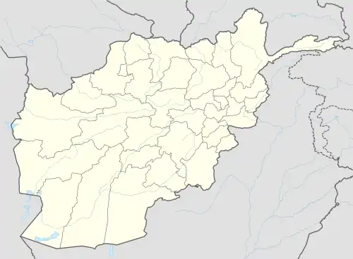
Shorabak District (also Shorawak[1]) is a remote district situated in the southeastern part of Kandahar Province, Afghanistan, 110 km south and east of Kandahar. It borders Reg District to the west, Spin Boldak District to the north and Pakistan to the east and south. The population is 13,020 as of 2020.[2] The district center Shorabak is located at 985 m altitude in the Eastern part of the district.
Shorabak District
شورابک ولسوالۍ | |
|---|---|
 Shorabak District | |
| Coordinates: 30°11′00″N 66°06′00″E | |
| Country | |
| Province | Kandahar |
| Area | |
| • Total | 4.15 km2 (1.60 sq mi) |
| Elevation | 1,243 m (4,078 ft) |
| Population (2020) | |
| • Total | 13,020 |
| • Density | 3,100/km2 (8,100/sq mi) |
| Time zone | UTC+4:30 (AFT) |
| Postal code | 3852 |
The district is currently controlled by the Taliban, who took over the district on February 21, 2017.[3]
Geography
Shorabak District is situated on the Afghan-Pakistani border, west of the Sulaiman Mountain Range. It has an average elevation of 1,243 meters above the sea level.[4]
References
- "Shorawak". GEOnet Names Server. Retrieved 13 October 2019.
- "Kandahār (Province, Afghanistan) - Population Statistics, Charts, Map and Location". www.citypopulation.de. Retrieved 2023-03-20.
- "Taliban overruns Afghan district where al Qaeda ran training camps - FDD's Long War Journal". longwarjournal.org. 21 February 2017.
- "Shurabak topographic map, elevation, terrain". Topographic maps. Retrieved 2023-03-20.
External links
Wikimedia Commons has media related to Shorabak District.
| Districts | 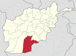 | |
|---|---|---|
| Populated places | ||
| Landforms | ||
| Other | ||
This article is issued from Wikipedia. The text is licensed under Creative Commons - Attribution - Sharealike. Additional terms may apply for the media files.