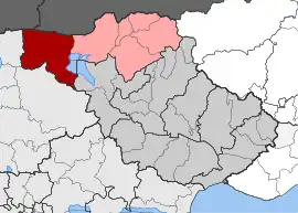
Rodopoli, Serres
Rodopoli (Greek: Ροδόπολη, old name: Σταθμός Ποροΐων) is a village in the Serres region of Greece. It is situated in the municipal unit of Kerkini, in the Sintiki municipality, within the Serres region of Central Macedonia.
Rodopoli
Ροδόπολη | |
|---|---|
 Rodopoli Location within the regional unit  | |
| Coordinates: 41.2578°N 22.9983°E | |
| Country | Greece |
| Administrative region | Central Macedonia |
| Regional unit | Serres |
| Municipality | Sintiki |
| Municipal unit | Kerkini |
| Elevation | 105 m (344 ft) |
| Community | |
| • Population | 820 (2011) |
| Time zone | UTC+2 (EET) |
| • Summer (DST) | UTC+3 (EEST) |
| Postal code | 620 55 |
| Area code(s) | +30 23270 |
| Vehicle registration | EP |
Rodopoli was recognized as a Community on 2 August 1926, by a relevant Decree published in the Government Gazette (Greece), which separated the settlement from the then existing settlement of the Poroy Railway Station. The station opened in 1900.[2] known before 1927 as Poroia (Greek: Πορόια)[2] the settlement had been annexed by Greece on 18 October 1912 during the First Balkan War.
Population evolution
Official census data for the settlement of Rodopolis, Serres can be found from the census of 1951 onwards. The Special Census Table of the Community of Rodopolis is the following:
| Population Census Table of the Community of Rodopolis | ||||||
|---|---|---|---|---|---|---|
| Inventory Year | Population | New Population | Population Change | |||
| 1951 | 1,743 inhabitants | - | - | |||
| 1961 | 1,250 inhabitants | -493 inhabitants | -28.3% | |||
| 1971 | 1,459 inhabitants | +209 inhabitants | + 16.7% | |||
| 1981 | 1,190 inhabitants | -269 inhabitants | -18.4% | |||
| 1991 | 904 inhabitants | -286 inhabitants | -24% | |||
| 2001 | 1,181 inhabitants | +277 inhabitants | + 30.6% | |||
| 2011 | 820 inhabitants | -361 inhabitants | -30.5% | |||
References
- "Απογραφή Πληθυσμού - Κατοικιών 2011. ΜΟΝΙΜΟΣ Πληθυσμός" (in Greek). Hellenic Statistical Authority.
- "EG | Σιδηροδρομικός Σταθμός Ροδόπολης (Σιδηροδρομικός Σταθμός) [ΣΕΡΡΕΣ, ΣΙΝΤΙΚΗ]". www.exploring-greece.gr (in Greek).