Quebec Route 382
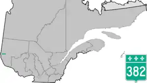
Route 382 is a provincial highway located in the Abitibi-Témiscamingue region in southwestern Quebec. The highway runs from Ville-Marie at the junction of Route 101 and ends south of Laforce. Between Lorrainville and Laverlochère-Angliers it overlaps Route 391.
Route 382 | ||||
|---|---|---|---|---|
 | ||||
| Route information | ||||
| Maintained by Transports Québec | ||||
| Length | 73 km[1] (45 mi) | |||
| Major junctions | ||||
| West end | ||||
| East end | 4th Rue in Belleterre | |||
| Location | ||||
| Country | Canada | |||
| Province | Quebec | |||
| Major cities | Ville-Marie, Lorrainville | |||
| Highway system | ||||
| ||||

Towns along Route 382
.jpg.webp)
Quebec Route 382 in Ville-Marie
Major intersections
The entire route is in Témiscamingue RCM.
| Location | km | mi | Destinations | Notes | |
|---|---|---|---|---|---|
| Ville-Marie | 0 | 0.0 | Western terminus | ||
| Lorrainville | Begin/end concurrency with Route 391 | ||||
| Begin/end concurrency with Route 391 | |||||
| Belleterre | 45.4 | 28.2 | 4th Rue | Eastern terminus | |
| 1.000 mi = 1.609 km; 1.000 km = 0.621 mi | |||||
See also
References
- Ministère des transports, "Distances routières", page (?), Les Publications du Québec, 2005
External links
- Official Transports Quebec Map (in French)
- Route 382 on Google Maps
This article is issued from Wikipedia. The text is licensed under Creative Commons - Attribution - Sharealike. Additional terms may apply for the media files.