Portal:California

Introduction

Welcome to the Portal:California. Such a lovely place.
California
State of California
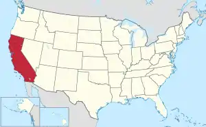
Map of the United States with California highlighted

California is a state in the Western United States. With over 38.9 million residents across a total area of approximately 163,696 square miles (423,970 km2), it is the most populous U.S. state, the third-largest U.S. state by area, and the most populated subnational entity in North America. California borders Oregon to the north, Nevada and Arizona to the east, and the Mexican state of Baja California to the south; it has a coastline along the Pacific Ocean to the west.

The Greater Los Angeles and San Francisco Bay areas in California are the nation's second and fifth-most populous urban regions, respectively. Greater Los Angeles has over 18.7 million residents and the San Francisco Bay Area has over 9.6 million residents. Los Angeles is the state's most populous city and the nation's second-most populous city. San Francisco is the second-most densely populated major city in the country. Los Angeles County is the country's most populous county, and San Bernardino County is the nation's largest county by area. Sacramento is the state's capital.

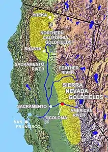
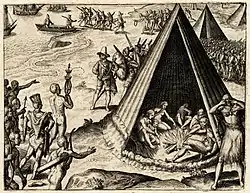
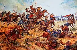
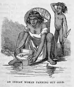
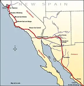
Prior to European colonization, California was one of the most culturally and linguistically diverse areas in pre-Columbian North America, and the indigenous peoples of California constituted the highest Native American population density north of what is now Mexico. European exploration in the 16th and 17th centuries led to the colonization of California by the Spanish Empire. In 1804, it was included in Alta California province within the Viceroyalty of New Spain. The area became a part of Mexico in 1821, following its successful war for independence, but was ceded to the United States in 1848 after the Mexican–American War. The California Gold Rush started in 1848 and led to dramatic social and demographic changes, including the depopulation of indigenous peoples in the California genocide. The western portion of Alta California was then organized and admitted as the 31st state on September 9, 1850, as a free state, following the Compromise of 1850. (Full article...)

Selected article -

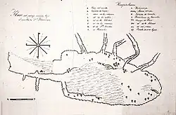
1843 map of Rancho San Francisco

Rancho San Francisco was a land grant in present-day northwestern Los Angeles County and eastern Ventura County, California. It was a grant of 48,612 acres (19,673 ha) by Governor Juan B. Alvarado to Antonio del Valle, a Mexican army officer, in recognition for his service to Alta California. It is not related to the city of San Francisco.

The rancho is the location of the first popularly known finding of gold in the Southern California area in 1842, in Placerita Canyon. Much of the present day city of Santa Clarita lies within the boundary of what was Rancho San Francisco. The adobe headquarters of the rancho, and the site of the gold find (known today as the "Oak of the Golden Dream"), are designated California Historical Landmarks. The rancho included portions of the San Gabriel, Santa Susana, Topatopa, and Sierra Pelona Mountain ranges. (Full article...)

General images -

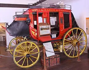
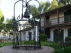
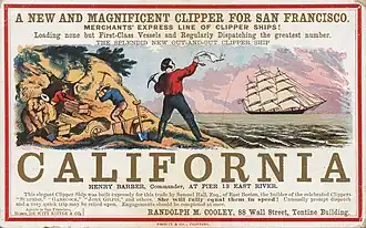
The following are images from various California-related articles on Wikipedia.

Selected quote -

Selected biographies -

Did you know -

  • ... that Katherine Loker donated $30 million each to Harvard and USC, and millions more to develop university, medical, and cultural programs in California?
  • ... that a man dropped his hat while riding Flight Deck and went to retrieve it, but ended up dying after being struck by the foot of a rider?
  • ... that California rancher Frank O'Connor could grow Lipstick and Halloween in a greenhouse?
  • ... that in 1948, Thomas Yarborough became the first African American to be elected as a city council member in California?
  • ... that Aramburu Island is named after its creator, a Marin County supervisor who ordered it cut off from the mainland because he "did not think any homes should be built" there?
  • ... that Chester Smith's California TV station ran its newscast on a "dental floss budget", as one former anchor put it?
  • ... that Ishihara Park and Gandara Park in Santa Monica, California, are both named after local World War II veterans whose military contributions were overlooked during their lifetimes?
  • ... that Cephas L. Bard, the first American physician in Ventura, California, was also the first person to die in the hospital he built there?

Selected picture -

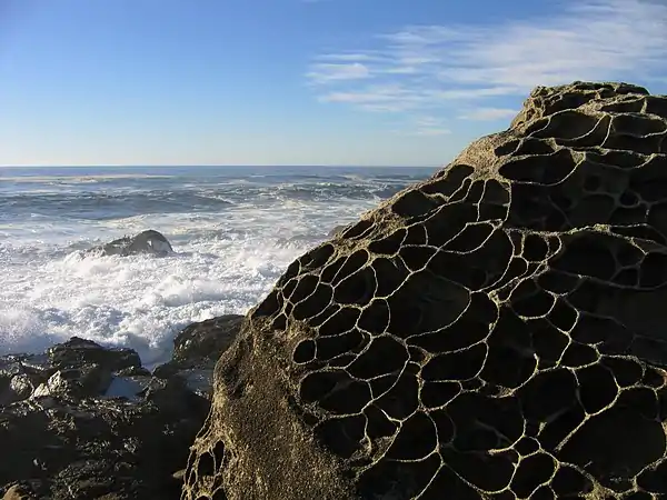
Tafoni at Salt Point, Sonoma Coast, California
Salt Point State Park is a state park located in Sonoma County, California, United States. The park covers 6,000 acres (24 km²) on the coast of Northern California with 20 miles (32 km) of hiking trails and over six miles of a rough rocky coast line including Salt Point which protrudes into the Pacific Ocean.

Selected panorama -

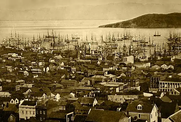
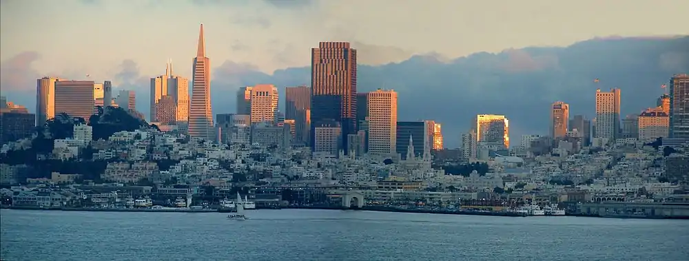
San Francisco at Sunset

The City and County of San Francisco is the fourth most populous city in California and the 14th most populous city in the United States, with a 2007 estimated population of 764,976. One of the most densely populated major American cities, San Francisco is part of the much larger San Francisco Bay Area, which is home to approximately 7.2 million people.

Topics

List of California state agencies      Association of Monterey Bay Area Governments      California Attorney General      California State Board of Education      CDF Aviation Management Program      CalPERS      California Air Resources Board      California Commission for Economic Development      California Department of Boating and Waterways      California Department of Forestry and Fire Protection      California Department of Insurance      California Insurance Commissioner election, 2006      California Legislative Analyst's Office      California Military Department      California Public Utilities Commission      California Speaks      California State Lands Commission      California State Lottery      California executive branch      CaliforniaVolunteers      California State Capitol      List of California District Attorneys      Districts in California      State of California enterprise IT systems      Department of Fair Employment and Housing      California Geological Survey      Governor of California      11-99 Foundation      California Institute for Regenerative Medicine      California Insurance Commissioner      Joint Powers Authority      Local Agency Formation Commission      Secretary of State of California      List of law enforcement agencies in California      California State Controller      California State Police      California Department of Transportation      California State Treasurer      Westlands Water District

Categories

Category puzzle
Category puzzle
Select [►] to view subcategories
California
Etymology of California
California-related lists
Works about California
Communications in California
California culture
Demographics of California
Economy of California
Education in California
Environment of California
Episcopal churches in California
Events in Sacramento, California
Geography of California
Geology of California
Government of California
Health in California
History of California
Indigenous peoples of California
California law
Military in California
Organizations based in California
People from California
Politics of California
Proposed laws of California
Science and technology in California
California society
Sports in California
Tourist attractions in California
Transportation in California
Images of California
California stubs

Quality content

Extended content

A-Class articles

  • File:1967 Mantra-Rock Dance Avalon poster.jpg
  • File:2010 mavericks competition.jpg
  • File:20070616 Chris Young visits Wrigley (4)-edit3.jpg
  • File:Acorn woodpecker holding a nut in its beak-0225.jpg
  • File:Agassiz statue Mwc00715.jpg
  • File:Albert Bierstadt - Among the Sierra Nevada, California - Google Art Project.jpg
  • File:Albino Alligator 2008.jpg
  • File:Alcatraz03182006.jpg
  • File:Alice Park - Records of the National Woman's Party.jpg
  • File:Amboy (California, USA), Hist. Route 66 -- 2012 -- 1.jpg
  • File:Ansel Adams and camera.jpg
  • File:Beulah Ream Allen receiving the Medal of Freedom (1945).jpg
  • File:Black-necked Stilt (Himantopus mexicanus), Corte Madera.jpg
  • File:Boats on Lake Oroville during the 2021 drought.jpg
  • File:Bodie ghost town.jpg
  • File:Border USA Mexico.jpg
  • File:Brown pelican in flight (Bodega Bay).jpg
  • File:Burned mobile home neighborhood in California edit.jpg
  • File:Buteo jamaicensis in flight at Llano Seco-1520.jpg
  • File:CA-84 Woodside April 2023 002.jpg
  • File:CA Ground Squirrel on rock.jpg
  • File:CID Array.jpg
  • File:Cable Car No. 1 and Alcatraz Island.jpg
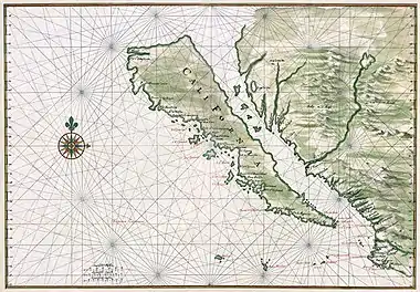
  • File:California island Vinckeboons5.jpg
  • File:California sea lion in La Jolla (70568).jpg
  • File:California state coat of arms (illustrated, 1876).jpg
  • File:CampanileMtTamalpiasSunset-original.jpg
  • File:Cervus canadensis nannodes at Tomales Point.jpg
  • File:Chemerinsky during Hyatt III sketch.jpg
  • File:Christ's Entry into Brussels in 1889.jpg
  • File:Crystal Mountains CA02.jpg
  • File:Cynthia Woodhead 1980 - Restoration.jpg
  • File:Deathvalleysky nps big.jpg
  • File:Devastation in San Bruno.jpg
  • File:Donner Lake as seen from Donner Pass.jpg
  • File:Double-crested cormorant at Sutro Baths-6460.jpg
  • File:Dungeness crab face closeup.jpg
  • File:EdwardTeller1958 fewer smudges.jpg
  • File:Egretta thula at Las Gallinas Wildlife Ponds.jpg
  • File:Elephant seals fighting.jpg
  • File:Eureka Inn, Entrance Hall.jpg
  • File:European starling at Bodega Head-1209.jpg
  • File:Fort Baker and Angel Island.jpg
  • File:Fort Mason Center and Downtown San Francisco.jpg
  • File:GGB reflection in raindrops.jpg
  • File:GREIDER Carol 2014 - Less vignetting.jpg
  • File:Gateway Generating Station rectified.jpg
  • File:Giant Marbles in Joshua Tree National Park.jpg
  • File:GoldenGateBridge BakerBeach MC.jpg
  • File:Grauman's Chinese Theatre, by Carol Highsmith fixed & straightened.jpg
  • File:Greater Yellowlegs2.jpg
  • File:Greater white-fronted goose in flight-1045.jpg
  • File:Gull ca usa.jpg
  • File:Hawk eating prey.jpg
  • File:Heinrich Berann NPS Panorama of Yosemite without labels.jpg
  • File:Hotel Del c1900b.jpg
  • File:Igor Stravinsky LOC 32392u.jpg
  • File:Jane Russell in The Outlaw.jpg
  • File:JetBlue292Landing.jpg
  • File:Jfader dryden.jpg
  • File:JohnShea.jpg
  • File:Joshua tree keys view pano more vertical.jpg
  • File:Juvenile pelecanus occidentalis in flight.jpg
  • File:Kobe Bryant 7144 adjusted.jpg
  • File:LAPD Bell 206 Jetranger.jpg
  • File:LagunaBeachCA photo D Ramey Logan.JPG
  • File:Lange-MigrantMother02.jpg
  • File:Langechildren2.jpg
  • File:Lansdowne Herakles Getty Museum.jpg
  • File:Line scan photo of nine car BART C1 train in 2017.jpg
  • File:Lockheed SR-71 Blackbird.jpg
  • File:Los Angeles Pollution.jpg
  • File:Los angeles from getty panorama.jpg
  • File:LutraCanadensis fullres.jpg
  • File:Male northern pintail at Llano Seco.jpg
  • File:Male wild turkey (Meleagris gallopavo) strutting.jpg
  • File:Map of Cathedral Peak Granodiorite.svg
  • File:Marilyn Monroe photo pose Seven Year Itch.jpg
  • File:Mary Pickford cph.3c17995u.jpg
  • File:McClure Tunnel west.jpg
  • File:Mission Santa Clara.jpg
  • File:Mono lake tufa.JPG
  • File:Mudpot at Lassen Volcanic National Park in August 2019.webm
  • File:NPG 2010 112 Lucia Chamberlain by Zaida Ben-Yusuf.jpg
  • File:Official Portrait of President Reagan 1981.jpg
  • File:Palace of Fine Arts (16794p).jpg
  • File:Parlos Verdes Light House Aug 2012.JPG
  • File:Pelecanus erythrorhynchos at Las Gallinas Wildlife Ponds.jpg
  • File:Photograph of Members of the Mochida Family Awaiting Evacuation - NARA - 537505 - Restoration.jpg
  • File:Pigeon Point Lighthouse (2016).jpg
  • File:Pioneertown california saloon and bath house.jpg
  • File:Point Arena Lighthouse, Mendocino County.jpg
  • File:Point Reyes Lighthouse (April 2012).jpg
  • File:Post-and-Grant-Avenue-Look.jpg
  • File:Pyrosoma atlanticum (12256).jpg
  • File:Randy's donuts1 edit1.jpg
  • File:RiP2013 GreenDay Mike Dirnt 0002.JPG
  • File:Ronald Reagan with cowboy hat 12-0071M edit.jpg
  • File:Rosalind Goodrich Bates (1931).jpg
  • File:Russian chapel at Fort Ross (2016).jpg
  • File:Sacramento,-California---State-Capitol.jpg
  • File:Sally Ride (1984).jpg
  • File:San Francisco City Hall as seen from 100 Van Ness at dusk (wide).jpg
  • File:San Francisco International Airport at night.jpg
  • File:San Francisco in ruin edit2.jpg
  • File:San gorgonio pass wind farm california pano.jpg
  • File:SanFrancisco1851a.jpg
  • File:SanFranciscoharbor1851c sharp.jpg
  • File:Sea otter nursing02.jpg
  • File:Seaborg in lab - restoration.jpg
  • File:Sfearthquake3b.jpg
  • File:Sharon Tate Valley of the Dolls 1967 - Restoration.jpg
  • File:Shasta dam under construction new edit.jpg
  • File:Sonoma chipmunk at Samuel P. Taylor State Park.jpg
  • File:Spanish shawl.JPG
  • File:Steve Jobs and Macintosh computer, January 1984, by Bernard Gotfryd - edited.jpg
  • File:Strip photo of San Francisco Cable Car 10.jpg
  • File:Surfer in california 2.JPG
  • File:Tower Bridge Sacramento edit.jpg
  • File:Tracy Caldwell Dyson in Cupola ISS.jpg
  • File:US-NBN-CA-Oakland-2248-1870-10-388-B.jpg
  • File:US-NBN-CA-Petaluma-2193-1870-100-209-A.jpg
  • File:US-NBN-CA-San Francisco-1741-1870-5-6758-B.jpg
  • File:US-NBN-CA-San Francisco-1741-1870-20-2772-C.jpg
  • File:US-NBN-CA-San Francisco-1741-1870-50-1616-A.jpg
  • File:USA Lassen NP Kings Creek CA edit3.jpg
  • File:Vernal Falls Rainbow.jpg
  • File:Victor Adam after Louis Choris - Vue du Presidio san Francisco, 1822.jpg
  • File:Vineyards of Napa Valley panorama.jpg
  • File:Walt Disney Concert Hall, LA, CA, jjron 22.03.2012.jpg
  • File:Waxman during Hyatt III sketch.jpg
  • File:World War II woman aircraft worker, Vega Aircraft Corporation, Burbank, California 1942.jpg

State facts

  • Nicknames: The Golden State
  • Capital: Sacramento
  • Total area: 163,696 mi2
    • Land: 156,002 mi2
    • Water: 7,694 mi2
  • Highest elevation: 14,505 ft (Mount Whitney)
  • Population 39,250,017 (2016 est)
  • Admission to the Union: September 9, 1850 (31st)

State symbols:

Related WikiProjects
Main Project

California

Sub-projects

Southern California • Los Angeles • San Francisco Bay Area • Santa Barbara County • California State Highways • California County Routes • University of California • California State University

Subportals


Related portals

Things you can do

Things you can do
Things you can do
  • Create Requested California Articles
  • Help assess articles supported by WikiProject California
  • Help suggest content for usage in this portal by using the archive links to obtain instructions
  • Write California-related topics if you see a redlink which is worthy of an article
  • Cleanup and expand stub-class articles relating to California

Associated Wikimedia

The following Wikimedia Foundation sister projects provide more on this subject:

More portals

Discover Wikipedia using portals

Shortcuts to this page: P:CALIFORNIAP:CAL

This article is issued from Wikipedia. The text is licensed under Creative Commons - Attribution - Sharealike. Additional terms may apply for the media files.