Pleudihen-sur-Rance
Pleudihen-sur-Rance (French pronunciation: [plødi.ɛ̃ syʁ ʁɑ̃s], literally Pleudihen on Rance; Breton: Pleudehen) is a commune in the Côtes-d'Armor department of Brittany in northwestern France.
Pleudihen-sur-Rance
Pleudehen | |
|---|---|
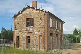
 Train station | |
.svg.png.webp) Coat of arms | |
Location of Pleudihen-sur-Rance | |
 Pleudihen-sur-Rance  Pleudihen-sur-Rance | |
| Coordinates: 48°30′42″N 1°57′02″W | |
| Country | France |
| Region | Brittany |
| Department | Côtes-d'Armor |
| Arrondissement | Dinan |
| Canton | Lanvallay |
| Intercommunality | Dinan Agglomération |
| Government | |
| • Mayor (2020–2026) | David Boixière[1] |
| Area 1 | 24.55 km2 (9.48 sq mi) |
| Population | 3,009 |
| • Density | 120/km2 (320/sq mi) |
| Time zone | UTC+01:00 (CET) |
| • Summer (DST) | UTC+02:00 (CEST) |
| INSEE/Postal code | 22197 /22690 |
| Elevation | 0–63 m (0–207 ft) |
| 1 French Land Register data, which excludes lakes, ponds, glaciers > 1 km2 (0.386 sq mi or 247 acres) and river estuaries. | |
It is known for the production of apples and Breton champagne (cider).
During the latter half of the 18th century, the town took in a large share of 2,000 Acadians who were deported to France against their will.
Geography
Located only a couple of miles from the Rance, Pleudihen-sur-Rance is accessible via the D29 that goes to La Vicomté-sur-Rance to the south (4 miles) and Châteauneuf-d'Ille-et-Vilaine (8 miles) to the north.
Population
Inhabitants of Pleudihen-sur-Rance are called pleudihennais in French.
| Year | Pop. | ±% p.a. |
|---|---|---|
| 1968 | 2,318 | — |
| 1975 | 2,351 | +0.20% |
| 1982 | 2,461 | +0.66% |
| 1990 | 2,495 | +0.17% |
| 1999 | 2,516 | +0.09% |
| 2007 | 2,746 | +1.10% |
| 2012 | 2,809 | +0.45% |
| 2017 | 2,909 | +0.70% |
| Source: INSEE[3] | ||
Attractions
The Musée de la Pomme et du Cidre (The Apple and Cider Museum), located in a farmhouse within town, is a prominent attraction, displaying various types of apple trees, production methods, and offers cider tasting.
Partnership
Pleudihen-sur-Rance maintains a town partnership with the German community of Herschbach in the Westerwaldkreis, Rhineland-Palatinate.
References
- "Répertoire national des élus: les maires" (in French). data.gouv.fr, Plateforme ouverte des données publiques françaises. 13 September 2022.
- "Populations légales 2020". The National Institute of Statistics and Economic Studies. 29 December 2022.
- Population en historique depuis 1968, INSEE