Kerpert
Kerpert (Breton: Kerbêr) is a commune in the Côtes-d'Armor department of Brittany in northwestern France.
Kerpert
Kerbêr | |
|---|---|
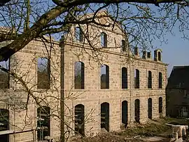 Abbey of Koad Malouen | |
Location of Kerpert | |
 Kerpert  Kerpert | |
| Coordinates: 48°22′38″N 3°07′58″W | |
| Country | France |
| Region | Brittany |
| Department | Côtes-d'Armor |
| Arrondissement | Guingamp |
| Canton | Callac |
| Intercommunality | Guingamp-Paimpol Agglomération |
| Government | |
| • Mayor (2020–2026) | Bruno Taloc[1] |
| Area 1 | 21.00 km2 (8.11 sq mi) |
| Population | 269 |
| • Density | 13/km2 (33/sq mi) |
| Time zone | UTC+01:00 (CET) |
| • Summer (DST) | UTC+02:00 (CEST) |
| INSEE/Postal code | 22092 /22480 |
| Elevation | 177–301 m (581–988 ft) |
| 1 French Land Register data, which excludes lakes, ponds, glaciers > 1 km2 (0.386 sq mi or 247 acres) and river estuaries. | |
Geography
Climate
Kerpert has a oceanic climate (Köppen climate classification Cfb). The average annual temperature in Kerpert is 10.7 °C (51.3 °F). The average annual rainfall is 1,130.6 mm (44.51 in) with January as the wettest month. The temperatures are highest on average in August, at around 17.2 °C (63.0 °F), and lowest in January, at around 5.3 °C (41.5 °F). The highest temperature ever recorded in Kerpert was 38.0 °C (100.4 °F) on 9 August 2003; the coldest temperature ever recorded was −12.8 °C (9.0 °F) on 2 January 1997.
| Climate data for Kerpert (1981–2010 averages, extremes 1987−present) | |||||||||||||
|---|---|---|---|---|---|---|---|---|---|---|---|---|---|
| Month | Jan | Feb | Mar | Apr | May | Jun | Jul | Aug | Sep | Oct | Nov | Dec | Year |
| Record high °C (°F) | 15.0 (59.0) |
20.5 (68.9) |
22.2 (72.0) |
27.0 (80.6) |
29.6 (85.3) |
33.7 (92.7) |
35.9 (96.6) |
38.0 (100.4) |
31.5 (88.7) |
27.6 (81.7) |
20.0 (68.0) |
15.3 (59.5) |
38.0 (100.4) |
| Average high °C (°F) | 7.7 (45.9) |
8.5 (47.3) |
11.0 (51.8) |
12.9 (55.2) |
16.5 (61.7) |
19.4 (66.9) |
21.4 (70.5) |
21.9 (71.4) |
18.9 (66.0) |
14.8 (58.6) |
10.6 (51.1) |
7.8 (46.0) |
14.3 (57.7) |
| Daily mean °C (°F) | 5.3 (41.5) |
5.7 (42.3) |
7.6 (45.7) |
9.0 (48.2) |
12.3 (54.1) |
14.8 (58.6) |
16.8 (62.2) |
17.2 (63.0) |
14.8 (58.6) |
11.7 (53.1) |
7.9 (46.2) |
5.4 (41.7) |
10.7 (51.3) |
| Average low °C (°F) | 2.9 (37.2) |
2.9 (37.2) |
4.1 (39.4) |
5.1 (41.2) |
8.0 (46.4) |
10.3 (50.5) |
12.2 (54.0) |
12.5 (54.5) |
10.8 (51.4) |
8.5 (47.3) |
5.2 (41.4) |
3.0 (37.4) |
7.1 (44.8) |
| Record low °C (°F) | −12.8 (9.0) |
−10.8 (12.6) |
−5.6 (21.9) |
−2.6 (27.3) |
0.4 (32.7) |
3.3 (37.9) |
6.3 (43.3) |
6.8 (44.2) |
3.3 (37.9) |
−2.2 (28.0) |
−4.8 (23.4) |
−8.3 (17.1) |
−12.8 (9.0) |
| Average precipitation mm (inches) | 135.3 (5.33) |
116.8 (4.60) |
86.7 (3.41) |
90.8 (3.57) |
72.8 (2.87) |
58.3 (2.30) |
61.9 (2.44) |
58.3 (2.30) |
75.4 (2.97) |
119.1 (4.69) |
123.1 (4.85) |
132.1 (5.20) |
1,130.6 (44.51) |
| Average precipitation days (≥ 1.0 mm) | 16.6 | 14.4 | 13.8 | 13.5 | 10.6 | 8.8 | 10.4 | 9.9 | 10.5 | 15.7 | 16.3 | 16.0 | 156.5 |
| Source: Météo France[3] | |||||||||||||
Population
|
|
The inhabitants of Kerpert are known in French as kerpertois.
References
- "Répertoire national des élus: les maires". data.gouv.fr, Plateforme ouverte des données publiques françaises (in French). 2 December 2020.
- "Populations légales 2020". The National Institute of Statistics and Economic Studies. 29 December 2022.
- "Climate of Kerpert 1981-2010" (PDF) (in French). Météo-France. Retrieved 18 June 2022.
External links
Wikimedia Commons has media related to Kerpert.
- Base Mérimée: Search for heritage in the commune, Ministère français de la Culture. (in French)
This article is issued from Wikipedia. The text is licensed under Creative Commons - Attribution - Sharealike. Additional terms may apply for the media files.