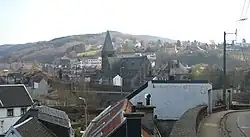
Pepinster
Pepinster (French pronunciation: [pepɛ̃stɛʁ] or [pəpɛ̃stɛʁ]) is a municipality of Wallonia located in the province of Liège, Belgium.
Pepinster
| |
|---|---|
 | |
 Coat of arms | |
Location of Pepinster | |
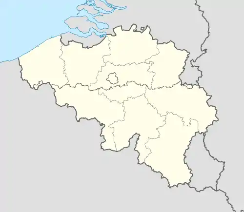 Pepinster Location in Belgium
Location of Pepinster in the province of Liège 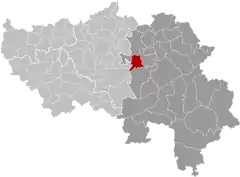 | |
| Coordinates: 50°34′N 05°49′E | |
| Country | |
| Community | French Community |
| Region | Wallonia |
| Province | Liège |
| Arrondissement | Verviers |
| Government | |
| • Mayor | Philippe Godin |
| • Governing party/ies | PEPIN |
| Area | |
| • Total | 24.89 km2 (9.61 sq mi) |
| Population (2018-01-01)[1] | |
| • Total | 9,765 |
| • Density | 390/km2 (1,000/sq mi) |
| Postal codes | 4860-4861 |
| NIS code | 63058 |
| Area codes | 087 |
| Website | www.pepinster.be |
On 1 January 2006 Pepinster had a total population of 9,560. The total area is 24.79 km2 which gives a population density of 386 inhabitants per km2. Pepinster is situated at the confluence of the rivers Hoëgne and Vesdre.
The municipality consists of the following districts: Cornesse, Pepinster (including the hamlet of Tancrémont), Soiron, and Wegnez.
Pepinster was hit extremely hard by the 2021 European floods, the village was temporarily cut off from roads.[2]
Image gallery
 Pepinster town hall
 Romanesque Christ (11th century)
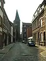
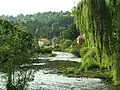 Vesdre river
See also
- Fort de Tancrémont, a companion to Fort Eben-Emael, located just outside the town
- List of protected heritage sites in Pepinster
- Shrine of Tancrémont
References
- "Wettelijke Bevolking per gemeente op 1 januari 2018". Statbel. Retrieved 9 March 2019.
- Belgium village of Pepinster cut off after extreme flooding on YouTube, 17 July 2021, Sky News. Archived at Ghostarchive and the Wayback Machine
External links
 Media related to Pepinster at Wikimedia Commons
Municipalities in the province of Liège, Wallonia | ||
|---|---|---|
| Huy | 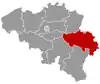 | |
| Liège | ||
| Verviers | ||
| Waremme | ||
| ||
This article is issued from Wikipedia. The text is licensed under Creative Commons - Attribution - Sharealike. Additional terms may apply for the media files.