Geer
Geer (French pronunciation: [ʒɛʁ]; Walloon: Djer) is a municipality of Wallonia located in the province of Liège, Belgium.
Geer
| |
|---|---|
.JPG.webp) | |
 Coat of arms | |
Location of Geer | |
 Geer Location in Belgium
Location of Geer in the province of Liège 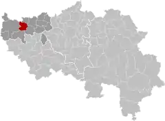 | |
| Coordinates: 50°40′N 05°10′E | |
| Country | |
| Community | French Community |
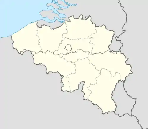
| Region | Wallonia |
| Province | Liège |
| Arrondissement | Waremme |
| Government | |
| • Mayor | Dominique Servais (independent) |
| • Governing party/ies | Intérêts communaux (independent) |
| Area | |
| • Total | 23.6 km2 (9.1 sq mi) |
| Population (2018-01-01)[1] | |
| • Total | 3,430 |
| • Density | 150/km2 (380/sq mi) |
| Postal codes | 4250, 4252-4254 |
| NIS code | 64029 |
| Area codes | 019 |
| Website | www.geer.be |
On January 1, 2006, Geer had a total population of 2,854. The total area is 23.62 km² which gives a population density of 121 inhabitants per km². Geer lies along the upper course of the river Jeker, which is called Geer in French.
The municipality consists of the following districts: Boëlhe, Darion, Geer, Hollogne-sur-Geer, Lens-Saint-Servais, Ligney, and Omal.
.JPG.webp)
Town hall
References
- "Wettelijke Bevolking per gemeente op 1 januari 2018". Statbel. Retrieved 9 March 2019.
External links
 Media related to Geer at Wikimedia Commons
Municipalities in the province of Liège, Wallonia | ||
|---|---|---|
| Huy | 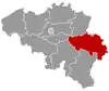 | |
| Liège | ||
| Verviers | ||
| Waremme | ||
| ||
This article is issued from Wikipedia. The text is licensed under Creative Commons - Attribution - Sharealike. Additional terms may apply for the media files.