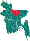
Netrokona Sadar Upazila
Netrokona Sadar (Bengali: নেত্রকোণা সদর) is an upazila (sub-district) of Netrokona District under Mymensingh Division, Bangladesh.[1]
Netrokona Sadar
নেত্রকোণা সদর | |
|---|---|
 Netrokona Sadar Location in Bangladesh | |
| Coordinates: 24°52.5′N 90°44′E | |
| Country | |
| Division | Mymensingh Division |
| District | Netrokona District |
| Government | |
| • Upazila Chairman | Muhammad Tafsir Uddin Khan |
| • MP (Netrokona-2) | Ashraf Ali Khan Khasru |
| Area | |
| • Total | 340.35 km2 (131.41 sq mi) |
| Population (2011) | |
| • Total | 372,785 |
| • Density | 1,100/km2 (2,800/sq mi) |
| Time zone | UTC+6 (BST) |
| Website | netrokonasadar |
Geography
Netrakona Sadar is located at 24.8750°N 90.7333°E. It has 51039 households and total area 340.35 km2. The upazila is bounded by Durgapur and Kalmakanda upazilas on the north, Kendua and Gauripur upazilas on the south, Barhatta and Atpara upazilas on the east, Purbadhala upazila on the west.[1]
History

Present-day Netrokona Sadar was ruled by a Koch king named Ganesh. The area was introduced to Islam by an 11th-century preacher by the name of Shah Sultan Rumi who arrived in 1053 CE. After gaining the king's respect, Rumi was given a few villages, in particular Madanpur, as a rent-free area. Rumi was buried in Madanpur in 1075.[2]
In opposition to Company rule in India, a group of rebels known as the Pagal Panthis emerged in Greater Mymensingh in 1764 lasting up until 1852. Natorkona was one of the main locations effected by the Pagal Panthis. In response, a police outpost (thana) was set up by the British officers at Natorkona to assist their allied zamindars in suppressing the Pagal Panthi revolt. It is said that when the Pagal Panthis looted the outpost, the officers relocated to Kaliganj Bazar in Satpai mouza which is the site of the present Netrokona Sadar police station. However, the name of the thana remained as Natorkona, later being corrupted to Netrokona.[3]
In 1829, the British East India Company tried to takeover the Shah Sultan Rumi estate. This was contested by the guardians of the shrine who provided an old Persian document dating from 1082 CE. In response, the government abandoned the plan and granted the estate to the document holder; Syed Jalaluddin.[2] Netrokona was made a thana in 1938 and made the capital of Netrokona Mahakuma in 1882.
Amidst the Indian independence movement, influential nationalist Subhas Chandra Bose gave a speech at the Methar Patti grounds on 15 March 1939. The All India Peasant Conference was held from 8 to 10 April 1945 at the Parar grounds. During the Bangladesh Liberation War, the Pakistan Army captured 4 people and shot them dead at the Trimohani Bridge on29 April 1971. A battle took place on 9 December leading to the death of three freedom fighters. The Pakistani army was finally defeated in Netrokona Sadar in a last encounter at the Agricultural Farm where two freedom fighters were also killed. In 1983, the Netrokona thana was upgraded to an upazila and it was made the capital of the Netrokona District in 1984.
Demographics

According to 2011 Bangladesh census, Netrakona Sadar had a population of 372,785. Males constituted 50.17% of the population and females 49.83%. Muslims formed 90.33% of the population, Hindus 9.61%, Christians 0.03% and others 0.03%. Netrakona Sadar had a literacy rate of 45.97% for the population 7 years and above.[4]
As of the 1991 Bangladesh census, Netrakona Sadar has a population of 265643. Males constitute 51.36% of the population, and females 48.64%. This Upazila's eighteen up population is 134197. Netrakona Sadar has an average literacy rate of 28.4% (7+ years), and a national average of 32.4% literate.[5]
Administration
Netrokona Thana was formed in 1874 and it was turned into an upazila in 1983.[1]
Netrakona Sadar Upazila is divided into Netrakona Municipality and 12 union parishads: Amtala, Challisha, Dakshin Bishiura, Kailati, Kaliara Gabragati, Lokkhiganj, Madanpur, Medni, Maugati, Rauha, Singhar Bangla, and Thakurakona. The union parishads are subdivided into 255 mauzas and 332 villages.[6]
Netrakona Municipality is subdivided into 9 wards and 51 mahallas.[6]
Upazila chairmen
| Name | Term |
|---|---|
| SM Bazlur Qadir | 25/5/1988-24/8/1995 |
| Muhammad Tafsir Uddin Khan Mokhtarpari | 23/2/2009-4/5/2014 |
| SM Kamrul Hasan | 5/5/2014-4/5/2019 |
| Muhammad Tafsir Uddin Khan Mokhtarpari | 5/5/2019-present |
Notable people
- Abu Abbas (d. 2009), politician
- Mujibur Rahman Khan (1910-1984), journalist and litterateur
- Rashid Uddin (1889-1964), Baul mystic
- Shah Sultan Rumi (d. 1075), Muslim missionary
References
- Syed Marufuzzaman (2012). "Netrokona Sadar Upazila". In Sirajul Islam; Miah, Sajahan; Khanam, Mahfuza; Ahmed, Sabbir (eds.). Banglapedia: the National Encyclopedia of Bangladesh (Online ed.). Dhaka, Bangladesh: Banglapedia Trust, Asiatic Society of Bangladesh. ISBN 984-32-0576-6. OCLC 52727562. OL 30677644M. Retrieved 25 October 2023.
- N. Hanif (2000). Biographical encyclopaedia of Sufis: South Asia. Sarup & Sons. p. 325.
- "উপজেলার ঐতিহ্য" [Sub District's Tradition]. Netrokona Shodor Upozela (in Bengali).
- "Bangladesh Population and Housing Census 2011: Zila Report – Netrokona" (PDF). Table P01 : Household and Population by Sex and Residence, Table P05 : Population by Religion, Age group and Residence, Table P09 : Literacy of Population 7 Years & Above by Religion, Sex and Residence. Bangladesh Bureau of Statistics (BBS), Ministry of Planning, Government of the People’s Republic of Bangladesh. Retrieved 14 December 2018.
- "Population Census Wing, BBS". Archived from the original on 2005-03-27. Retrieved November 10, 2006.
- "District Statistics 2011: Netrokona" (PDF). Bangladesh Bureau of Statistics. Archived from the original (PDF) on 13 November 2014. Retrieved 14 July 2014.
