Monteignet-sur-l'Andelot
Monteignet-sur-l'Andelot (French pronunciation: [mɔ̃tɛɲɛ syʁ lɑ̃dlo]) is a commune in the Allier department in central France.
Monteignet-sur-l'Andelot | |
|---|---|
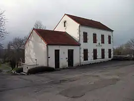 Town hall | |
Location of Monteignet-sur-l'Andelot | |
 Monteignet-sur-l'Andelot  Monteignet-sur-l'Andelot | |
| Coordinates: 46°07′23″N 3°15′27″E | |
| Country | France |
| Region | Auvergne-Rhône-Alpes |
| Department | Allier |
| Arrondissement | Vichy |
| Canton | Gannat |
| Government | |
| • Mayor (2020–2026) | Fabien Cartoux[1] |
| Area 1 | 9.38 km2 (3.62 sq mi) |
| Population | 262 |
| • Density | 28/km2 (72/sq mi) |
| Time zone | UTC+01:00 (CET) |
| • Summer (DST) | UTC+02:00 (CEST) |
| INSEE/Postal code | 03182 /03800 |
| Elevation | 305–345 m (1,001–1,132 ft) (avg. 345 m or 1,132 ft) |
| 1 French Land Register data, which excludes lakes, ponds, glaciers > 1 km2 (0.386 sq mi or 247 acres) and river estuaries. | |
Population
| Year | Pop. | ±% |
|---|---|---|
| 1962 | 274 | — |
| 1968 | 283 | +3.3% |
| 1975 | 249 | −12.0% |
| 1982 | 297 | +19.3% |
| 1990 | 287 | −3.4% |
| 1999 | 271 | −5.6% |
| 2008 | 233 | −14.0% |
| 2012 | 245 | +5.2% |
| Source: INSEE (1968–2012) | ||
See also
References
- "Répertoire national des élus: les maires" (in French). data.gouv.fr, Plateforme ouverte des données publiques françaises. 4 May 2022.
- "Populations légales 2020". The National Institute of Statistics and Economic Studies. 29 December 2022.
Wikimedia Commons has media related to Monteignet-sur-l'Andelot.
This article is issued from Wikipedia. The text is licensed under Creative Commons - Attribution - Sharealike. Additional terms may apply for the media files.