Minjavan-e Gharbi Rural District
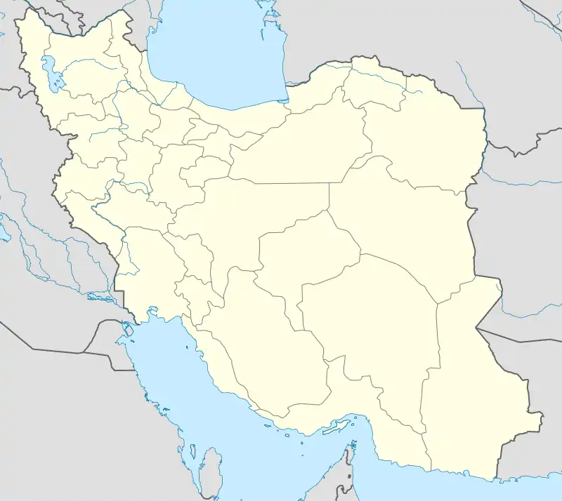
Minjavan-e Gharbi Rural District (Persian: دهستان منجوان غربی)[3] is in Minjavan District of Khoda Afarin County, East Azerbaijan province, Iran.
Minjavan-e Gharbi Rural District
Persian: دهستان منجوان غربی | |
|---|---|
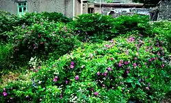 Wild roses cover abandoned houses in Abbasabad, 2009 | |
 Minjavan-e Gharbi Rural District | |
| Coordinates: 38°54′04″N 46°44′56″E[1] | |
| Country | |
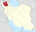
| Province | East Azerbaijan |
| County | Khoda Afarin |
| District | Minjavan |
| Population (2016)[2] | |
| • Total | 4,094 |
| Time zone | UTC+3:30 (IRST) |
At the National Census of 2006, its population was 4,378 in 931 households, when it was in the former Khoda Afarin District of Kaleybar County.[4] There were 4,214 inhabitants in 1,063 households at the following census of 2011,[5] by which time Khoda Afarin District had risen to the status of a county and divided into three districts.[6] At the most recent census of 2016, the population of the rural district was 4,094 in 1,282 households. The largest of its 42 villages was Asheqlu, with 534 people.[2] There is a significant decline in the population, which is a reflection of a general trend in the Arasbaran region due to the lack of jobs.
History
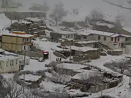
In the wake of White Revolution (early 1960s) many clans of Mohammad Khanlu Tribe used the north part of the district as their winter quarters. The tribe's summer quarters were located in the mountains of the southern part, which include prime pastures.[7] The district's population was in steady decline since the launch of land reform policies in the early 1960s. By 2000 some villages, for instance Garmanab, were already abandoned. Some expatriates, working as painters in Tehran, returned and built summer residences. At present the district is witnessing an unprecedented construction boom, a fact that can be easily noticed by comparing the included photos, both taken from Abbasabad respectively in 2009 and 2014.
References
- OpenStreetMap contributors (3 April 2023). "Minjavan-e Gharbi Rural District (Khoda Afarin County)" (Map). OpenStreetMap. Retrieved 3 April 2023.
- "Census of the Islamic Republic of Iran, 1395 (2016)". AMAR (in Persian). The Statistical Center of Iran. p. 03. Archived from the original (Excel) on 13 November 2020. Retrieved 19 December 2022.
- Iranian National Committee for Standardization of Geographical Names website (in Persian)
- "Census of the Islamic Republic of Iran, 1385 (2006)". AMAR (in Persian). The Statistical Center of Iran. p. 03. Archived from the original (Excel) on 20 September 2011. Retrieved 25 September 2022.
- "Census of the Islamic Republic of Iran, 1390 (2011)" (Excel). Iran Data Portal (in Persian). The Statistical Center of Iran. p. 03. Retrieved 19 December 2022.
- "Letter of approval regarding country divisions in Kalibar county, approved 09/07/1389". Qavanin (in Persian). 7 September 1389. Retrieved 18 February 2023.
- P. Oberling, “The Tribes of Qarāca Dāġ,” Oriens 17, 1964, pp. 60–95
| Capital | |||||||||||||||||||||||||||||||
|---|---|---|---|---|---|---|---|---|---|---|---|---|---|---|---|---|---|---|---|---|---|---|---|---|---|---|---|---|---|---|---|
| Districts |
| ||||||||||||||||||||||||||||||