Mahanoro
Mahanoro is a rural municipality located in the Atsinanana region of eastern Madagascar, along the coast.
Mahanoro | |
|---|---|
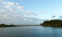
 beach of Mahanoro | |
 Mahanoro Location in Madagascar | |
| Coordinates: 19°54′S 48°48′E | |
| Country | |
| Region | Atsinanana |
| District | Mahanoro District |
| Area | |
| • Total | 264.40 km2 (102.09 sq mi) |
| Population (2018)Census | |
| • Total | 37,800 |
| Time zone | UTC3 (EAT) |
| Postal code | 510 |
It is located 9 km north of the mouth of the Mangoro River.[1] The Canal des Pangalanes is nearby, and the "Chutes de la Sahatsio" waterfalls are 18 km north of town.[2] Though a small airport is situated on the north side of the town, the location is quite isolated and with limited tourism, though it is reported to have a single hotel.[2]
There is a lighthouse on a cape just south of the town, constructed in 1936, and in poor repair.[3]
Fokontany
21 fokontany (villages) belong to this municipality:[4] Androhomanasa, Ambohimiarina, Maroahitra, Ambohitsara I, Ambilabe, Ambinanisasika, Bemangahazo, Ambodiriana Lohariana, Tandroroho, Miakara, Androrangambo, Maintimbato, Sahabe, Fiadanana, Vohitromby, Tanambao I, Ambalakininina, Ankadirano, Tanamborozano, Ambalamangahazo and Papagnambo.
Roads
Only one road leads to Mahanoro: northswards to Toamasina the National road 11a and southwards to Nosy Varika and Mananjary by the National road 11.
Climate
| Climate data for Mahanoro (1991–2020) | |||||||||||||
|---|---|---|---|---|---|---|---|---|---|---|---|---|---|
| Month | Jan | Feb | Mar | Apr | May | Jun | Jul | Aug | Sep | Oct | Nov | Dec | Year |
| Record high °C (°F) | 34.9 (94.8) |
34.6 (94.3) |
34.0 (93.2) |
32.6 (90.7) |
34.3 (93.7) |
30.4 (86.7) |
30.3 (86.5) |
29.1 (84.4) |
30.0 (86.0) |
32.0 (89.6) |
33.2 (91.8) |
34.4 (93.9) |
34.9 (94.8) |
| Average high °C (°F) | 30.5 (86.9) |
30.4 (86.7) |
29.9 (85.8) |
29.1 (84.4) |
27.4 (81.3) |
25.6 (78.1) |
24.6 (76.3) |
25.1 (77.2) |
26.0 (78.8) |
27.4 (81.3) |
28.8 (83.8) |
30.0 (86.0) |
27.9 (82.2) |
| Daily mean °C (°F) | 26.8 (80.2) |
26.8 (80.2) |
26.4 (79.5) |
25.4 (77.7) |
23.7 (74.7) |
21.8 (71.2) |
20.7 (69.3) |
21.0 (69.8) |
21.9 (71.4) |
23.5 (74.3) |
25.0 (77.0) |
26.3 (79.3) |
24.1 (75.4) |
| Average low °C (°F) | 23.0 (73.4) |
23.2 (73.8) |
22.9 (73.2) |
21.6 (70.9) |
20.0 (68.0) |
17.9 (64.2) |
16.9 (62.4) |
16.9 (62.4) |
17.7 (63.9) |
19.6 (67.3) |
21.1 (70.0) |
22.5 (72.5) |
20.3 (68.5) |
| Record low °C (°F) | 18.4 (65.1) |
19.7 (67.5) |
18.7 (65.7) |
16.8 (62.2) |
13.0 (55.4) |
13.5 (56.3) |
11.2 (52.2) |
11.0 (51.8) |
11.9 (53.4) |
13.0 (55.4) |
13.0 (55.4) |
17.4 (63.3) |
11.0 (51.8) |
| Average precipitation mm (inches) | 284.4 (11.20) |
291.4 (11.47) |
275.9 (10.86) |
171.7 (6.76) |
161.5 (6.36) |
122.5 (4.82) |
124.5 (4.90) |
96.2 (3.79) |
68.2 (2.69) |
91.2 (3.59) |
96.9 (3.81) |
180.3 (7.10) |
1,964.7 (77.35) |
| Average precipitation days (≥ 1.0 mm) | 17.9 | 17.8 | 17.5 | 14.3 | 12.9 | 14.0 | 16.0 | 12.5 | 9.0 | 10.5 | 10.1 | 14.0 | 166.5 |
| Source: NOAA[5] | |||||||||||||
References
- Moriarity, H.A. Islands in the Southern Indian Ocean, p. 126-28 (1891) (historical entry on Mahanoro from 1891)
- Bradt, Hilary. Madagascar: The Bradt Travel Guide, p. 297 (2007)
- Rowlett, Russ. "Lighthouses of Madagascar". The Lighthouse Directory. University of North Carolina at Chapel Hill. Retrieved 5 March 2013.
- Redynalusation du Comité Communal
- "Mahanoro Climate Normals 1991–2020". World Meteorological Organization Climatological Standard Normals (1991–2020). National Oceanic and Atmospheric Administration. Archived from the original on 25 September 2023. Retrieved 25 September 2023.
Capital: Toamasina | ||
| Antanambao Manampotsy - 507 | 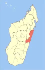 | |
| Mahanoro - 510 | ||
| Marolambo - 513 | ||
| Toamasina I - 501 | ||
| Toamasina II - 502 | ||
| Vatomandry - 517 | ||
| Vohabinany (Brickaville) - 508 | ||
7 districts; 75 communes | ||