List of cities in Botswana
The following is a list of cities and towns in Botswana with population of over 3,000 citizens. State capitals are shown in boldface.
| Rank | Name | District | Census District | Population 2011.[1] | Male Population | Female Population |
|---|---|---|---|---|---|---|
| 1. | Gaborone | South-East District | Gaborone | 231,592 | 113,580 | 118,012 |
| 2. | Francistown | North-East District | Francistown | 98,961 | 48,124 | 50,837 |
| 3. | Molepolole | Kweneng District | Kweneng East | 73,103 | 34,115 | 38,988 |
| 4. | Maun | North-West District | Ngamiland East | 65,693 | 31,633 | 34,060 |
| 5. | Mogoditshane | Kweneng District | Kweneng East | 58,632 | 29,561 | 29,071 |
| 6. | Serowe | Central District | Serowe Palapye | 57,588 | 27,749 | 29,839 |
| 7. | Kanye | Southern District | Ngwaketse | 52,214 | 24,850 | 27,364 |
| 8. | Selibe Phikwe | Central District | Selibe Phikwe | 49,411 | 24,749 | 24,662 |
| 9. | Mochudi | Kgatleng District | Kgatleng | 47,001 | 22,235 | 24,766 |
| 10. | Mahalapye | Central District | Central Mahalapye | 46,418 | 22,527 | 23,891 |
| 11. | Palapye | Central District | Serowe Palapye | 41,102 | 21,476 | 19,626 |
| 12. | Tlokweng | South-East District | South East | 37,364 | 17,882 | 19,482 |
| 13. | Ramotswa | South-East District | South East | 30,381 | 14,280 | 16,101 |
| 14. | Lobatse | South-East District | Lobatse | 29,007 | 14,145 | 14,862 |
| 15. | Letlhakane | Central District | Central Boteti | 26,393 | 13,187 | 13,206 |
| 16. | Moshupa | Southern District | Ngwaketse | 24,231 | 11,498 | 12,733 |
| 17. | Tonota | Central District | Central Tutume | 24,007 | 11,240 | 12,767 |
| 18. | Thamaga | Kweneng District | Kweneng East | 23,096 | 10,774 | 12,322 |
| 19. | Bobonong | Central District | Central Bobonong | 22,483 | 10,456 | 12,027 |
| 20. | Tutume | Central District | Central Tutume | 18,295 | 8,560 | 9,735 |
| 21. | Jwaneng | Southern District | Jwaneng | 18,008 | 9,831 | 8,177 |
| 22. | Mmopane | Kweneng District | Kweneng East | 17,845 | 8,813 | 9,032 |
| 23. | Gabane | Kweneng District | Kweneng East | 16,671 | 8,063 | 8,608 |
| 24. | Ghanzi | Ghanzi District | Ghanzi | 16,276 | 8,060 | 8,216 |
| 25. | Mmadinare | Central District | Central Bobonong | 15,177 | 7,314 | 7,863 |
| 26. | Shoshong | Central District | Central Mahalapye | 11,884 | 5,808 | 6,076 |
| 27. | Kopong | Kweneng District | Kweneng East | 11,099 | 5,457 | 5,642 |
| 28. | Letlhakeng | Kweneng District | Kweneng West | 9,871 | 4,894 | 4,977 |
| 29. | Orapa | Central District | Orapa | 9,531 | 4,736 | 4,795 |
| 30. | Tshabong | Kgalagadi District | Kgalagadi South | 9,489 | 4,723 | 4,766 |
| 31. | Molapowabojang | Southern District | Ngwaketse | 9,433 | 4,522 | 4,911 |
| 32. | Metsimotlhabe | Kweneng District | Kweneng East | 9,270 | 4,440 | 4,830 |
| 33. | Kasane | Chobe District | Chobe | 9,244 | 4,609 | 4,635 |
| 34. | Gumare | North-West District | Ngamiland West | 8,970 | 4,258 | 4,712 |
| 35. | Tati Siding | North-East District | North East | 8,197 | 3,869 | 4,328 |
| 36. | Otse | South-East District | South East | 7,976 | 3,883 | 4,093 |
| 37. | Nata | Central District | Central Tutume | 7,732 | 3,784 | 3,948 |
| 38. | Lentsweletau | Kweneng District | Kweneng East | 7,467 | 3,849 | 3,618 |
| 39. | Mmankgodi | Kweneng District | Kweneng East | 7,459 | 3,532 | 3,927 |
| 40. | Lerala | Central District | Serowe Palapye | 7,455 | 3,500 | 3,955 |
| 41. | Shakawe | North-West District | Ngamiland West | 7,420 | 3,594 | 3,826 |
| 42. | Rakops | Central District | Central Boteti | 7,240 | 3,464 | 3,776 |
| 43. | Gweta | Central District | Central Tutume | 7,016 | 3,446 | 3,570 |
| 44. | Sefophe | Central District | Central Bobonong | 6,938 | 3,271 | 3,667 |
| 45. | Mmathethe | Southern District | Borolong | 6,928 | 3,429 | 3,499 |
| 46. | Kang | Kgalagadi District | Kgalagadi North | 6,570 | 3,327 | 3,243 |
| 47. | Dukwi | Central District | Central Tutume | 6,507 | 3,342 | 3,165 |
| 48. | Bokaa | Kgatleng District | Kgatleng | 6,462 | 3,280 | 3,182 |
| 49. | Good Hope | Southern District | Barolong | 6,377 | 2,900 | 3,477 |
| 50. | Maitengwe | Central District | Central Tutume | 6,216 | 2,794 | 3,422 |
| 51. | Mathangwane | Central District | Central Tutume | 5,983 | 2,893 | 3,090 |
| 52. | Kumakwane | Kweneng District | Kweneng East | 5,901 | 2,853 | 3,048 |
| 53. | Oodi | Kgatleng District | Kgatleng | 5,874 | 2,858 | 3,016 |
| 54. | Masunga | North-East District | North East | 5,666 | 2,555 | 3,111 |
| 55. | Sefhare | Central District | Central Mahalapye | 5,295 | 2,428 | 2,867 |
| 56. | Borolong | Central District | Central Tutume | 5,269 | 2,436 | 2,833 |
| 57. | Mopipi | Central District | Central Boteti | 5,247 | 2,543 | 2,704 |
| 58. | Etsha 6 | North-West District | Ngamiland West | 5,234 | 2,283 | 2,951 |
| 59. | Chadibe | Central District | Central Tutume | 5,218 | 2,468 | 2,750 |
| 60. | Lotlhakane | Southern District | Ngwaketse | 5,210 | 2,411 | 2,799 |
| 61. | Moiyabana | Central District | Serowe Palapye | 5,161 | 2,685 | 2,476 |
| 62. | Sehithwa | North-West District | Ngamiland East | 5,142 | 2,671 | 2,471 |
| 63. | Maunatlala | Central District | Serowe Palapye | 4,951 | 2,534 | 2,417 |
| 64. | Tsetsebjwe | Central District | Central Bobonong | 4,848 | 2,259 | 2,589 |
| 65. | Hukuntsi | Kgalagadi District | Kgalagadi North | 4,751 | 2,313 | 2,438 |
| 66. | Ramokgonami | Central District | Central Mahalapye | 4,596 | 2,146 | 2,450 |
| 67. | Rasesa | Kgatleng District | Kgatleng | 4,491 | 2,264 | 2,227 |
| 68. | Kazungula | Chobe District | Chobe | 4,320 | 2,167 | 2,153 |
| 69. | Mandunyane | Central District | Central Tutume | 4,278 | 2,121 | 2,157 |
| 70. | Ramotswa station/Taung | South-East District | South East | 4,250 | 2,101 | 2,149 |
| 71. | Sojwe | Kweneng District | Kweneng East | 4,207 | 1,941 | 2,266 |
| 72. | Shashe-Mooke | Central District | Central Tutume | 4,028 | 1,967 | 2,061 |
| 73. | Manyana | Southern District | Ngwaketse | 3,885 | 1,869 | 2,016 |
| 74. | Charles Hill | Ghanzi District | Ghanzi | 3,791 | 1,915 | 1,876 |
| 75. | Lecheng | Central District | Serowe Palapye | 3,776 | 1,846 | 1,930 |
| 76. | Takatokwane | Kweneng District | Kweneng West | 3,727 | 1,829 | 1,898 |
| 77. | Seronga | North-West District | Ngamiland West | 3,716 | 1,726 | 1,990 |
| 78. | Sebina | Central District | Central Tutume | 3,687 | 1,607 | 1,688 |
| 79. | Pitsane Siding | Southern District | Barolong | 3,654 | 1,699 | 1,955 |
| 80. | Nkange | Central District | Central Tutume | 3,651 | 1,581 | 2,070 |
| 81. | Morwa | Kgatleng District | Kgatleng | 3,643 | 1,735 | 1,908 |
| 82. | Serule | Central District | Serowe Palapye | 3,639 | 1,793 | 1,846 |
| 83. | Sowa | Central District | Sowa | 3,598 | 1,961 | 1,637 |
| 84. | Shashe/Semotswane | Central District | Central Tutume | 3,499 | 1,763 | 1,736 |
| 85. | Tumasera | Central District | Central Mahalapye | 3,494 | 1,614 | 1,880 |
| 86. | Matshelagabedi | North East District | North East | 3,488 | 1,706 | 1,782 |
| 87. | Werda | Kgalagadi District | Kgalagadi South | 3,417 | 1,614 | 1,803 |
| 88. | Nokaneng | North-West District | Ngamiland West | 3,401 | 1,737 | 1,664 |
| 89. | Khakhea | Southern District | Ngwaketse West | 3,337 | 1,597 | 1,740 |
| 90. | Mookane | Central District | Central Mahalapye | 3,302 | 1,588 | 1,714 |
| 91. | Modipane | Kgatleng District | Kgatleng | 3,298 | 1,603 | 1,695 |
| 92. | Digwana | Southern District | Barolong | 3,297 | 1,576 | 1,721 |
| 93. | Artisia | Kgatleng District | Kgatleng | 3,288 | 1,773 | 1,515 |
| 94. | Salajwe | Kweneng District | Kweneng West | 3,247 | 1,614 | 1,633 |
| 95. | Thabala | Central District | Serowe Palapye | 3,241 | 1,583 | 1,658 |
| 96. | Chadibe | Central District | Central Mahalapye | 3,207 | 1,479 | 1,728 |
| 97. | Matsiloje | North East District | North East | 3,150 | 1,611 | 1,539 |
| 98. | Khudumelapye | Kweneng District | Kweneng West | 3,149 | 1,538 | 1,611 |
| 99. | Lesenepole/Matolwane | Central District | Serowe Palapye | 3,130 | 1,482 | 1,648 |
| 100. | Radisele | Central District | Serowe Palapye | 3,121 | 1,436 | 1,685 |
| 101. | Molalatau | Central District | Central Bobonong | 3,107 | 1,566 | 1,541 |
| 102. | Tsao | North-West District | Ngamiland East | 3,049 | 1,528 | 1,521 |
| 103. | Mmashoro | Central District | Serowe Palapye | 3,042 | 1,425 | 1,617 |
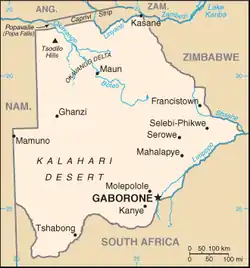
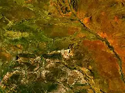
Map of Botswana
References
- Central Statistics Office (April 2012). "POPULATION OF TOWNS, VILLAGES AND ASSOCIATED LOCALITIES" (PDF). 2011 POPULATION AND HOUSING CENSUS. Gaborone, Botswana. Retrieved 30 April 2022.
This article is issued from Wikipedia. The text is licensed under Creative Commons - Attribution - Sharealike. Additional terms may apply for the media files.
