Les Hautes-Rivières
Les Hautes-Rivières (French pronunciation: [le ot ʁivjɛʁ]) is a commune in the Ardennes department in northern France. It lies on both banks of the river Semois, on the border with Belgium.
Les Hautes-Rivières | |
|---|---|
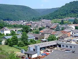 A general view of Les Hautes-Rivières | |
.svg.png.webp) Coat of arms | |
Location of Les Hautes-Rivières | |
 Les Hautes-Rivières 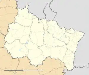 Les Hautes-Rivières | |
| Coordinates: 49°53′04″N 4°50′34″E | |
| Country | France |
| Region | Grand Est |
| Department | Ardennes |
| Arrondissement | Charleville-Mézières |
| Canton | Bogny-sur-Meuse |
| Intercommunality | Vallées et Plateau d'Ardenne |
| Government | |
| • Mayor (2020–2026) | Denis Disy[1] |
| Area 1 | 31.34 km2 (12.10 sq mi) |
| Population | 1,382 |
| • Density | 44/km2 (110/sq mi) |
| Time zone | UTC+01:00 (CET) |
| • Summer (DST) | UTC+02:00 (CEST) |
| INSEE/Postal code | 08218 /08800 |
| Elevation | 157–501 m (515–1,644 ft) (avg. 185 m or 607 ft) |
| 1 French Land Register data, which excludes lakes, ponds, glaciers > 1 km2 (0.386 sq mi or 247 acres) and river estuaries. | |
Population
| Year | Pop. | ±% |
|---|---|---|
| 1962 | 1,990 | — |
| 1968 | 2,091 | +5.1% |
| 1975 | 2,320 | +11.0% |
| 1982 | 2,354 | +1.5% |
| 1990 | 2,077 | −11.8% |
| 1999 | 1,947 | −6.3% |
| 2008 | 1,725 | −11.4% |
See also
References
- "Répertoire national des élus: les maires". data.gouv.fr, Plateforme ouverte des données publiques françaises (in French). 9 August 2021.
- "Populations légales 2020". The National Institute of Statistics and Economic Studies. 29 December 2022.
Wikimedia Commons has media related to Les Hautes-Rivières.
This article is issued from Wikipedia. The text is licensed under Creative Commons - Attribution - Sharealike. Additional terms may apply for the media files.