La Salvetat-Peyralès
La Salvetat-Peyralès (French pronunciation: [la salvəta peʁalɛs]; Occitan: La Salvetat de Peiralés) is a commune in the Aveyron department in southern France.
La Salvetat-Peyralès | |
|---|---|
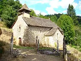 Murat chapel | |
.svg.png.webp) Coat of arms | |
Location of La Salvetat-Peyralès | |
 La Salvetat-Peyralès  La Salvetat-Peyralès | |
| Coordinates: 44°13′16″N 2°12′13″E | |
| Country | France |
| Region | Occitania |
| Department | Aveyron |
| Arrondissement | Villefranche-de-Rouergue |
| Canton | Aveyron et Tarn |
| Intercommunality | Aveyron Bas Ségala Viaur |
| Government | |
| • Mayor (2020–2026) | Paul Marty[1] |
| Area 1 | 54.24 km2 (20.94 sq mi) |
| Population | 989 |
| • Density | 18/km2 (47/sq mi) |
| Time zone | UTC+01:00 (CET) |
| • Summer (DST) | UTC+02:00 (CEST) |
| INSEE/Postal code | 12258 /12440 |
| Elevation | 210–638 m (689–2,093 ft) (avg. 612 m or 2,008 ft) |
| 1 French Land Register data, which excludes lakes, ponds, glaciers > 1 km2 (0.386 sq mi or 247 acres) and river estuaries. | |
Population
| Year | Pop. | ±% |
|---|---|---|
| 1962 | 1,484 | — |
| 1968 | 1,672 | +12.7% |
| 1975 | 1,478 | −11.6% |
| 1982 | 1,311 | −11.3% |
| 1990 | 1,162 | −11.4% |
| 1999 | 1,062 | −8.6% |
| 2008 | 1,068 | +0.6% |
See also
References
- "Répertoire national des élus: les maires". data.gouv.fr, Plateforme ouverte des données publiques françaises (in French). 9 August 2021.
- "Populations légales 2020". The National Institute of Statistics and Economic Studies. 29 December 2022.
Wikimedia Commons has media related to La Salvetat-Peyralès.
This article is issued from Wikipedia. The text is licensed under Creative Commons - Attribution - Sharealike. Additional terms may apply for the media files.