La Chapelle-Gauthier, Eure
La Chapelle-Gauthier (French pronunciation: [la ʃapɛl ɡotje] ⓘ) is a commune in the Eure department in northern France.
La Chapelle-Gauthier | |
|---|---|
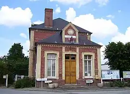 Town hall | |
Location of La Chapelle-Gauthier | |
 La Chapelle-Gauthier  La Chapelle-Gauthier | |
| Coordinates: 48°59′13″N 0°27′47″E | |
| Country | France |
| Region | Normandy |
| Department | Eure |
| Arrondissement | Bernay |
| Canton | Breteuil |
| Intercommunality | Bernay Terres de Normandie |
| Government | |
| • Mayor (2020–2026) | Pascal Laignel[1] |
| Area 1 | 16.43 km2 (6.34 sq mi) |
| Population | 410 |
| • Density | 25/km2 (65/sq mi) |
| Time zone | UTC+01:00 (CET) |
| • Summer (DST) | UTC+02:00 (CEST) |
| INSEE/Postal code | 27148 /27270 |
| Elevation | 144–207 m (472–679 ft) (avg. 201 m or 659 ft) |
| 1 French Land Register data, which excludes lakes, ponds, glaciers > 1 km2 (0.386 sq mi or 247 acres) and river estuaries. | |
Population
| Year | Pop. | ±% |
|---|---|---|
| 1962 | 415 | — |
| 1968 | 426 | +2.7% |
| 1975 | 365 | −14.3% |
| 1982 | 349 | −4.4% |
| 1990 | 350 | +0.3% |
| 1999 | 381 | +8.9% |
| 2008 | 364 | −4.5% |
See also
References
- "Répertoire national des élus: les maires". data.gouv.fr, Plateforme ouverte des données publiques françaises (in French). 2 December 2020.
- "Populations légales 2020". The National Institute of Statistics and Economic Studies. 29 December 2022.
Wikimedia Commons has media related to La Chapelle-Gauthier.
This article is issued from Wikipedia. The text is licensed under Creative Commons - Attribution - Sharealike. Additional terms may apply for the media files.