La Chapelle-Forainvilliers
La Chapelle-Forainvilliers (French pronunciation: [la ʃapɛl fɔʁɛ̃vilje]) is a commune in the Eure-et-Loir department in northern France.
La Chapelle-Forainvilliers | |
|---|---|
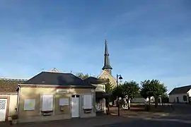 The town hall and church in La Chapelle-Forainvilliers | |
Location of La Chapelle-Forainvilliers | |
 La Chapelle-Forainvilliers  La Chapelle-Forainvilliers | |
| Coordinates: 48°43′46″N 1°30′09″E | |
| Country | France |
| Region | Centre-Val de Loire |
| Department | Eure-et-Loir |
| Arrondissement | Dreux |
| Canton | Anet |
| Intercommunality | CA Pays de Dreux |
| Government | |
| • Mayor (2020–2026) | Samuel Bove[1] |
| Area 1 | 5.38 km2 (2.08 sq mi) |
| Population | 196 |
| • Density | 36/km2 (94/sq mi) |
| Time zone | UTC+01:00 (CET) |
| • Summer (DST) | UTC+02:00 (CEST) |
| INSEE/Postal code | 28076 /28500 |
| Elevation | 118–136 m (387–446 ft) (avg. 220 m or 720 ft) |
| 1 French Land Register data, which excludes lakes, ponds, glaciers > 1 km2 (0.386 sq mi or 247 acres) and river estuaries. | |
Population
| Year | Pop. | ±% |
|---|---|---|
| 1962 | 49 | — |
| 1968 | 70 | +42.9% |
| 1975 | 95 | +35.7% |
| 1982 | 77 | −18.9% |
| 1990 | 120 | +55.8% |
| 1999 | 169 | +40.8% |
| 2008 | 174 | +3.0% |
References
- "Répertoire national des élus: les maires". data.gouv.fr, Plateforme ouverte des données publiques françaises (in French). 9 August 2021.
- "Populations légales 2020". The National Institute of Statistics and Economic Studies. 29 December 2022.
Wikimedia Commons has media related to La Chapelle-Forainvilliers.
This article is issued from Wikipedia. The text is licensed under Creative Commons - Attribution - Sharealike. Additional terms may apply for the media files.