Allainville, Eure-et-Loir
Allainville (French pronunciation: [alɛ̃vil]) is a commune in the Eure-et-Loir department in northern France.
Allainville | |
|---|---|
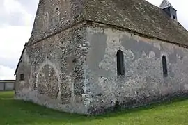 The church in Allainville | |
Location of Allainville | |
 Allainville  Allainville | |
| Coordinates: 48°43′25″N 1°18′06″E | |
| Country | France |
| Region | Centre-Val de Loire |
| Department | Eure-et-Loir |
| Arrondissement | Dreux |
| Canton | Dreux-1 |
| Intercommunality | Pays de Dreux |
| Government | |
| • Mayor (2020–2026) | Alain Caperan[1] |
| Area 1 | 5.28 km2 (2.04 sq mi) |
| Population | 141 |
| • Density | 27/km2 (69/sq mi) |
| Time zone | UTC+01:00 (CET) |
| • Summer (DST) | UTC+02:00 (CEST) |
| INSEE/Postal code | 28003 /28500 |
| Elevation | 118–147 m (387–482 ft) (avg. 136 m or 446 ft) |
| 1 French Land Register data, which excludes lakes, ponds, glaciers > 1 km2 (0.386 sq mi or 247 acres) and river estuaries. | |
Population
| Year | Pop. | ±% p.a. |
|---|---|---|
| 1968 | 42 | — |
| 1975 | 35 | −2.57% |
| 1982 | 82 | +12.93% |
| 1990 | 124 | +5.31% |
| 1999 | 120 | −0.36% |
| 2007 | 154 | +3.17% |
| 2012 | 140 | −1.89% |
| 2017 | 136 | −0.58% |
| Source: INSEE[3] | ||
References
- "Répertoire national des élus: les maires". data.gouv.fr, Plateforme ouverte des données publiques françaises (in French). 2 December 2020.
- "Populations légales 2020". The National Institute of Statistics and Economic Studies. 29 December 2022.
- Population en historique depuis 1968, INSEE
Wikimedia Commons has media related to Allainville (Eure-et-Loir).
This article is issued from Wikipedia. The text is licensed under Creative Commons - Attribution - Sharealike. Additional terms may apply for the media files.