Kokpekti District
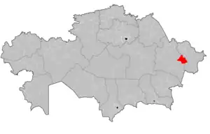
Kokpekti (Kazakh: Көкпекті ауданы, romanized: Kökpektı audany) is a district of the East Kazakhstan & Abai regions in eastern Kazakhstan. The administrative center of the district is the selo of Kokpekti.[2]
Kokpekti | |
|---|---|
District | |
| Көкпекті ауданы | |
 | |
| Country | |
| Region | East Kazakhstan Region and Abai Region |
| Administrative center | Kokpekti |
| Founded | 1930 |
| Government | |
| • Akim | Dildabek Orazbayev[1] |
| Area | |
| • Total | 5,600 sq mi (14,600 km2) |
| Population (2019) | |
| • Total | 28 260 |
| Time zone | UTC+6 (East) |
| Website | http://www.kokpekti.vko.gov.kz/ru/ |
Geography
The district is located in the central part of the region. In the south, the district borders on Tarbagatay District, in the west - on Zharma, in the north - on Ulansky district, in the east it is washed by Bukhtarma reservoir, through which it borders on Altai, Katon-Karagai and Kurshimsky districts.
The relief of the territory of the district is mainly hilly, in the north - mountainous (Kalbinsky ridge), in the south - the northern part basins of Lake Zaisan. The highest point of the region is Mount Karazhal (1,606 m).[3]
References
- "Дильдабек Оразбаев назначен акимом Кокпектинского района". dknews.kz. 2022-06-30.
- "www.geonames.de Subdivisions of Kazakhstan in local languages". Archived from the original on 2016-03-03. Retrieved 2008-04-21.
- "Кокпектинский район". kray.pushkinlibrary.kz.
This article is issued from Wikipedia. The text is licensed under Creative Commons - Attribution - Sharealike. Additional terms may apply for the media files.
