Jacona, New Mexico
Jacona is an unincorporated community and census-designated place in Santa Fe County, New Mexico, United States. Its population was 412 as of the 2010 census.[4]
Jacona, New Mexico | |
|---|---|
 Jacona | |
| Coordinates: 35°53′26″N 106°02′32″W | |
| Country | United States |
| State | New Mexico |
| County | Santa Fe |
| Area | |
| • Total | 0.85 sq mi (2.19 km2) |
| • Land | 0.85 sq mi (2.19 km2) |
| • Water | 0.00 sq mi (0.00 km2) |
| Elevation | 5,768 ft (1,758 m) |
| Population | |
| • Total | 400 |
| • Density | 472.26/sq mi (182.33/km2) |
| Time zone | UTC-7 (Mountain (MST)) |
| • Summer (DST) | UTC-6 (MDT) |
| Area code | 505 |
| GNIS feature ID | 928741[3] |
The name is a Spanish approximation of Sakona, the Tewa name of the pueblo which was abandoned in 1696.[5]
Geography
Jacona is located at 35.8905811°N 106.0422454°W.[3] According to the U.S. Census Bureau, the community has an area of 0.847 square miles (2.19 km2), all land.[4]
Education
It is zoned to Pojoaque Valley Schools.[7] Pojoaque Valley High School is the zoned comprehensive high school.
References
- "ArcGIS REST Services Directory". United States Census Bureau. Retrieved October 12, 2022.
- "Census Population API". United States Census Bureau. Retrieved October 12, 2022.
- "Jacona". Geographic Names Information System. United States Geological Survey, United States Department of the Interior.
- "2010 Census Gazetteer Files - Places: New Mexico". U.S. Census Bureau. Retrieved December 31, 2016.
- Pearce, T.M.,editor, New Mexico Place Names, A Geographical Dictionary, University of New Mexico Press 1965. ISBN 0-8263-0082-0
- "Census of Population and Housing". Census.gov. Retrieved June 4, 2016.
- "2020 CENSUS - SCHOOL DISTRICT REFERENCE MAP: Santa Fe County, NM" (PDF). U.S. Census Bureau. Retrieved July 30, 2021.
Municipalities and communities of Santa Fe County, New Mexico, United States | ||
|---|---|---|
| Cities | 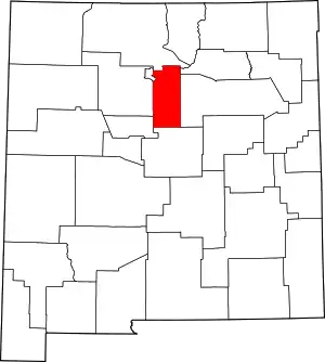 Map of New Mexico highlighting Santa Fe County | |
| Town | ||
| CDPs |
| |
| Other communities | ||
| Ghost town | ||
| Indian reservation | ||
| Footnotes | ‡This populated place also has portions in an adjacent county or counties | |
This article is issued from Wikipedia. The text is licensed under Creative Commons - Attribution - Sharealike. Additional terms may apply for the media files.