List of mountain peaks of New Mexico
This article comprises three sortable tables of major mountain peaks[1] of the U.S. State of New Mexico.
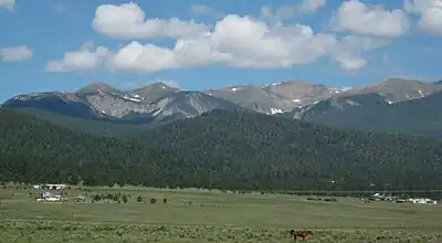
The summit of a mountain or hill may be measured in three principal ways:
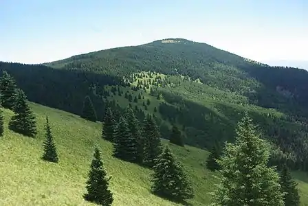
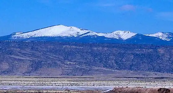
- The topographic elevation of a summit measures the height of the summit above a geodetic sea level.[2][3] The first table below ranks the 30 highest major summits of New Mexico by elevation.
- The topographic prominence of a summit is a measure of how high the summit rises above its surroundings.[4][3] The second table below ranks the 30 most prominent summits of New Mexico.
- The topographic isolation (or radius of dominance) of a summit measures how far the summit lies from its nearest point of equal elevation.[5] The third table below ranks the 30 most isolated major summits of New Mexico.
Highest major summits
Of the highest major summits of New Mexico, Wheeler Peak exceeds 4000 meters (13,123 feet) elevation, 11 peaks exceed 3500 meters (11,483 feet), and 26 peaks exceed 3000 meters (9843 feet) elevation.
Most prominent summits
Of the most prominent summits of New Mexico, Sierra Blanca Peak is an ultra-prominent summit with more than 1500 meters (4921 feet) of topographic prominence and 12 peaks exceed 1000 meters (3281 feet) of topographic prominence.
Most isolated major summits
Of the most isolated major summits of New Mexico, Sierra Blanca Peak exceeds 200 kilometers (124.3 miles) of topographic isolation and three peaks exceed 100 kilometers (62.14 miles) of topographic isolation.
Gallery
See also
- List of mountain peaks of North America
- List of mountain peaks of Greenland
- List of mountain peaks of Canada
- List of mountain peaks of the Rocky Mountains
- List of mountain peaks of the United States
- List of mountain peaks of Alaska
- List of mountain peaks of Arizona
- List of mountain peaks of California
- List of mountain peaks of Colorado
- List of mountain peaks of Hawaiʻi
- List of mountain peaks of Idaho
- List of mountain peaks of Montana
- List of mountain peaks of Nevada
- List of mountain peaks of New Mexico
- List of mountain peaks of Oregon
- List of mountain peaks of Utah
- List of mountain peaks of Washington (state)
- List of mountain peaks of Wyoming
- List of mountain peaks of México
- List of mountain peaks of Central America
- List of mountain peaks of the Caribbean
- New Mexico
- Geography of New Mexico
- Category:Mountains of New Mexico
- Geography of New Mexico
- Physical geography
Notes
- The summit of Wheeler Peak is the highest point of the Taos Mountains and the U.S. State of New Mexico.
- Wheeler Peak is the southernmost 4000-meter (13,123-foot) summit of the Rocky Mountains.
- The summit of Truchas Peak is the highest point of the Santa Fe Mountains.
- Truchas Peak is the southernmost summit of its elevation in the Rocky Mountains.
- The elevation of Venado Peak includes an adjustment of +1.65 m (5.41 ft) from NGVD 29 to NAVD 88.
- The summit of Baldy Mountain is the highest point of the Cimarron Range.
- The summit of Sierra Blanca Peak is the highest point of the Sacramento Mountains.
- The summit of Cerro Vista is the highest point of the southern Sangre de Cristo Range.
- The summit of Chicoma Mountain is the highest point of the Jemez Mountains.
- The summit of Mount Taylor is the highest point of the northern San Mateo Mountains.
- The summit of Whitewater Baldy is the highest point of the Mogollon Mountains.
- The elevation of Whitewater Baldy includes an adjustment of +1.273 m (4.18 ft) from NGVD 29 to NAVD 88.
- The summit of South Baldy is the highest point of the Magdalena Mountains.
- The summit of Sandia Crest is the highest point of the Sandia Mountains.
- The elevation of Sandia Crest includes an adjustment of +1.101 m (3.61 ft) from NGVD 29 to NAVD 88.
- The elevation of San Pedro Peaks includes an adjustment of +1.306 m (4.28 ft) from NGVD 29 to NAVD 88.
- The summit of West Blue Mountain is the highest point of the San Mateo Mountains.
- The elevation of West Blue Mountain includes an adjustment of +1.112 m (3.65 ft) from NGVD 29 to NAVD 88.
- The elevation of Alegres Mountain includes an adjustment of +1.078 m (3.54 ft) from NGVD 29 to NAVD 88.
- The elevation of Capitan Mountains high point includes an adjustment of +0.963 m (3.16 ft) from NGVD 29 to NAVD 88.
- The summit of McKnight Mountain is the highest point of the Black Range.
- The elevation of McKnight Mountain includes an adjustment of +1.193 m (3.91 ft) from NGVD 29 to NAVD 88.
- The summit of Manzano Peak is the highest point of the Manzano Mountains.
- The elevation of Ute Mountain includes an adjustment of +1.288 m (4.23 ft) from NGVD 29 to NAVD 88.
- The summit of Atalaya Mountain is the highest point of the Santa Fe Mountains.
- The summit of Ladrones Benchmark is the highest point of Sierra Ladrones.
- The summit of Organ Needle is the highest point of the San Andres Mountains.
- The elevation of Organ Needle includes an adjustment of +0.738 m (2.42 ft) from NGVD 29 to NAVD 88.
- The summit of South Baldy is the highest point of the Magdalena Mountains.
- The elevation of Animas Mountains high point includes an adjustment of +0.979 m (3.21 ft) from NGVD 29 to NAVD 88.
- The summit of Florida Peak is the highest point of the Florida Mountains.
- The elevation of Florida Peak includes an adjustment of +0.647 m (2.12 ft) from NGVD 29 to NAVD 88.
- The summit of Carrizo Peak is the highest point of the Carrizo Mountains.
- The summit of Cookes Peak is the highest point of the Cookes Range.
- The elevation of South Sacramento Mountains high point includes an adjustment of +0.962 m (3.16 ft) from NGVD 29 to NAVD 88.
- The summit of Gallinas Peak is the highest point of the Gallinas Mountains.
- The summit elevation of Gallinas Peak includes a vertical offset of -0.025 m (-0.1 ft) from the station benchmark.
References
- This article defines a significant summit as a summit with at least 100 meters (328.1 feet) of topographic prominence, and a major summit as a summit with at least 500 meters (1640 feet) of topographic prominence. All summits in this article have at least 500 meters of topographic prominence. An ultra-prominent summit is a summit with at least 1500 meters (4921 feet) of topographic prominence.
- All elevations in this article include an elevation adjustment from the National Geodetic Vertical Datum of 1929 (NGVD 29) to the North American Vertical Datum of 1988 (NAVD 88). For further information, please see this United States National Geodetic Survey note.
- If the elevation or prominence of a summit is calculated as a range of values, the arithmetic mean is shown.
- The topographic prominence of a summit is the topographic elevation difference between the summit and its highest or key col to a higher summit. The summit may be near its key col or quite far away. The key col for Denali in Alaska is the Isthmus of Rivas in Nicaragua, 7642 kilometers (4749 miles) away.
- The topographic isolation of a summit is the great-circle distance to its nearest point of equal elevation.
- "WHEELER". Datasheet for NGS Station GM0779. U.S. National Geodetic Survey. Retrieved 14 June 2016.
- "Wheeler Peak". Geographic Names Information System. United States Geological Survey, United States Department of the Interior.
- "Wheeler Peak". Peakbagger.com. Retrieved 14 June 2016.
- "Wheeler Peak". Bivouac.com. Retrieved 14 June 2016.
- "TRUCHAS". Datasheet for NGS Station FN0666. U.S. National Geodetic Survey. Retrieved 14 June 2016.
- "Truchas Peak". Geographic Names Information System. United States Geological Survey, United States Department of the Interior.
- "Truchas Peak". Peakbagger.com. Retrieved 14 June 2016.
- "Truchas Peak". Bivouac.com. Retrieved 14 June 2016.
- "Venado Peak". Geographic Names Information System. United States Geological Survey, United States Department of the Interior.
- "Venado Peak". Peakbagger.com. Retrieved 14 June 2016.
- "Venado Peak". Bivouac.com. Retrieved 14 June 2016.
- "GOLD". Datasheet for NGS Station GM0854. U.S. National Geodetic Survey. Retrieved 14 June 2016.
- "Gold Hill". Geographic Names Information System. United States Geological Survey, United States Department of the Interior.
- "Gold Hill". Peakbagger.com. Retrieved 14 June 2016.
- "Gold Hill". Bivouac.com. Retrieved 14 June 2016.
- "SANTA FE BALDY". Datasheet for NGS Station FN0726. U.S. National Geodetic Survey. Retrieved 14 June 2016.
- "Santa Fe Baldy". Geographic Names Information System. United States Geological Survey, United States Department of the Interior.
- "Santa Fe Baldy". Peakbagger.com. Retrieved 14 June 2016.
- "Santa Fe Baldy". Bivouac.com. Retrieved 14 June 2016.
- "CUERVO". Datasheet for NGS Station GM0770. U.S. National Geodetic Survey. Retrieved 14 June 2016.
- "Little Costilla Peak". Geographic Names Information System. United States Geological Survey, United States Department of the Interior.
- "Little Costilla Peak". Peakbagger.com. Retrieved 14 June 2016.
- "Little Costilla Peak". Bivouac.com. Retrieved 14 June 2016.
- "BALDY MTN". Datasheet for NGS Station GM0775. U.S. National Geodetic Survey. Retrieved 14 June 2016.
- "Baldy Mountain". Geographic Names Information System. United States Geological Survey, United States Department of the Interior.
- "Baldy Mountain". Peakbagger.com. Retrieved 14 June 2016.
- "Baldy Mountain". Bivouac.com. Retrieved 14 June 2016.
- "SIERRA BLANCA". Datasheet for NGS Station DR1010. U.S. National Geodetic Survey. Retrieved 14 June 2016.
- "Sierra Blanca Peak". Geographic Names Information System. United States Geological Survey, United States Department of the Interior.
- "Sierra Blanca Peak". Peakbagger.com. Retrieved 14 June 2016.
- "Sierra Blanca Peak". Bivouac.com. Retrieved 14 June 2016.
- "CERRO". Datasheet for NGS Station GM0798. U.S. National Geodetic Survey. Retrieved 14 June 2016.
- "Cerro Vista". Geographic Names Information System. United States Geological Survey, United States Department of the Interior.
- "Cerro Vista". Peakbagger.com. Retrieved 14 June 2016.
- "Cerro Vista". Bivouac.com. Retrieved 14 June 2016.
- "CLEAR". Datasheet for NGS Station GM0792. U.S. National Geodetic Survey. Retrieved 14 June 2016.
- "Mount Phillips". Geographic Names Information System. United States Geological Survey, United States Department of the Interior.
- "Mount Phillips". Peakbagger.com. Retrieved 14 June 2016.
- "Mount Phillips". Bivouac.com. Retrieved 14 June 2016.
- "LANGLEY". Datasheet for NGS Station GN0677. U.S. National Geodetic Survey. Retrieved 14 June 2016.
- "Chicoma Mountain". Geographic Names Information System. United States Geological Survey, United States Department of the Interior.
- "Chicoma Mountain". Peakbagger.com. Retrieved 14 June 2016.
- "Chicoma Mountain". Bivouac.com. Retrieved 14 June 2016.
- "TAYLOR". Datasheet for NGS Station FO1614. U.S. National Geodetic Survey. Retrieved 14 June 2016.
- "Mount Taylor". Geographic Names Information System. United States Geological Survey, United States Department of the Interior.
- "Mount Taylor". Peakbagger.com. Retrieved 14 June 2016.
- "Mount Taylor". Bivouac.com. Retrieved 14 June 2016.
- "11252 REDONDO". Datasheet for NGS Station FO1482. U.S. National Geodetic Survey. Retrieved 14 June 2016.
- "Redondo Peak". Geographic Names Information System. United States Geological Survey, United States Department of the Interior.
- "Redondo Peak". Peakbagger.com. Retrieved 14 June 2016.
- "Redondo Peak". Bivouac.com. Retrieved 14 June 2016.
- "SAN ANTONE". Datasheet for NGS Station GN0422. U.S. National Geodetic Survey. Retrieved 14 June 2016.
- "San Antonio Mountain". Geographic Names Information System. United States Geological Survey, United States Department of the Interior.
- "San Antonio Mountain". Peakbagger.com. Retrieved 14 June 2016.
- "San Antonio Mountain". Bivouac.com. Retrieved 14 June 2016.
- "Whitewater Baldy". Geographic Names Information System. United States Geological Survey, United States Department of the Interior.
- "Whitewater Baldy". Peakbagger.com. Retrieved 14 June 2016.
- "PICURIS". Datasheet for NGS Station GM0819. U.S. National Geodetic Survey. Retrieved 14 June 2016.
- "Picuris Peak". Geographic Names Information System. United States Geological Survey, United States Department of the Interior.
- "Picuris Peak". Peakbagger.com. Retrieved 14 June 2016.
- "Picuris Peak". Bivouac.com. Retrieved 14 June 2016.
- "SOUTH". Datasheet for NGS Station DS1463. U.S. National Geodetic Survey. Retrieved 14 June 2016.
- "South Baldy". Geographic Names Information System. United States Geological Survey, United States Department of the Interior.
- "South Baldy". Peakbagger.com. Retrieved 14 June 2016.
- "South Baldy". Bivouac.com. Retrieved 14 June 2016.
- "Sandia Crest". Peakbagger.com. Retrieved 14 June 2016.
- "San Pedro Peaks". Peakbagger.com. Retrieved 14 June 2016.
- "San Pedro Peaks". Bivouac.com. Retrieved 14 June 2016.
- "West Blue Mountain". Geographic Names Information System. United States Geological Survey, United States Department of the Interior.
- "West Blue Mountain". Peakbagger.com. Retrieved 14 June 2016.
- "Alegres Mountain". Geographic Names Information System. United States Geological Survey, United States Department of the Interior.
- "Alegres Mountain". Peakbagger.com. Retrieved 14 June 2016.
- "Capitan Mountains high point". Peakbagger.com. Retrieved 14 June 2016.
- "Capitan Mountains high point". Bivouac.com. Retrieved 14 June 2016.
- "McKnight Mountain". Geographic Names Information System. United States Geological Survey, United States Department of the Interior.
- "McKnight Mountain". Peakbagger.com. Retrieved 14 June 2016.
- "MT WITHINGTON". Datasheet for NGS Station DS1373. U.S. National Geodetic Survey. Retrieved 14 June 2016.
- "Mount Withington". Geographic Names Information System. United States Geological Survey, United States Department of the Interior.
- "Mount Withington". Peakbagger.com. Retrieved 14 June 2016.
- "Mount Withington". Bivouac.com. Retrieved 14 June 2016.
- "MANZANO". Datasheet for NGS Station EQ0698. U.S. National Geodetic Survey. Retrieved 14 June 2016.
- "Manzano Peak". Geographic Names Information System. United States Geological Survey, United States Department of the Interior.
- "Manzano Peak". Peakbagger.com. Retrieved 14 June 2016.
- "Ute Mountain". Geographic Names Information System. United States Geological Survey, United States Department of the Interior.
- "Ute Mountain". Peakbagger.com. Retrieved 14 June 2016.
- "Ute Mountain". Bivouac.com. Retrieved 14 June 2016.
- "SANTA FE". Datasheet for NGS Station DR1030. U.S. National Geodetic Survey. Retrieved 18 May 2019.
- "Atalaya Mountain". Peakbagger.com. Retrieved 18 May 2019.
- "Atalaya Mountain". Bivouac.com. Retrieved 18 May 2019.
- "LADRONES". Datasheet for NGS Station EQ1026. U.S. National Geodetic Survey. Retrieved 14 June 2016.
- "Ladrones Benchmark". Peakbagger.com. Retrieved 14 June 2016.
- "Ladrones Benchmark". Bivouac.com. Retrieved 14 June 2016.
- "Organ Needle". Peakbagger.com. Retrieved 14 June 2016.
- "Organ Needle". Bivouac.com. Retrieved 14 June 2016.
- "SALINAS". Datasheet for NGS Station DS1225. U.S. National Geodetic Survey. Retrieved 14 June 2016.
- "Salinas Peak". Peakbagger.com. Retrieved 14 June 2016.
- "Salinas Peak". Bivouac.com. Retrieved 14 June 2016.
- "SOUTH". Datasheet for NGS Station DS1463. U.S. National Geodetic Survey. Retrieved 14 June 2016.
- "South Baldy". Geographic Names Information System. United States Geological Survey, United States Department of the Interior.
- "South Baldy". Peakbagger.com. Retrieved 14 June 2016.
- "South Baldy". Bivouac.com. Retrieved 14 June 2016.
- "BIG HATCHET". Datasheet for NGS Station CF0273. U.S. National Geodetic Survey. Retrieved 14 June 2016.
- "Big Hatchet Peak". Peakbagger.com. Retrieved 14 June 2016.
- "Big Hatchet Peak". Bivouac.com. Retrieved 14 June 2016.
- "Animas Mountains high point". Peakbagger.com. Retrieved 14 June 2016.
- "Animas Mountains high point". Bivouac.com. Retrieved 14 June 2016.
- "Florida Peak". Peakbagger.com. Retrieved 14 June 2016.
- "Florida Peak". Bivouac.com. Retrieved 14 June 2016.
- "CARRIZO". Datasheet for NGS Station DR1030. U.S. National Geodetic Survey. Retrieved 14 June 2016.
- "Carrizo Peak". Peakbagger.com. Retrieved 14 June 2016.
- "Carrizo Peak". Bivouac.com. Retrieved 14 June 2016.
- "COOKS". Datasheet for NGS Station CX1921. U.S. National Geodetic Survey. Retrieved 14 June 2016.
- "Cookes Peak". Peakbagger.com. Retrieved 14 June 2016.
- "Cookes Peak". Bivouac.com. Retrieved 14 June 2016.
- "SAN ANDRES". Datasheet for NGS Station CX1739. U.S. National Geodetic Survey. Retrieved 14 June 2016.
- "San Andres Peak". Peakbagger.com. Retrieved 14 June 2016.
- "San Andres Peak". Bivouac.com. Retrieved 14 June 2016.
- "CORDUNA". Datasheet for NGS Station CW0900. U.S. National Geodetic Survey. Retrieved 14 June 2016.
- "Wind Mountain". Geographic Names Information System. United States Geological Survey, United States Department of the Interior.
- "Wind Mountain". Peakbagger.com. Retrieved 14 June 2016.
- "Wind Mountain". Bivouac.com. Retrieved 14 June 2016.
- "South Sacramento Mountains high point". Peakbagger.com. Retrieved 14 June 2016.
- "South Sacramento Mountains high point". Bivouac.com. Retrieved 14 June 2016.
- "GALLINAS". Datasheet for NGS Station EP0629. U.S. National Geodetic Survey. Retrieved 14 June 2016.
- "Gallinas Peak". Geographic Names Information System. United States Geological Survey, United States Department of the Interior.
- "Gallinas Peak". Peakbagger.com. Retrieved 14 June 2016.
- "Gallinas Peak". Bivouac.com. Retrieved 14 June 2016.
External links
- United States Geological Survey (USGS)
- United States National Geodetic Survey (NGS)
- Bivouac.com
- Peakbagger.com
- Peaklist.org
- Peakware.com
- Summitpost.org
