Francs Peak
Francs Peak, elevation 13,158 feet (4,011 m), is the highest point in the Absaroka Range which extends from north-central Wyoming into south-central Montana, in the United States. It is in the Washakie Wilderness of Shoshone National Forest, and the peak is also the highest point in Park County, Wyoming, which includes much of Yellowstone National Park.[3] It was named after Otto Franc, a cattle baron and homesteader in the Big Horn Basin.[4]
| Francs Peak | |
|---|---|
 Francs Peak from Haymaker Pass | |
| Highest point | |
| Elevation | 13,158 ft (4,011 m)[1] |
| Prominence | 4,056 ft (1,236 m)[1] |
| Listing | |
| Coordinates | 43°57′41″N 109°19′51″W[2] |
| Geography | |
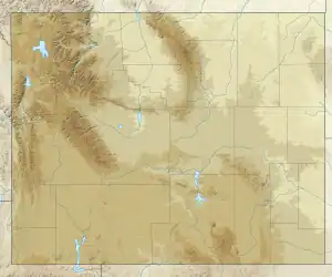
 Francs Peak Location in Wyoming  Francs Peak Location in the United States | |
| Location | Park County, Wyoming, U.S. |
| Parent range | Absaroka Range |
| Topo map | USGS Francs Peak |
| Climbing | |
| Easiest route | Hike |
Climate
| Climate data for Francs Peak 43.9586 N, 109.3331 W, Elevation: 12,671 ft (3,862 m) (1991–2020 normals) | |||||||||||||
|---|---|---|---|---|---|---|---|---|---|---|---|---|---|
| Month | Jan | Feb | Mar | Apr | May | Jun | Jul | Aug | Sep | Oct | Nov | Dec | Year |
| Average high °F (°C) | 17.5 (−8.1) |
16.7 (−8.5) |
21.8 (−5.7) |
26.7 (−2.9) |
36.0 (2.2) |
46.7 (8.2) |
56.7 (13.7) |
55.7 (13.2) |
47.0 (8.3) |
34.5 (1.4) |
23.0 (−5.0) |
16.9 (−8.4) |
33.3 (0.7) |
| Daily mean °F (°C) | 8.1 (−13.3) |
6.5 (−14.2) |
10.9 (−11.7) |
15.4 (−9.2) |
24.2 (−4.3) |
34.0 (1.1) |
42.8 (6.0) |
42.0 (5.6) |
34.1 (1.2) |
23.1 (−4.9) |
13.7 (−10.2) |
7.7 (−13.5) |
21.9 (−5.6) |
| Average low °F (°C) | −1.4 (−18.6) |
−3.7 (−19.8) |
0.1 (−17.7) |
4.1 (−15.5) |
12.4 (−10.9) |
21.3 (−5.9) |
28.9 (−1.7) |
28.2 (−2.1) |
21.1 (−6.1) |
11.8 (−11.2) |
4.4 (−15.3) |
−1.4 (−18.6) |
10.5 (−12.0) |
| Average precipitation inches (mm) | 1.84 (47) |
2.11 (54) |
2.35 (60) |
2.93 (74) |
5.26 (134) |
2.42 (61) |
1.70 (43) |
1.68 (43) |
2.19 (56) |
2.03 (52) |
2.02 (51) |
2.32 (59) |
28.85 (734) |
| Source: PRISM Climate Group[5] | |||||||||||||
See also
References
- "Francs Peak, Wyoming". Peakbagger.com. Retrieved October 5, 2014.
- "Francs Peak". Geographic Names Information System. United States Geological Survey, United States Department of the Interior. Retrieved October 5, 2014.
- Francs Peak, WY (Map). TopoQwest (United States Geological Survey Maps). Retrieved October 5, 2014.
- "Francs Peak". SummitPost.org. Retrieved October 5, 2014.
- "PRISM Climate Group, Oregon State University". PRISM Climate Group, Oregon State University. Retrieved October 2, 2023.
To find the table data on the PRISM website, start by clicking Coordinates (under Location); copy Latitude and Longitude figures from top of table; click Zoom to location; click Precipitation, Minimum temp, Mean temp, Maximum temp; click 30-year normals, 1991-2020; click 800m; click Retrieve Time Series button.
External links
This article is issued from Wikipedia. The text is licensed under Creative Commons - Attribution - Sharealike. Additional terms may apply for the media files.