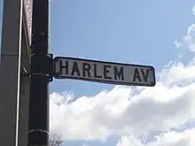
Harlem Avenue
Harlem Avenue is a major north–south street located in Chicago and its west, southwest, and northwest suburbs. It stretches from Glenview Road in Glenview to the intersection of East South Street and South Drecksler Road in Peotone, where it diverges into Illinois Route 50. At 54.1 miles (87.1 km), it is the third-longest street in the United States, after Telegraph Road in southeastern Michigan and O Street in Nebraska. For most of its length, it carries Illinois Route 43. There is a stop along the Metra's BNSF Line at Harlem Avenue and Windsor Avenue in Berwyn, Illinois. There is also a major transit center where Metra's UP West Line and the Chicago Transit Authority Green Line share a facility in Oak Park, Illinois. The northern terminus of Harlem Avenue is also nearby the Glenview station for both Metra's Milwaukee District/North Line and Amtrak intercity trains.
| 7200 West | |
| Part of | |
|---|---|
| Location | Chicago |
| North end | Lehigh Avenue at Glenview Road in Glenview 42.0727°N 87.8055°W |
| South end | 41.3300°N 87.7853°W |
Communities served
From north to south:
- Glenview (suburb)
- Morton Grove (suburb)
- Niles (suburb)
- Park Ridge (suburb)
- Edison Park (Chicago neighborhood)
- Norwood Park (Chicago neighborhood)
- Harwood Heights (suburb)
- Norridge (suburb)
- Dunning (Chicago neighborhood)
- Montclare (Chicago neighborhood)
- Elmwood Park (suburb)
- Austin (Chicago neighborhood)
- River Forest (suburb)
- Oak Park (suburb)
- Forest Park (suburb)
- Berwyn (suburb)
- North Riverside (suburb)
- Riverside (suburb)
- Lyons (suburb)
- Stickney (suburb)
- Forest View (suburb)
- Garfield Ridge (Chicago neighborhood)
- Clearing (Chicago neighborhood)
- Summit (suburb)
- Bedford Park (suburb)
- Bridgeview (suburb)
- Burbank (suburb)
- Oak Lawn (suburb)
- Chicago Ridge (suburb)
- Worth (suburb)
- Palos Heights (suburb)
- Orland Park (suburb)
- Tinley Park (suburb)
- Matteson (suburb)
- Frankfort (suburb)
- Monee (suburb)
Major intersections
| County | Location | mi[1] | km | Destinations | Notes |
|---|---|---|---|---|---|
| Will | Peotone | 0.0 | 0.0 | Continuation beyond South Street | |
| Drecksler Road/South Street | Southern terminus | ||||
| 0.9 | 1.4 | ||||
| Will–Cook county line | Frankfort Square–Matteson– Frankfort tripoint | 12.4 | 20.0 | Southern end of IL 43 overlap; southern terminus of IL 43 | |
| Tinley Park | 15.5 | 24.9 | |||
| Cook | Tinley Park–Orland Park line | 19.0 | 30.6 | ||
| Palos Heights | 24.1 | 38.8 | |||
| Worth | 25.7 | 41.4 | Northern terminus of IL 7 | ||
| Oak Lawn–Bridgeview line | 27.1 | 43.6 | Interchange | ||
| Summit–Forest View line | 32.8 | 52.8 | |||
| Lyons–Riverside– Berwyn tripoint | 34.5 | 55.5 | |||
| Forest Park–Oak Park line | 37.9 | 61.0 | |||
| Oak Park–River Forest– Elmwood Park–Chicago quadripoint | 40.4 | 65.0 | |||
| Chicago–Norridge line | 43.4 | 69.8 | |||
| Chicago | 45.3 | 72.9 | |||
| 45.4 | 73.1 | ||||
| Niles | 47.9 | 77.1 | |||
| 48.5 | 78.1 | Northern end of IL 43 overlap | |||
| Morton Grove–Niles line | 49.5 | 79.7 | |||
| Glenview–Morton Grove line | 50.5 | 81.3 | |||
| Glenview | 51.7 | 83.2 | Glenview Road | Northern terminus | |
1.000 mi = 1.609 km; 1.000 km = 0.621 mi
| |||||