Frankfort Square, Illinois
Frankfort Square is a census-designated place (CDP) in Will County, Illinois, United States. Per the 2020 census, the population was 8,968.[4]
Frankfort Square | |
|---|---|
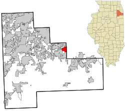
 Location in Will County and the state of Illinois. | |
| Coordinates: 41°31′8″N 87°48′11″W | |
| Country | United States |
| State | Illinois |
| County | Will |
| Township | Frankfort |
| Area | |
| • Total | 2.50 sq mi (6.47 km2) |
| • Land | 2.50 sq mi (6.47 km2) |
| • Water | 0.00 sq mi (0.00 km2) |
| Elevation | 709 ft (216 m) |
| Population (2020) | |
| • Total | 8,968 |
| • Density | 3,592.95/sq mi (1,387.14/km2) |
| Time zone | UTC-6 (CST) |
| • Summer (DST) | UTC-5 (CDT) |
| ZIP code | 60423[3] |
| Area codes | 815, 779 |
| FIPS code | 17-27644 |
Geography
Frankfort Square is located at 41°31′8″N 87°48′11″W.[5]
According to the United States Census Bureau, the CDP has a total area of 2.1 square miles (5.4 km2), all land. It is bordered by Frankfort to the south, Tinley Park to the north and Matteson (in Cook County) to the east.
Demographics
| Census | Pop. | Note | %± |
|---|---|---|---|
| 2010 | 9,276 | — | |
| 2020 | 8,968 | −3.3% | |
| U.S. Decennial Census[6] 2010[7] 2020[8] | |||
2020 census
| Race / Ethnicity | Pop 2010[7] | Pop 2020[8] | % 2010 | % 2020 |
|---|---|---|---|---|
| White alone (NH) | 8,275 | 7,312 | 89.21% | 81.53% |
| Black or African American alone (NH) | 113 | 265 | 1.22% | 2.95% |
| Native American or Alaska Native alone (NH) | 10 | 9 | 0.11% | 0.10% |
| Asian alone (NH) | 141 | 183 | 1.52% | 2.04% |
| Pacific Islander alone (NH) | 1 | 1 | 0.01% | 0.01% |
| Some Other Race alone (NH) | 8 | 22 | 0.09% | 0.25% |
| Mixed Race/Multi-Racial (NH) | 85 | 265 | 0.92% | 2.95% |
| Hispanic or Latino (any race) | 643 | 911 | 6.93% | 10.16% |
| Total | 9,276 | 8,968 | 100.00% | 100.00% |
Note: the US Census treats Hispanic/Latino as an ethnic category. This table excludes Latinos from the racial categories and assigns them to a separate category. Hispanics/Latinos can be of any race.
2000 Census
As of the census[9] of 2000, there were 7,766 people, 2,363 households, and 2,018 families living in the CDP. The population density was 3,705.4 inhabitants per square mile (1,430.7/km2). There were 2,376 housing units at an average density of 1,133.7 per square mile (437.7/km2). The racial makeup of the CDP was 94.84% White, 1.27% African American, 0.05% Native American, 1.74% Asian, 1.21% from other races, and 0.89% from two or more races. Hispanic or Latino of any race were 4.02% of the population.
There were 2,363 households, out of which 57.7% had children under the age of 18 living with them, 73.5% were married couples living together, 8.6% had a female householder with no husband present, and 14.6% were non-families. 11.8% of all households were made up of individuals, and 1.4% had someone living alone who was 65 years of age or older. The average household size was 3.29 and the average family size was 3.60.
In the CDP, the population was spread out, with 36.1% under the age of 18, 7.0% from 18 to 24, 37.0% from 25 to 44, 17.6% from 45 to 64, and 2.3% who were 65 years of age or older. The median age was 31 years. For every 100 females, there were 97.8 males. For every 100 females age 18 and over, there were 96.9 males.
The average income for a household in the CDP is $69,459, and the median income for a family was $72,689. Males had a median income of $50,171 versus $30,750 for females. The per capita income for the CDP was $22,038. About 2.3% of families and 2.4% of the population were below the poverty line, including 3.2% of those under age 18 and 12.1% of those age 65 or over.
See also
References
- "2020 U.S. Gazetteer Files". United States Census Bureau. Retrieved March 15, 2022.
- "USGS detail on Frankfort Square". Retrieved November 11, 2007.
- "Frankfort Square IL ZIP Code". zipdatamaps.com. 2023. Retrieved February 17, 2023.
- "Frankfort Square CDP, Illinois". United States Census Bureau. Retrieved April 15, 2022.
- "US Gazetteer files: 2010, 2000, and 1990". United States Census Bureau. February 12, 2011. Retrieved April 23, 2011.
- "Decennial Census of Population and Housing by Decades". US Census Bureau.
- "P2 HISPANIC OR LATINO, AND NOT HISPANIC OR LATINO BY RACE – 2010: DEC Redistricting Data (PL 94-171) – Frankfort Square CDP, Illinois". United States Census Bureau.
- "P2 HISPANIC OR LATINO, AND NOT HISPANIC OR LATINO BY RACE – 2020: DEC Redistricting Data (PL 94-171) – Frankfort Square CDP, Illinois". United States Census Bureau.
- "U.S. Census website". United States Census Bureau. Retrieved January 31, 2008.